216.126.194.231 - IP Lookup: Free IP Address Lookup, Postal Code Lookup, IP Location Lookup, IP ASN, Public IP
Country:
Region:
City:
Location:
Time Zone:
Postal Code:
ISP:
ASN:
language:
User-Agent:
Proxy IP:
Blacklist:
IP information under different IP Channel
ip-api
Country
Region
City
ASN
Time Zone
ISP
Blacklist
Proxy
Latitude
Longitude
Postal
Route
db-ip
Country
Region
City
ASN
Time Zone
ISP
Blacklist
Proxy
Latitude
Longitude
Postal
Route
IPinfo
Country
Region
City
ASN
Time Zone
ISP
Blacklist
Proxy
Latitude
Longitude
Postal
Route
IP2Location
216.126.194.231Country
Region
new jersey
City
cherry hill
Time Zone
America/New_York
ISP
Language
User-Agent
Latitude
Longitude
Postal
ipdata
Country
Region
City
ASN
Time Zone
ISP
Blacklist
Proxy
Latitude
Longitude
Postal
Route
Popular places and events near this IP address

Barclay-Kingston, New Jersey
Populated place in Camden County, New Jersey, US
Distance: Approx. 759 meters
Latitude and longitude: 39.91,-74.99583333
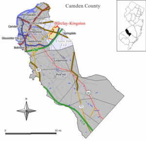
Barclay-Kingston is an unincorporated community and former census-designated place (CDP) located within Cherry Hill Township, in Camden County, in the U.S. state of New Jersey. As of the 2000 United States Census, the section population was 10,728. In the 2010 United States Census, the Barclay-Kingston CDP was split into two new CDPs, Barclay and Kingston Estates.

Erlton-Ellisburg, New Jersey
Populated place in Camden County, New Jersey, US
Distance: Approx. 1259 meters
Latitude and longitude: 39.91527778,-75.01444444
Erlton-Ellisburg was an unincorporated community and census-designated place (CDP) located within Cherry Hill Township, in Camden County, in the U.S. state of New Jersey. As of the 2000 United States Census, the CDP's population was 8,168. The area comprises Erlton and Ellisburg, two neighborhoods in western Cherry Hill.

WYPA
Air 1 radio station in Cherry Hill, New Jersey
Distance: Approx. 1403 meters
Latitude and longitude: 39.912056,-74.988778
WYPA (89.5 FM) is a non–commercial Christian worship formatted radio station licensed to serve Cherry Hill, New Jersey. The station is owned by Educational Media Foundation and is a member of the nationally syndicated Air1 radio network. WYPA uses HD Radio, and simulcasts the classical programming of WWFM on its HD2 subchannel.
Cherry Hill Public Schools
School district in Camden County, New Jersey, US
Distance: Approx. 234 meters
Latitude and longitude: 39.907192,-75.001258
The Cherry Hill Public Schools are a comprehensive community public school district, serving students in pre-kindergarten through twelfth grade from Cherry Hill, in Camden County, in the U.S. state of New Jersey. As of the 2020–21 school year, the district, comprised of 19 schools, had an enrollment of 10,596 students and 887.6 classroom teachers (on an FTE basis), for a student–teacher ratio of 11.9:1. It was the state's twelfth-largest school district in 2011 and is one of the largest suburban districts.
Cherry Hill Public Library
Public library in Cherry Hill, New Jersey, US
Distance: Approx. 1471 meters
Latitude and longitude: 39.9205,-75.00319
The Cherry Hill Public Library is a public library located at 1100 Kings Highway North in Cherry Hill, New Jersey. The library is overseen by the Library Board of Trustees and run by The Library Director. Originally called The Cherry Hill Free Public Library, the word "Free" was dropped from the title in 2003.
Ponzio's
Philadelphian eatery
Distance: Approx. 1001 meters
Latitude and longitude: 39.9138,-75.0121
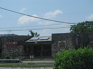
Ponzio's is a family style diner, bar, and bakery located in Cherry Hill, New Jersey at the former Ellisburg Circle. Ponzio's opened in 1964 and is a popular eatery in the Philadelphia metropolitan area, hosting families, power brokers, and celebrities. It is considered an iconic location and is known as Cherry Hill's oldest restaurant.
Cherry Hill, New Jersey
Township in Camden County, New Jersey, US
Distance: Approx. 669 meters
Latitude and longitude: 39.904611,-74.997
Cherry Hill is a township within Camden County, in the U.S. state of New Jersey. As a suburb of Philadelphia, the township is part of South Jersey and the Delaware Valley region. Cherry Hill Township grew during the mid-20th century suburbanization, becoming one of the Delaware Valley's main commercial centers, including the Cherry Hill Mall.

Barclay Farm House
Historic house in New Jersey, United States
Distance: Approx. 841 meters
Latitude and longitude: 39.90277778,-74.99611111
The Barclay Farm House, also known as the Barclay Farmstead, is located at 209 Barclay Lane in Cherry Hill, Camden County, in the U.S. state of New Jersey. The historic Federal house was added to the National Register of Historic Places on January 26, 1978, for its significance in architecture.
Fred E. and Elaine Cox Clever House
Distance: Approx. 993 meters
Latitude and longitude: 39.8994,-74.9986
The Fred E. and Elaine Cox Clever House at 417 Sherry Way, Cherry Hill, New Jersey, was designed by architect Louis Kahn. The Clevers commissioned Kahn to design it in 1957 after seeing his influential Trenton Bath House; it was completed in 1962. It is one of only nine built houses designed by Kahn, who is best known for designing institutional buildings.: 422–429 In early 2015, the Clever house, having fallen into serious disrepair was listed for sale.
Cherry Hill Alternative High School
High school in Camden County, New Jersey, US
Distance: Approx. 1209 meters
Latitude and longitude: 39.913506,-74.992376
The Cherry Hill Alternative High School (also known as the Estelle Malberg Alternative High School or simply Malberg) is an alternative public high school in Cherry Hill in Camden County, in the U.S. state of New Jersey, for students who need behavioral and emotional support. Malberg, as it is commonly known to most Cherry Hill residents, is also the location of the Cherry Hill Public Schools administration building, which was previously at the Rosa Administration Building (formerly Heritage Middle School until 1985 and was renamed Rosa International Middle School in 1999). Malberg was built in 1969 and was originally an early childhood center, then became an alternative high school in 1997.

Scarborough Bridge
Bridge in Cherry Hill, New Jersey
Distance: Approx. 1225 meters
Latitude and longitude: 39.900667,-74.992547
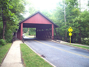
The Scarborough Bridge is a wooden covered bridge in the Barclay Farm neighborhood of Cherry Hill, New Jersey. It carries 2 lanes of Covered Bridge Road, as well as 2 sidewalks for pedestrians and bicyclists. The bridge was named after Bob Scarborough, a housing developer who established the Barclay Farm neighborhood, where the bridge is located.

Barclay, New Jersey
Populated place in Camden County, New Jersey, US
Distance: Approx. 727 meters
Latitude and longitude: 39.901243,-75.000829
Barclay Farm (or simply Barclay) is an unincorporated community and census-designated place (CDP) located within Cherry Hill, in Camden County, in the U.S. state of New Jersey, that had been part of the Barclay-Kingston CDP until 2000, which was split to form the CDPs of Barclay and Kingston Estates as of the 2010 Census. Until the 2000 census, Barclay was included as part of the Barclay-Kingston CDP. As of the 2010 United States Census, the CDP's population was 4,428. Located on a 32-acre (13 ha) site, the Barclay Farm House is a historic farmhouse constructed in 1816.
Weather in this IP's area
clear sky
-11 Celsius
-17 Celsius
-12 Celsius
-10 Celsius
1035 hPa
59 %
1035 hPa
1032 hPa
10000 meters
4.12 m/s
290 degree

