216.126.194.114 - IP Lookup: Free IP Address Lookup, Postal Code Lookup, IP Location Lookup, IP ASN, Public IP
Country:
 USA
USARegion:
City:
Location:
Time Zone:
Postal Code:
ISP:
ASN:
language:
User-Agent:
Proxy IP:
Blacklist:
IP information under different IP Channel
ip-api
Country
Region
City
ASN
Time Zone
ISP
Blacklist
Proxy
Latitude
Longitude
Postal
Route
db-ip
Country
Region
City
ASN
Time Zone
ISP
Blacklist
Proxy
Latitude
Longitude
Postal
Route
IPinfo
Country
Region
City
ASN
Time Zone
ISP
Blacklist
Proxy
Latitude
Longitude
Postal
Route
IP2Location
216.126.194.114Country
usRegion
pennsylvania
City
ford city
Time Zone
America/New_York
ISP
Language
User-Agent
Latitude
Longitude
Postal
ipdata
Country
Region
City
ASN
Time Zone
ISP
Blacklist
Proxy
Latitude
Longitude
Postal
Route
Popular places and events near this IP address

Ford City, Pennsylvania
Borough in Pennsylvania, United States
Distance: Approx. 593 meters
Latitude and longitude: 40.77138889,-79.53
Ford City is a borough in Armstrong County, Pennsylvania, United States, 40 miles (64 km) northeast of Pittsburgh along the east bank of the Allegheny River and 4 miles (6 km) south of Kittanning, the county seat. The population was 2,859 at the 2020 census. It is part of the Pittsburgh metropolitan area.

Ford Cliff, Pennsylvania
Borough in Pennsylvania, United States
Distance: Approx. 1060 meters
Latitude and longitude: 40.76,-79.53638889
Ford Cliff is a borough in Armstrong County, Pennsylvania, United States. The population was 361 at the 2020 census.

Lenape Heights, Pennsylvania
Census-designated place in Pennsylvania, United States
Distance: Approx. 419 meters
Latitude and longitude: 40.76527778,-79.5225
Lenape Heights is a census-designated place (CDP) in Armstrong County, Pennsylvania, United States. The population was 1,144 at the 2020 census.
Manor Township, Armstrong County, Pennsylvania
Township in Pennsylvania, United States
Distance: Approx. 1746 meters
Latitude and longitude: 40.76444444,-79.50666667
Manor Township is a township in Armstrong County, Pennsylvania, United States. The population was 4,190 at the 2020 census, a decrease from the figure of 4,227 tabulated in 2010.

Manorville, Pennsylvania
Borough in Pennsylvania, United States
Distance: Approx. 2263 meters
Latitude and longitude: 40.78638889,-79.52166667
Manorville is a borough in Armstrong County, Pennsylvania, United States. The population was 382 at the 2020 census.

WKFO
Radio station in Kittanning, Pennsylvania
Distance: Approx. 2542 meters
Latitude and longitude: 40.78861111,-79.53472222
WKFO (1380 AM) is a 24-hour commercially licensed radio station with a maximum power output of 1,000 watts, non-directional. The station, licensed to the county seat of Kittanning, Pennsylvania is wholly owned by Matthew Lightner, through licensee Lightner Communications, based in Blair County, Pennsylvania. Studios, offices and transmitter facilities are located on Bunker Hill Road, in North Buffalo Township, Pennsylvania.
Lenape Technical School
Public school in the United States
Distance: Approx. 567 meters
Latitude and longitude: 40.76767,-79.52065
Lenape Technical School is a public technical high school in Ford City, Pennsylvania. It offers vocational training in 14 technical areas. Students attend Lenape Tech full-time or part-time for two or three years, 10th through 12th grade, and receive training in their chosen technical field and their complementary academic disciplines.
Cogley Island
Alluvial island in Pennsylvania, U.S.
Distance: Approx. 1720 meters
Latitude and longitude: 40.78194444,-79.52777778
Cogley Island is an alluvial island in the Allegheny River in North Buffalo Township, Armstrong County in the U.S. state of Pennsylvania. The island is situated across from Ford City and Manorville boroughs. The elevation of Cogley Island is 768 feet above sea level.

Crooked Creek (Allegheny River tributary)
River in the United States
Distance: Approx. 2965 meters
Latitude and longitude: 40.7489532,-79.5536568
Crooked Creek is a tributary of the Allegheny River in both Armstrong and Indiana counties in the U.S. state of Pennsylvania. Several covered bridges span the stream and its tributaries in Indiana County. The Thomas Covered Bridge crosses Crooked Creek in Armstrong Township.
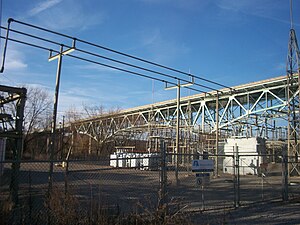
Ford City Veterans Bridge
Bridge in Ford City and North Buffalo Township
Distance: Approx. 1566 meters
Latitude and longitude: 40.76139,-79.54451
The Ford City Veterans Bridge is a girder bridge connecting Ford City and North Buffalo Township, Pennsylvania. It was constructed in 2000 to replace a 1914 structure. The structure was one of the first in the nation to use a new type of high-performance, weather resistant steel.

Ford City Armory
United States historic place
Distance: Approx. 701 meters
Latitude and longitude: 40.77166667,-79.53194444
The Ford City Armory is a historic National Guard armory located at 301 Tenth Street in Ford City, Armstrong County, Pennsylvania. It was designed by architect Joseph F. Kuntz. It was built in 1930.
McGrann, Pennsylvania
Unincorporated community in Pennsylvania, United States
Distance: Approx. 1728 meters
Latitude and longitude: 40.78138889,-79.52138889
McGrann is an unincorporated community in Armstrong County, Pennsylvania, United States. The community is bounded by Manorville to the northwest, Ford City to the southwest, and Pennsylvania Route 66 to the east. McGrann has a post office with ZIP code 16236, which opened on July 19, 1898.
Weather in this IP's area
overcast clouds
-6 Celsius
-6 Celsius
-7 Celsius
-6 Celsius
1027 hPa
84 %
1027 hPa
982 hPa
10000 meters
0.98 m/s
1.51 m/s
81 degree
100 %