216.122.12.98 - IP Lookup: Free IP Address Lookup, Postal Code Lookup, IP Location Lookup, IP ASN, Public IP
Country:
Region:
City:
Location:
Time Zone:
Postal Code:
IP information under different IP Channel
ip-api
Country
Region
City
ASN
Time Zone
ISP
Blacklist
Proxy
Latitude
Longitude
Postal
Route
Luminati
Country
ASN
Time Zone
America/Chicago
ISP
HOOD-CANAL
Latitude
Longitude
Postal
IPinfo
Country
Region
City
ASN
Time Zone
ISP
Blacklist
Proxy
Latitude
Longitude
Postal
Route
IP2Location
216.122.12.98Country
Region
washington
City
union
Time Zone
America/Los_Angeles
ISP
Language
User-Agent
Latitude
Longitude
Postal
db-ip
Country
Region
City
ASN
Time Zone
ISP
Blacklist
Proxy
Latitude
Longitude
Postal
Route
ipdata
Country
Region
City
ASN
Time Zone
ISP
Blacklist
Proxy
Latitude
Longitude
Postal
Route
Popular places and events near this IP address

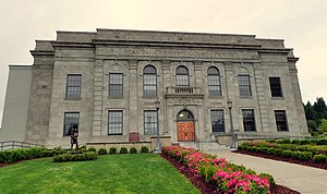
Mason County, Washington
County in Washington, United States
Distance: Approx. 7895 meters
Latitude and longitude: 47.35,-123.18
Mason County is a county located in the U.S. state of Washington. As of the 2020 census, the population was 65,726. The county seat and only incorporated city is Shelton.

Skokomish people
North American tribe
Distance: Approx. 6467 meters
Latitude and longitude: 47.33472222,-123.16
The Skokomish (pronounced ) are one of nine tribes of the Twana, a Native American people of western Washington state in the United States. The tribe lives along Hood Canal, a fjord-like inlet on the west side of the Kitsap Peninsula and the Puget Sound basin. Historically the Twana were hunters, fishers, and gatherers who had a nomadic lifestyle during the warmer months, while living in more permanent homes during the winter months.
Skokomish River
River in the United States
Distance: Approx. 3228 meters
Latitude and longitude: 47.34,-123.11777778
The Skokomish River (Twana: squʔquʔ) is a river in Mason County, Washington, United States. It is the largest river flowing into Hood Canal, a western arm of Puget Sound. From its source at the confluence of the North and South Forks the main stem Skokomish River is approximately 9 miles (14 km) long.
Union, Washington
CDP in Washington, United States
Distance: Approx. 2250 meters
Latitude and longitude: 47.35694444,-123.09955556
Union or Union City is a small census-designated place in Mason County, Washington, United States. The community lies along the southern shore of the Great Bend of the Hood Canal, near the mouth of the Skokomish River, which flows from the nearby Olympic Mountains. The U.S. Census reported a population of 631 inhabitants in the 2010 census.

Mason Lake
Distance: Approx. 8877 meters
Latitude and longitude: 47.33333333,-122.95916667
Mason Lake is a natural elongated lake south of Belfair, Washington, United States in Mason County. Named for Charles H. Mason, the first secretary of Washington Territory, the lake is on the isthmus of the Kitsap Peninsula between the Hood Canal and Pickering Passage of the Case Inlet. The smaller Benson Lake is to its eastern side.

Potlatch State Park
State park in the U.S. state of Washington
Distance: Approx. 6613 meters
Latitude and longitude: 47.36166667,-123.15972222
Potlatch State Park is a 57-acre (23 ha) Washington state park located on Hood Canal near the town of Potlatch in Mason County. The park offers camping, hiking, boating, fishing, shellfish harvesting, beachcombing, and sailboarding. Potlatch State Park was opened in 1960 on a prime piece of land that was traditionally territory of the Skokomish people.

Tahuya River
River in Washington, United States
Distance: Approx. 3364 meters
Latitude and longitude: 47.37027778,-123.05138889
The Tahuya River is a stream in the U.S. state of Washington. It originates at Tahuya Lake in western Kitsap Peninsula and flows south, emptying into Hood Canal near the Great Bend.

Twanoh State Park
State park in Washington (state), United States
Distance: Approx. 8254 meters
Latitude and longitude: 47.37277778,-122.97416667
Twanoh State Park is a public recreation area located 16 miles (26 km) southwest of Belfair on the east side of Hood Canal in Mason County, Washington. The state park's 188 acres (76 ha) include 3,167 feet (965 m) of saltwater shoreline and 2.5 miles (4.0 km) of inland hiking trails. The park is managed by the Washington State Parks and Recreation Commission.

Skokomish Indian Tribe
Ethnic group
Distance: Approx. 6459 meters
Latitude and longitude: 47.334866,-123.159929
The Skokomish Indian Tribe, formerly known as the Skokomish Indian Tribe of the Skokomish Reservation, and in its own official use the Skokomish Tribal Nation, is a federally recognized tribe of Skokomish, Twana, Klallam, and Chimakum people. They are a tribe of Southern Coast Salish indigenous people of the Pacific Northwest located in Washington. The Skokomish are one of nine bands of Twana people.

Lake Skokomish
Glacial lake (former) in Kitsap County, Washington
Distance: Approx. 4418 meters
Latitude and longitude: 47.363322,-123.127485
During the Vashon Glaciation a series of lakes formed along the southern margin of the Cordilleran Ice Cap. In the Hood Canal depression, two significant lake stages existed, Lake Skokomish and Lake Hood. Early Lake Skokomish’s surface was at 350 ft (110 m) above sea level, draining across the divide at Shelton, Washington into early Glacial Lake Russell.
Alderbrook Resort & Spa
Hotel in Union, Washington, United States
Distance: Approx. 678 meters
Latitude and longitude: 47.347482,-123.067462
Alderbrook Resort & Spa, aka Alderbrook Inn or Alderbrook, is a hotel located in Union, WA on the southern shores of Hood Canal. Approximately two hours west of Seattle, Alderbrook has views of nearby Olympic National Park and Mount Washington. Alderbrook opened in 1920 as a group of tent cabins with wood stoves and has been expanded and remodeled numerous times.

Schumacher Creek
Stream in Washington state
Distance: Approx. 7321 meters
Latitude and longitude: 47.31857,-122.98668
Schumacher Creek, formerly Shumocher Creek, is a creek in Mason County in the U.S. state of Washington. It flows into Mason Lake on the traditional territory of the Squaxin Island Tribe. Schumacher Creek is part of the Sherwood Creek watershed, and contains Trask Lake and Carson Lake.
Weather in this IP's area
overcast clouds
4 Celsius
4 Celsius
3 Celsius
5 Celsius
1032 hPa
95 %
1032 hPa
1020 hPa
10000 meters
1.12 m/s
1.22 m/s
277 degree
100 %
