216.117.25.186 - IP Lookup: Free IP Address Lookup, Postal Code Lookup, IP Location Lookup, IP ASN, Public IP
Country:
Region:
City:
Location:
Time Zone:
Postal Code:
ISP:
ASN:
language:
User-Agent:
Proxy IP:
Blacklist:
IP information under different IP Channel
ip-api
Country
Region
City
ASN
Time Zone
ISP
Blacklist
Proxy
Latitude
Longitude
Postal
Route
db-ip
Country
Region
City
ASN
Time Zone
ISP
Blacklist
Proxy
Latitude
Longitude
Postal
Route
IPinfo
Country
Region
City
ASN
Time Zone
ISP
Blacklist
Proxy
Latitude
Longitude
Postal
Route
IP2Location
216.117.25.186Country
Region
ohio
City
centerville
Time Zone
America/New_York
ISP
Language
User-Agent
Latitude
Longitude
Postal
ipdata
Country
Region
City
ASN
Time Zone
ISP
Blacklist
Proxy
Latitude
Longitude
Postal
Route
Popular places and events near this IP address

Centerville, Ohio
City in Ohio, United States
Distance: Approx. 3261 meters
Latitude and longitude: 39.62222222,-84.12222222
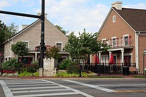
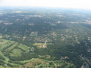
Centerville is a city in Montgomery County, Ohio, United States. A core suburb of Metro Dayton, its population was 24,240 as of the 2020 census.

Woodbourne-Hyde Park, Ohio
Unincorporated community and census-designated place in Ohio, United States
Distance: Approx. 3966 meters
Latitude and longitude: 39.66194444,-84.175
Woodbourne-Hyde Park is an unincorporated area in Washington Township in Montgomery County, Ohio, United States. A Suburb of Dayton. It was delineated as a census-designated place (CDP) at the 2000 census, at which time its population was 7,910.
Centerville High School (Ohio)
Public secondary school in Centerville, Ohio, United States
Distance: Approx. 976 meters
Latitude and longitude: 39.627528,-84.148074
Centerville High School is a public school of secondary education for grades 9–12 located in Centerville, Ohio, USA, situated 10 miles (16 km) south of Dayton. It is the only high school in the Centerville City School District, which also includes three middle schools, six elementary schools and two K–1 schools, or "primary villages". The district serves all of the city of Centerville and Washington Township, as well as a portion of the city of Kettering.
Town Hall Theatre (Centerville)
Theatre group in Centerville, Ohio, United States
Distance: Approx. 88 meters
Latitude and longitude: 39.629167,-84.159167
Town Hall Theatre is a children’s theater group located in Centerville, Ohio. It operates and performs in Washington Township Hall and is part of the recreation department of Washington Township, Montgomery County, Ohio.
Centerville City School District
School district in Ohio
Distance: Approx. 708 meters
Latitude and longitude: 39.62416667,-84.16555556
Centerville City School District is the school district serving Centerville and Washington Township, Ohio, United States. It's ranked as one of the top public schools in the US and is ranked 2nd in the region.

Washington Township, Montgomery County, Ohio
Township in Ohio, United States
Distance: Approx. 725 meters
Latitude and longitude: 39.63416667,-84.16333333
A suburb of Dayton, Washington Township is the largest of nine townships of Montgomery County, Ohio, United States. The population was 61,882 at the 2020 census. The township, through the independent Centerville-Washington Park District, contains eight community parks, nine nature parks and 33 neighborhood parks encompassing 1,000 acres in Centerville and Washington Township.
Dayton Christian High School
Secondary school in Miamisburg, Ohio , United States
Distance: Approx. 4676 meters
Latitude and longitude: 39.614227,-84.210732
Dayton Christian High School is a private, non-denominational Christian high school located in Miamisburg, Ohio, United States, educating approximately 900 students. Dayton Christian integrates Biblical instruction into its curriculum. Dayton Christian's mission is "Educating for Eternity." The school's founder, Rev.
Spring Valley Academy
Private, k-12 college preparatory school in Centerville, Ohio, USA
Distance: Approx. 2096 meters
Latitude and longitude: 39.615,-84.1422222
Spring Valley Academy (known locally as "SVA" or "Spring Valley") is a Seventh-day Adventist K-12 private school located in Centerville, Ohio. It is a part of the Seventh-day Adventist education system, the world's second largest Christian school system.
Premier Health Miami Valley Hospital South
Hospital in Ohio, United States
Distance: Approx. 4696 meters
Latitude and longitude: 39.6529,-84.1148
Premier Health Miami Valley Hospital South is a hospital in Centerville, Ohio. It is a branch of Miami Valley Hospital in Dayton, Ohio and is managed by Premier Health. Designed and constructed in 2007 as an outpatient facility with an emergency department, the facility grew faster than expected and became a full-service hospital with as office building for physicians and a five-story patient wing added between 2009 and 2013.
Kettering Health Washington Township
Hospital in Ohio, United States
Distance: Approx. 4039 meters
Latitude and longitude: 39.644098,-84.20188
Kettering Health Washington Township, formerly known as Southview Medical Center, is an acute care hospital in Washington Township, Montgomery County, Ohio, United States, at the junction of State Route 725 and Interstate 675. It is part of the Kettering Health network. It features a maternity center, intensive care unit, catheter laboratory, endoscopy/colonoscopy center and the Hand Center of Southwest Ohio, a specialized center for the treatment of hand injuries.
Manor, Ohio
Ghost town in Ohio, United States
Distance: Approx. 4557 meters
Latitude and longitude: 39.58944444,-84.14305556
Manor is a ghost town in Washington Township, Montgomery County, Ohio, United States. Originally, Manor was founded as a railway stop between Centerville and Lytle on the Cincinnati, Lebanon, and Northern Railway. It was located on Social Row Road just one mile east of Dayton-Lebanon Pike (State Route 48).

Grantland Gardens, Washington Township
Neighborhood in Montgomery, Ohio, United States
Distance: Approx. 4315 meters
Latitude and longitude: 39.66384167,-84.17978333
Grantland Gardens is a neighborhood located in Washington Township in Montgomery County, Ohio, United States at 39°39′49.83″N 84°10′47.22″W (39.663841,-84.1797829). The name originates from the legal description for land parcels in the area.
Weather in this IP's area
overcast clouds
-5 Celsius
-11 Celsius
-5 Celsius
-5 Celsius
1018 hPa
83 %
1018 hPa
985 hPa
1294 meters
4.73 m/s
6.46 m/s
330 degree
100 %
