Country:
 USA
USARegion:
City:
Latitude and Longitude:
Time Zone:
Postal Code:
IP information under different IP Channel
ip-api
Country
Region
City
ASN
Time Zone
ISP
Blacklist
Proxy
Latitude
Longitude
Postal
Route
IPinfo
Country
Region
City
ASN
Time Zone
ISP
Blacklist
Proxy
Latitude
Longitude
Postal
Route
MaxMind
Country
Region
City
ASN
Time Zone
ISP
Blacklist
Proxy
Latitude
Longitude
Postal
Route
Luminati
Country
USASN
Time Zone
America/Chicago
ISP
TVC-AS1
Latitude
Longitude
Postal
db-ip
Country
Region
City
ASN
Time Zone
ISP
Blacklist
Proxy
Latitude
Longitude
Postal
Route
ipdata
Country
Region
City
ASN
Time Zone
ISP
Blacklist
Proxy
Latitude
Longitude
Postal
Route
Popular places and events near this IP address
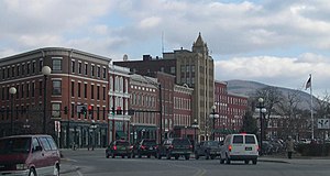
Rutland (city), Vermont
City in Vermont, United States
Distance: Approx. 187 meters
Latitude and longitude: 43.60888889,-72.97972222
Rutland is the only city in and the seat of Rutland County, Vermont, United States. As of the 2020 census, the city had a total population of 15,807. It is located approximately 65 miles (105 km) north of the Massachusetts state line, 35 miles (56 km) west of New Hampshire state line, and 20 miles (32 km) east of the New York state line.

St. Peter's Church and Mount St. Joseph Convent Complex
Historic church in Vermont, United States
Distance: Approx. 718 meters
Latitude and longitude: 43.60222222,-72.98611111
St. Peter's Church and Mount St. Joseph Convent Complex is a Roman Catholic religious and educational complex on Convent and Meadow Streets in Rutland, Vermont.
Mount Saint Joseph Academy (Rutland, Vermont)
Private, coeducational school in Rutland, Vermont, United States
Distance: Approx. 603 meters
Latitude and longitude: 43.60305556,-72.98527778
Mount Saint Joseph Academy is a Roman Catholic college preparatory high school located in Rutland, Vermont. The school is under the jurisdiction of the Diocese of Burlington.

Rutland station
Distance: Approx. 192 meters
Latitude and longitude: 43.6058,-72.9817
Rutland station is a train station in Rutland, Vermont served by Amtrak, the national railroad passenger system. It is served by the single daily round trip of the Amtrak Ethan Allen Express. The station has a single low-level side platform, with a short high-level section for accessible level boarding.

Longfellow School (Rutland, Vermont)
United States historic place
Distance: Approx. 240 meters
Latitude and longitude: 43.60861111,-72.97833333
The Longfellow School, also known as Church Street School, is a historic school building at 6 Church Street in Rutland, Vermont. Built in 1890, it was the first purpose-built graded school in the city, serving as a model for later schools. It was listed on the National Register of Historic Places in 1976.
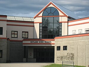
Rutland City School District
School in Rutland, Vermont, United States
Distance: Approx. 286 meters
Latitude and longitude: 43.60833333,-72.9775
Rutland City Public Schools is the school district that manages public schools in Rutland City, Vermont, United States.
Rutland Downtown Historic District
Historic district in Vermont, United States
Distance: Approx. 670 meters
Latitude and longitude: 43.60138889,-72.98111111
Rutland Downtown Historic District, is the center of government for Rutland, Vermont. The sector of "downtown" is roughly defined as the area between Strongs Avenue, State, Wales, Washington, Pine, and Cottage Streets. The area is also a major center for business, and is considered the most cultural part of Rutland.
Chaffee Art Center
Chaffee Art Center Rutland (1961)
Distance: Approx. 717 meters
Latitude and longitude: 43.607707,-72.97191
The Chaffee Art Center for the Visual Arts is a non profit art center located in Rutland, Vermont. Operated by the Rutland Area Arts Association, the center's exhibit gallery usually displays artwork made by artists that reside in the Rutland County area. The Center offers visual art classes for children and adults.

Paramount Theater (Rutland, Vermont)
Theater in Rutland, Vermont, United States
Distance: Approx. 188 meters
Latitude and longitude: 43.60663889,-72.97872222
The Paramount Theatre, also known as The Playhouse, is a historic performance theatre located in Rutland, Vermont. The theatre hosts many events and performances and is a contributing property to the Rutland Downtown Historic District, which is listed on the National Register of Historic Places.

Rutland Jewish Center
Unaffiliated historic synagogue in Rutland, Vermont, US
Distance: Approx. 539 meters
Latitude and longitude: 43.61222222,-72.98138889
The Rutland Jewish Center is a non-denominational Jewish synagogue and religious community center located at 96 Grove Street in Rutland, Vermont, in the United States. The synagogue, owned by the Congregation Adath Israel, is located in the former H. H. Baxter Memorial Library building, a Richardsonian Romanesque structure that is listed on the National Register of Historic Places.

Rutland Courthouse Historic District
Historic district in Vermont, United States
Distance: Approx. 493 meters
Latitude and longitude: 43.60694444,-72.97472222
The Rutland Courthouse Historic District encompasses an architecturally cohesive area of civic and residential buildings in Rutland, Vermont. Roughly bounded by Court, Washington, South Main, and West Streets, the district was principally developed between 1850 and 1875, and includes a number of prominent municipal and county buildings, including the Rutland County courthouse, the Rutland Free Library, and the Grace Congregational United Church. The district was listed on the National Register of Historic Places in 1976.
Immaculate Heart of Mary School (Rutland, Vermont)
United States historic place
Distance: Approx. 454 meters
Latitude and longitude: 43.60888889,-72.97555556
The Immaculate Heart of Mary School is a historic school building at 10 Lincoln Avenue in Rutland, Vermont. Built in 1951, it is a rare example of International style architecture in the state, designed by Dirsa & Lampron of Manchester, New Hampshire. It was listed on the National Register of Historic Places in 2020.
Weather in this IP's area
broken clouds
13 Celsius
13 Celsius
12 Celsius
14 Celsius
1010 hPa
96 %
1010 hPa
987 hPa
10000 meters
2.06 m/s
110 degree
75 %
06:23:00
19:16:56