216.104.162.165 - IP Lookup: Free IP Address Lookup, Postal Code Lookup, IP Location Lookup, IP ASN, Public IP
Country:
Region:
City:
Location:
Time Zone:
Postal Code:
ISP:
ASN:
language:
User-Agent:
Proxy IP:
Blacklist:
IP information under different IP Channel
ip-api
Country
Region
City
ASN
Time Zone
ISP
Blacklist
Proxy
Latitude
Longitude
Postal
Route
db-ip
Country
Region
City
ASN
Time Zone
ISP
Blacklist
Proxy
Latitude
Longitude
Postal
Route
IPinfo
Country
Region
City
ASN
Time Zone
ISP
Blacklist
Proxy
Latitude
Longitude
Postal
Route
IP2Location
216.104.162.165Country
Region
california
City
san diego
Time Zone
America/Los_Angeles
ISP
Language
User-Agent
Latitude
Longitude
Postal
ipdata
Country
Region
City
ASN
Time Zone
ISP
Blacklist
Proxy
Latitude
Longitude
Postal
Route
Popular places and events near this IP address

Poway, California
City in California, United States
Distance: Approx. 4022 meters
Latitude and longitude: 32.97,-117.03861111
Poway () is a city in San Diego County, California, United States. Poway's rural roots influenced its motto "The City in the Country". The city had a population of 48,841 as of the 2020 United States census.

Poway–Midland Railroad
Heritage railroad in Poway, California
Distance: Approx. 4164 meters
Latitude and longitude: 32.97027778,-117.03694444
The Poway–Midland Railroad is a heritage railroad in Old Poway Park in Poway, California. The group "Poway–Midland Railroad Volunteers, Inc." operates the railroad and was founded in 1991 as a non-profit organization dedicated to the restoration, operation and maintenance of antique railroad equipment. Excursions are run each weekend (the 1st and 3rd weekends of each month using a 1907 Baldwin 0-4-0 steam locomotive, except in January or February).

Black Mountain Open Space Park
Open space park and nature area in San Diego, CA, USA
Distance: Approx. 3406 meters
Latitude and longitude: 32.981712,-117.116422
Black Mountain Open Space Park is a city park in the suburbs of San Diego, California.

Rancho Bernardo, San Diego
Community of San Diego in California
Distance: Approx. 4267 meters
Latitude and longitude: 33.01666667,-117.06666667
Rancho Bernardo is a master-planned community in the northern hills of San Diego, California.

Mt. Carmel High School (San Diego)
High school in San Diego, California
Distance: Approx. 4116 meters
Latitude and longitude: 32.96666667,-117.12111111
Mt. Carmel High School (MCHS) is a public high school in Rancho Peñasquitos, a community of San Diego, California, United States. It is part of Poway Unified School District.

Rancho Bernardo High School
Public high school in San Diego, California, United States
Distance: Approx. 2139 meters
Latitude and longitude: 32.99527778,-117.06611111
Rancho Bernardo High School (RBHS) is a public high school in San Diego County, California. It is part of Poway Unified School District. The school was opened in 1991 as the district's third high school.

Rancho Peñasquitos, San Diego
Community of San Diego in California, United States
Distance: Approx. 4037 meters
Latitude and longitude: 32.9594,-117.115575
Rancho Peñasquitos is a suburban community in northeastern San Diego, California. It is named after the first Mexican land grant in San Diego County, Rancho Santa Maria de Los Peñasquitos. (Peñasquitos is Spanish for "little cliffs".) The community abuts Los Peñasquitos Canyon Preserve, an open space preserve that offers hiking, biking, and equestrian trails.

Carmel Mountain Ranch, San Diego
Community of San Diego in California
Distance: Approx. 249 meters
Latitude and longitude: 32.97785278,-117.07923889
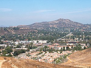
Carmel Mountain Ranch, sometimes shortened to simply Carmel Mountain, or abbreviated to CMR by local residents and organizations, is a community of San Diego, California, United States, in the northeastern part of the city. Despite its name, Carmel Mountain Ranch is actually in the shadow of Black Mountain. Carmel Mountain proper is about 10 miles west of the Carmel Mountain Ranch neighborhood.

Sabre Springs, San Diego
Community of San Diego in California
Distance: Approx. 3498 meters
Latitude and longitude: 32.952,-117.097
Sabre Springs is a community in San Diego, California, located in the northeastern part of the city. It is bounded by the city limits of Poway on the east, Ted Williams Parkway on the north, Interstate 15 on the west, and the community of Miramar Ranch North to the south. Sabre Springs is bisected north-south by Poway Road.
Palomar Medical Center Poway
Hospital in California, United States
Distance: Approx. 2933 meters
Latitude and longitude: 32.997,-117.056
Palomar Medical Center Poway is a hospital in Poway, California. It opened in 1977. It is operated by Palomar Health, which also operates Palomar Medical Center Escondido.

Fairway Village
Community of San Diego in California
Distance: Approx. 249 meters
Latitude and longitude: 32.97785278,-117.07923889
Fairway Village is a neighborhood division of Carmel Mountain Ranch, located along Stoney Gate Place, parallel to Ted Williams Parkway and crossed by Shoal Creek Drive, in San Diego, California.
Rancho Paguai
Distance: Approx. 4297 meters
Latitude and longitude: 32.95222222,-117.04805556
Rancho Paguai, named by the Mexicans after a local Kumeyaay village, was located in what is now the valley of Poway Creek and Poway Valley. It was a Mexican land grant rancho, granted by Governor Juan Alvarado on September 7, 1839, and confirmed May 22, 1840, to Rosario E. Aguilar a former Corporal of the San Diego Mission guard and the Majordomo of the Mission in 1838. However, Aguilar did not occupy or improve it and so forfeited the grant.
Weather in this IP's area
overcast clouds
11 Celsius
10 Celsius
10 Celsius
13 Celsius
1019 hPa
77 %
1019 hPa
999 hPa
9656 meters
5.14 m/s
280 degree
100 %