213.87.101.136 - IP Lookup: Free IP Address Lookup, Postal Code Lookup, IP Location Lookup, IP ASN, Public IP
Country:
Region:
City:
Location:
Time Zone:
Postal Code:
IP information under different IP Channel
ip-api
Country
Region
City
ASN
Time Zone
ISP
Blacklist
Proxy
Latitude
Longitude
Postal
Route
Luminati
Country
ASN
Time Zone
Europe/Moscow
ISP
MTS PJSC
Latitude
Longitude
Postal
IPinfo
Country
Region
City
ASN
Time Zone
ISP
Blacklist
Proxy
Latitude
Longitude
Postal
Route
IP2Location
213.87.101.136Country
Region
buryatiya, respublika
City
ulan-ude
Time Zone
Asia/Irkutsk
ISP
Language
User-Agent
Latitude
Longitude
Postal
db-ip
Country
Region
City
ASN
Time Zone
ISP
Blacklist
Proxy
Latitude
Longitude
Postal
Route
ipdata
Country
Region
City
ASN
Time Zone
ISP
Blacklist
Proxy
Latitude
Longitude
Postal
Route
Popular places and events near this IP address
Ulan-Ude
City in the Republic of Buryatia, Russia
Distance: Approx. 1059 meters
Latitude and longitude: 51.83333333,107.6
Ulan-Ude (; Russian: Улан-Удэ, Russian pronunciation: [ʊˈlan ʊˈdɛ]; Buryat: Улаан-Үдэ, romanized: Ulaan-Üde, IPA [ʊˌlaːɴ‿ˈʉdə]) is the capital city of Buryatia, Russia, located about 100 kilometers (62 mi) southeast of Lake Baikal on the Uda River at its confluence with the Selenga. According to the 2021 Census, 437,565 people lived in Ulan-Ude; up from 404,426 recorded in the 2010 Census, making the city the third-largest in the Russian Far East by population.

Far Eastern Republic
1920–1922 buffer state in the Russian Far East
Distance: Approx. 1059 meters
Latitude and longitude: 51.83333333,107.6
The Far Eastern Republic (Russian: Дальневосточная Республика, romanized: Dal'nevostochnaya Respublika, IPA: [dəlʲnʲɪvɐˈstotɕnəjə rʲɪsˈpublʲɪkə]; ДВР, DVR), sometimes called the Chita Republic (Читинская Республика, Chitinskaya Respublika, [tɕɪˈtʲɪnskəjə rʲɪsˈpublʲɪkə]), was a nominally independent state that existed from April 1920 to November 1922 in the easternmost part of the Russian Far East. Although nominally independent, it largely came under the control of the Russian Soviet Federative Socialist Republic (RSFSR), which envisaged it as a buffer state between the RSFSR and the territories occupied by Japan during the Russian Civil War of 1917–1922. Its first president was Alexander Krasnoshchyokov.

Uda (Selenga)
River in Buryatia, Russia
Distance: Approx. 2758 meters
Latitude and longitude: 51.8325,107.57111111
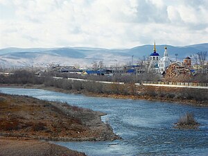
The Uda (Russian: Уда́ [ʊˈda]; Buryat: Үдэ гол, romanized: Üde gol) is a river in the Buryat Republic, Russia. It is a right tributary of the Selenga, which it meets near the city Ulan-Ude. Its length is 467 kilometers (290 mi), and it has a drainage basin of 34,800 square kilometres (13,400 sq mi).

Odigitrievsky Cathedral
Distance: Approx. 1769 meters
Latitude and longitude: 51.8225,107.58472222
St. Odigitrievsky Cathedral is an Orthodox church, a monument of architecture of the Siberian Baroque of the middle of the 18th century in Transbaikalia. It was built in 1741–1785 in the city of Verkhneudinsk (since 1934 – Ulan-Ude) The first stone building of the city, located in the historical center of Ulan-Ude, on the right coast of the Uda river and near its confluence with the Selenga River.
Ulan-Ude Vostochny Airport
Airport in Ulan Ude
Distance: Approx. 9236 meters
Latitude and longitude: 51.85,107.73833333
Ulan-Ude Vostochny Airport (also listed as Ulan Ude East) is an airport in the Buryat Republic, Russia, located 9 km east of Ulan Ude. It services medium-size airliners. The airfield served as a bomber staging base.

Ulan-Ude Aviation Plant
Russian joint-stock company specializing in aircraft manufacturing
Distance: Approx. 9489 meters
Latitude and longitude: 51.85793435,107.73771907
Ulan-Ude Aviation Plant (UUAZ, Russian: Улан-Удэнский авиационный завод, Ulan-Udėnskij aviacionný zavod; Buryat: Улаан-Үдын авиационно завод) is a Russian joint-stock company specializing in aircraft manufacturing. It is based in Ulan-Ude, Buryatia.
Buryat State University
Distance: Approx. 2212 meters
Latitude and longitude: 51.8339,107.5803
Buryat State University (Russian: Бурятский государственный университет) is an institution of higher education in Siberia and the Russian Far East, located in the city of Ulan-Ude, Buryat Republic, Russia. Courses are taught in Russian and Buryat. It was established in 1932 as the Buryat State Teachers' Training College, and became a university in 1995.
Ulan-Ude Ethnographic Museum
Open-air museum in eight kilometres northeast of Ulan-Ude, Buryatia
Distance: Approx. 7226 meters
Latitude and longitude: 51.88638889,107.64833333
The Ulan-Ude Ethnographic Museum is an outdoor museum, located in the village Upper Berezovka, eight kilometres northeast of Ulan-Ude, Buryatia.

Buryat National Opera
Distance: Approx. 1980 meters
Latitude and longitude: 51.833063,107.583392
Buryat Opera and Ballet Theatre (officially known as the "G. Tsydynzhapov Buryat State Academic Opera and Ballet Theatre", Buryat: Г. Цыдынжаповай нэрэмжэтэ Буряадай гγрэнэй дуури бγжэгэй эрдэмэй театр, Russian: Бурятский театр оперы и балета имени Г. Ц. Цыдынжапова) is a music theatre in Ulan-Ude, the capital of the Buryat Republic, Russia. It operates its own music school, a dance school, and an art institute. The theatre opened in 1939.

Ulan-Ude railway station
Railway station in Ulan-Ude, Russia
Distance: Approx. 2491 meters
Latitude and longitude: 51.84116667,107.58316667
Ulan-Ude railway station is the primary passenger railway station for the city of Ulan-Ude in the Republic of Buryatia in Russia, and an important stop along the Trans-Siberian Railway and Trans-Mongolian Railway.
Weather in this IP's area
light shower snow
-14 Celsius
-14 Celsius
-14 Celsius
-14 Celsius
1029 hPa
85 %
1029 hPa
962 hPa
2300 meters
1 m/s
75 %


