Country:
Region:
City:
Latitude and Longitude:
Time Zone:
Postal Code:
IP information under different IP Channel
ip-api
Country
Region
City
ASN
Time Zone
ISP
Blacklist
Proxy
Latitude
Longitude
Postal
Route
Luminati
Country
Region
jm
City
modiinilit
ASN
Time Zone
Asia/Jerusalem
ISP
Partner Communications Ltd.
Latitude
Longitude
Postal
IPinfo
Country
Region
City
ASN
Time Zone
ISP
Blacklist
Proxy
Latitude
Longitude
Postal
Route
db-ip
Country
Region
City
ASN
Time Zone
ISP
Blacklist
Proxy
Latitude
Longitude
Postal
Route
ipdata
Country
Region
City
ASN
Time Zone
ISP
Blacklist
Proxy
Latitude
Longitude
Postal
Route
Popular places and events near this IP address
Modi'in Illit
Israeli settlement in the West Bank
Distance: Approx. 987 meters
Latitude and longitude: 31.93055556,35.04166667
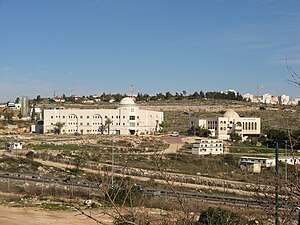
Modi'in Illit (Hebrew: מוֹדִיעִין עִלִּית; Arabic: موديعين عيليت, lit. "Upper Modi'in") is a Haredi Jewish-Israeli settlement organized as a city council in the West Bank, situated midway between Jerusalem and Tel Aviv. Built on the land of five Palestinian villages–Ni'lin, Kharbata, Saffa, Bil'in, and Dir Qadis–Modi'in Illit was granted city status by the Israeli government in 2008.
Bil'in
Palestinian village in Ramallah and al-Bireh, State of Palestine
Distance: Approx. 1834 meters
Latitude and longitude: 31.92777778,35.07111111
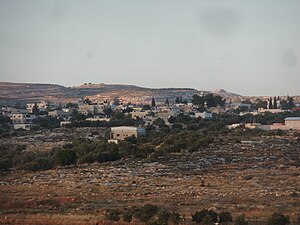
Bil'in (Arabic: بلعين) is a Palestinian village located in the Ramallah and al-Bireh Governorate, 12 kilometres (7.5 mi) west of the city of Ramallah in the central West Bank. According to the Palestinian Central Bureau of Statistics, Bil'in had a population of 2,137 in 2017. In the 2000s, it was known for its regular protests against Israeli occupation.

Matityahu (Israeli settlement)
Israeli settlement in the West Bank
Distance: Approx. 1640 meters
Latitude and longitude: 31.92972222,35.03444444
Matityahu (Hebrew: מַתִּתְיָהוּ) is an Israeli settlement organized as a community settlement in the West Bank. Located approximately midway between Jerusalem and Tel Aviv, near the settlement of Modi'in Illit and the city of Modi'in-Maccabim-Re'ut. It is named after Matityahu the Hasmonean, who lived in Modi'in (1 Maccabees 2:15-17).
Maarava Machon Rubin
Haredi Yeshiva high school in Matityahu, Israel
Distance: Approx. 2355 meters
Latitude and longitude: 31.93055556,35.02694444
Maarava Machon Rubin is an Orthodox yeshiva high school located in the town of Matityahu, near Modi'in, midway between Jerusalem and Tel Aviv in Israel. The yeshiva was founded and is headed by Rabbi Baruch Chait who is originally from the United States. The institution was dedicated by Moshe and Elaine Rubin in memory of his parents, Yosef Dov and Sheindel, and siblings, Akiva, Yehudah Aryeh, and Rivkah, who were murdered by the Nazis during the Holocaust.

Hashmonaim
Israeli settlement in the West Bank
Distance: Approx. 2865 meters
Latitude and longitude: 31.93101389,35.02157222
Hashmonaim (Hebrew: חַשְׁמוֹנָאִים, lit. Hasmoneans) is an Israeli settlement located in the western section of the West Bank, off Route 443. Hashmonaim is located two kilometers east of Modi'in-Maccabim-Re'ut, midway between Jerusalem and Tel Aviv and is part of the Mateh Binyamin Regional Council.

Deir Qaddis
Municipality type D in Ramallah and al-Bireh, State of Palestine
Distance: Approx. 2446 meters
Latitude and longitude: 31.94944444,35.04555556
Deir Qaddis (Arabic: دير قديس) is a Palestinian town in the Ramallah and al-Bireh Governorate of the State of Palestine, in the central West Bank, located sixteen kilometers west of Ramallah. According to the Palestinian Central Bureau of Statistics, the town had a population of 2,452 inhabitants in 2017. The town consists of 8,207 dunams, of which 438 dunams are classified as built-up area.

Saffa, Ramallah
Town in the West Bank, State of Palestine
Distance: Approx. 2437 meters
Latitude and longitude: 31.90694444,35.05833333
Saffa (Arabic: صفّاء) is a Palestinian town in the Ramallah and al-Bireh Governorate, located west of Ramallah in the northern West Bank. According to the Palestinian Central Bureau of Statistics (PCBS), the town had a population of 4,374 inhabitants in 2017.
Lapid (community settlement)
Community settlement in central Israel
Distance: Approx. 2192 meters
Latitude and longitude: 31.91638889,35.03305556
Lapid (Hebrew: לַפִּיד, lit. 'Torch') is an Israeli community settlement. Located in the Latrun salient of the Green Line near Modi'in Illit, it falls under the jurisdiction of Hevel Modi'in Regional Council. In 2022 it had a population of 2,325.

Kfar Ruth
Israeli moshav in the former no-man's land between Israel and the West Bank
Distance: Approx. 2527 meters
Latitude and longitude: 31.91,35.03555556
Kfar Ruth (Hebrew: כְּפַר רוּת, lit. 'Ruth's Village') is an Israeli settlement organised as a moshav. It was established in 1977 in an area that had become a no-man's land between Israel and Jordanian-controlled West Bank at the end of the 1948 Arab–Israeli War, before becoming part of the Israeli-occupied territories in the 1967 Six-Day War. It falls under the jurisdiction of Hevel Modi'in Regional Council and had a population of 275 in 2022.

Kfar HaOranim
Israeli settlement in the West Bank
Distance: Approx. 1607 meters
Latitude and longitude: 31.91916667,35.03833333
Kfar HaOranim (Hebrew: כְּפָר הָאֳרָנִים, lit. 'Village of the Pines'), also known as Menora (Hebrew: מְנוֹרָה) or Giv'at Ehud, is an Israeli settlement in the West Bank. Contiguous with Lapid and located near to the major city of Modi'in, it is organised as a community settlement and falls under the jurisdiction of Mateh Binyamin Regional Council. In 2022 it had a population of 2,604.
Kharbatha Bani Harith
Municipality type D in Ramallah and al-Bireh, State of Palestine
Distance: Approx. 2742 meters
Latitude and longitude: 31.94527778,35.0725
Kharbatha Bani Harith (Arabic: خربثا بني حارث) is a Palestinian village in the central West Bank, located 15 kilometers west of Ramallah in the Ramallah and al-Bireh Governorate. According to the Palestinian Central Bureau of Statistics, the village had a population of 3,471 in 2017. It has a total land area of 7,120 dunams.

Mir Brachfeld
Haredi yeshiva in Israel
Distance: Approx. 1649 meters
Latitude and longitude: 31.94097222,35.04306111
Mir Brachfeld is an Haredi Jewish yeshiva in the Israeli settlement of Modi'in Illit . It was founded by Rabbi Nosson Tzvi Finkel as a branch of the Mir Yeshiva in Jerusalem. Rabbi Aryeh Finkel led the yeshiva until his death in 2016.
Weather in this IP's area
clear sky
16 Celsius
15 Celsius
16 Celsius
18 Celsius
1014 hPa
48 %
1014 hPa
982 hPa
10000 meters
2.57 m/s
140 degree
06:10:27
16:39:26


