213.77.5.18 - IP Lookup: Free IP Address Lookup, Postal Code Lookup, IP Location Lookup, IP ASN, Public IP
Country:
Region:
City:
Location:
Time Zone:
Postal Code:
IP information under different IP Channel
ip-api
Country
Region
City
ASN
Time Zone
ISP
Blacklist
Proxy
Latitude
Longitude
Postal
Route
Luminati
Country
Region
14
City
warsaw
ASN
Time Zone
Europe/Warsaw
ISP
Orange Polska Spolka Akcyjna
Latitude
Longitude
Postal
IPinfo
Country
Region
City
ASN
Time Zone
ISP
Blacklist
Proxy
Latitude
Longitude
Postal
Route
IP2Location
213.77.5.18Country
Region
wielkopolskie
City
konin
Time Zone
Europe/Warsaw
ISP
Language
User-Agent
Latitude
Longitude
Postal
db-ip
Country
Region
City
ASN
Time Zone
ISP
Blacklist
Proxy
Latitude
Longitude
Postal
Route
ipdata
Country
Region
City
ASN
Time Zone
ISP
Blacklist
Proxy
Latitude
Longitude
Postal
Route
Popular places and events near this IP address

Konin Voivodeship
Former administrative division of Poland
Distance: Approx. 1350 meters
Latitude and longitude: 52.211513,18.25515
Konin Voivodeship (Polish: województwo konińskie) - a unit of administrative division and local government in Poland from 1975 to 1998, superseded by Greater Poland Voivodeship. Its capital city was Konin.

Konin
Place in Greater Poland Voivodeship, Poland
Distance: Approx. 1294 meters
Latitude and longitude: 52.21666667,18.26666667
Konin ([ˈkɔɲin]) is a city in central Poland, on the Warta River. It is the capital of Konin County and is located within the Greater Poland Voivodeship. Prior to 1999, it was the capital of the Konin Voivodeship.

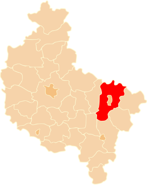
Konin County
County in Greater Poland Voivodeship, Poland
Distance: Approx. 1294 meters
Latitude and longitude: 52.21666667,18.26666667
Konin County (Polish: powiat koniński) is a unit of territorial administration and local government (powiat) in Greater Poland Voivodeship, west-central Poland. It came into being on January 1, 1999, as a result of the Polish local government reforms passed in 1998. Its administrative seat is the city of Konin, although the city is not part of the county (it constitutes a separate city county).
Kraśnica, Greater Poland Voivodeship
Village in Greater Poland Voivodeship, Poland
Distance: Approx. 3662 meters
Latitude and longitude: 52.23333333,18.2
Kraśnica [kraɕˈnit͡sa] is a village in the administrative district of Gmina Golina, within Konin County, Greater Poland Voivodeship, in west-central Poland. It lies approximately 7 kilometres (4 mi) south-east of Golina, 5 km (3 mi) west of Konin, and 90 km (56 mi) east of the regional capital Poznań.
Posada, Gmina Kazimierz Biskupi
Village in Greater Poland Voivodeship, Poland
Distance: Approx. 3825 meters
Latitude and longitude: 52.25527778,18.23027778
Posada [pɔˈsada] is a village in the administrative district of Gmina Kazimierz Biskupi, within Konin County, Greater Poland Voivodeship, in west-central Poland.
Brzeźno, Konin County
Village in Greater Poland Voivodeship, Poland
Distance: Approx. 4227 meters
Latitude and longitude: 52.2,18.3
Brzeźno [ˈbʐɛʑnɔ] is a village in the administrative district of Gmina Krzymów, within Konin County, Greater Poland Voivodeship, in west-central Poland. It lies approximately 10 kilometres (6 mi) west of Krzymów, 3 km (2 mi) south-east of Konin, and 97 km (60 mi) east of the regional capital Poznań.
Chójki, Gmina Krzymów
Village in Greater Poland Voivodeship, Poland
Distance: Approx. 3148 meters
Latitude and longitude: 52.21111111,18.29277778
Chójki [ˈxui̯ki] is a village in the administrative district of Gmina Krzymów, within Konin County, Greater Poland Voivodeship, in west-central Poland. It lies approximately 2 kilometres (1 mi) east of Konin, and 96 km (60 mi) east of the regional capital Poznań.
Zalesie, Gmina Krzymów
Village in Greater Poland Voivodeship, Poland
Distance: Approx. 3183 meters
Latitude and longitude: 52.21861111,18.29722222
Zalesie [zaˈlɛɕɛ] is a village in the administrative district of Gmina Krzymów, within Konin County, Greater Poland Voivodeship, in west-central Poland. It lies approximately 10 kilometres (6 mi) west of Krzymów, 3 km (2 mi) east of Konin, and 97 km (60 mi) east of the regional capital Poznań.
Krągola Pierwsza
Village in Greater Poland Voivodeship, Poland
Distance: Approx. 1294 meters
Latitude and longitude: 52.21666667,18.26666667
Krągola Pierwsza [krɔnˈɡɔla ˈpjɛrfʂa] is a village in the administrative district of Gmina Stare Miasto, within Konin County, Greater Poland Voivodeship, in west-central Poland. It lies approximately 95 km (59 mi) east of the regional capital Poznań.
Rumin, Poland
Village in Greater Poland Voivodeship, Poland
Distance: Approx. 3571 meters
Latitude and longitude: 52.21666667,18.2
Rumin [ˈrumin] is a village in the administrative district of Gmina Stare Miasto, within Konin County, Greater Poland Voivodeship, in west-central Poland. It lies approximately 4 kilometres (2 mi) north of Stare Miasto, 5 km (3 mi) west of Konin, and 90 km (56 mi) east of the regional capital Poznań. The village has an approximate population of 600.
Żychlin, Greater Poland Voivodeship
Village in Greater Poland Voivodeship, Poland
Distance: Approx. 4583 meters
Latitude and longitude: 52.18333333,18.26666667
Żychlin [ˈʐɨxlin] is a village in the administrative district of Gmina Stare Miasto, within Konin County, Greater Poland Voivodeship, in west-central Poland. It lies approximately 4 kilometres (2 mi) east of Stare Miasto, 4 km (2 mi) south of Konin, and 96 km (60 mi) east of the regional capital Poznań.

Konin railway station
Railway station in Konin, Poland
Distance: Approx. 890 meters
Latitude and longitude: 52.23138889,18.25166667
Konin railway station is a railway station in Konin, in the Greater Poland Voivodeship, Poland. The station opened in 1921 and is located on the Warsaw–Kunowice railway and Konin–Kazimierz Biskupi railway. The train services are operated by PKP and Koleje Wielkopolskie.
Weather in this IP's area
light rain
5 Celsius
-1 Celsius
5 Celsius
5 Celsius
1005 hPa
84 %
1005 hPa
994 hPa
10000 meters
9.98 m/s
14.86 m/s
288 degree
100 %
