213.76.217.55 - IP Lookup: Free IP Address Lookup, Postal Code Lookup, IP Location Lookup, IP ASN, Public IP
Country:
Region:
City:
Location:
Time Zone:
Postal Code:
ISP:
ASN:
language:
User-Agent:
Proxy IP:
Blacklist:
IP information under different IP Channel
ip-api
Country
Region
City
ASN
Time Zone
ISP
Blacklist
Proxy
Latitude
Longitude
Postal
Route
db-ip
Country
Region
City
ASN
Time Zone
ISP
Blacklist
Proxy
Latitude
Longitude
Postal
Route
IPinfo
Country
Region
City
ASN
Time Zone
ISP
Blacklist
Proxy
Latitude
Longitude
Postal
Route
IP2Location
213.76.217.55Country
Region
lodzkie
City
piotrkow trybunalski
Time Zone
Europe/Warsaw
ISP
Language
User-Agent
Latitude
Longitude
Postal
ipdata
Country
Region
City
ASN
Time Zone
ISP
Blacklist
Proxy
Latitude
Longitude
Postal
Route
Popular places and events near this IP address

Piotrków Voivodeship
Former administrative division in Poland
Distance: Approx. 690 meters
Latitude and longitude: 51.405033,19.693289
Piotrków Voivodeship (Polish: województwo piotrkowskie) was a voivodeship, or unit of administrative division and local government, in Poland from 1975 to 1998, superseded by Łódź Voivodeship. Its capital city was Piotrków Trybunalski.

Piotrków Trybunalski
Place in Łódź Voivodeship, Poland
Distance: Approx. 1509 meters
Latitude and longitude: 51.4,19.68333333
Piotrków Trybunalski ([ˈpʲɔtrkuf trɨbuˈnalskʲi] ; also known by alternative names), often simplified to Piotrków, is a city in central Poland with 71,252 inhabitants (2021). It is the capital of Piotrków County and the second-largest city in the Łódź Voivodeship. Founded in the late Middle Ages, Piotrków was once a royal city and holds an important place in Polish history; the first parliament sitting was held here in the 15th century.

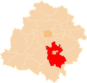
Piotrków County
County in Łódź Voivodeship, Poland
Distance: Approx. 1509 meters
Latitude and longitude: 51.4,19.68333333
Piotrków County (Polish: powiat piotrkowski) is a unit of territorial administration and local government (powiat) in Łódź Voivodeship, central Poland. It came into being on January 1, 1999, as a result of the Polish local government reforms passed in 1998. Its administrative seat is the city of Piotrków Trybunalski, although the city is not part of the county (it constitutes a separate city county).

Great Synagogue (Piotrków Trybunalski)
Destroyed synagogue in Piotrków Trybunalski, Poland
Distance: Approx. 466 meters
Latitude and longitude: 51.409566,19.701608
The Great Synagogue (Polish: Wielka Synagoga w Piotrkowie Trybunalskim) was a former Orthodox Jewish congregation and synagogue, located at 29 Jerizilimska Street, in Piotrków Trybunalski, in the Łódź Voivodeship of Poland. Designed by David Friedlander and completed in 1793, the synagogue served as a house of prayer until World War II when it was desecrated by Nazis. After the war, the building was renovated and repurposed as a county library.

Piotrków Governorate
1867–1915 unit of Poland
Distance: Approx. 690 meters
Latitude and longitude: 51.405033,19.693289
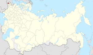
Piotrków Governorate was an administrative-territorial unit (guberniya) of Congress Poland of the Russian Empire, established in 1867 by splitting some areas of Radom and Warsaw Governorates. Its capital was in Petrokov (Piotrków Trybunalski).
Longinówka
Village in Łódź Voivodeship, Poland
Distance: Approx. 4329 meters
Latitude and longitude: 51.36666667,19.7
Longinówka [lɔŋɡiˈnufka] is a village in the administrative district of Gmina Rozprza, within Piotrków County, Łódź Voivodeship, in central Poland. It lies approximately 9 kilometres (6 mi) north-east of Rozprza, 4 km (2 mi) south of Piotrków Trybunalski, and 49 km (30 mi) south of the regional capital Łódź.
Poniatów, Piotrków County
Village in Łódź Voivodeship, Poland
Distance: Approx. 4400 meters
Latitude and longitude: 51.39305556,19.76333333
Poniatów [pɔˈɲatuf] is a village in the administrative district of Gmina Sulejów, within Piotrków County, Łódź Voivodeship, in central Poland. It lies approximately 10 kilometres (6 mi) north-west of Sulejów, 6 km (4 mi) east of Piotrków Trybunalski, and 48 km (30 mi) south-east of the regional capital Łódź.
Zalesice, Łódź Voivodeship
Village in Łódź Voivodeship, Poland
Distance: Approx. 3315 meters
Latitude and longitude: 51.3775,19.71944444
Zalesice [zalɛˈɕit͡sɛ] is a village in the administrative district of Gmina Sulejów, within Piotrków County, Łódź Voivodeship, in central Poland. It lies approximately 12 kilometres (7 mi) west of Sulejów, 4 km (2 mi) south-east of Piotrków Trybunalski, and 49 km (30 mi) south of the regional capital Łódź.
Zalesice-Kolonia, Łódź Voivodeship
Village in Łódź Voivodeship, Poland
Distance: Approx. 4397 meters
Latitude and longitude: 51.36805556,19.72333333
Zalesice-Kolonia [zalɛˈɕit͡sɛ kɔˈlɔɲa] is a village in the administrative district of Gmina Sulejów, within Piotrków County, Łódź Voivodeship, in central Poland. It lies approximately 12 kilometres (7 mi) west of Sulejów, 5 km (3 mi) south-east of Piotrków Trybunalski, and 50 km (31 mi) south of the regional capital Łódź.
Battle of Piotrków Trybunalski
Distance: Approx. 1509 meters
Latitude and longitude: 51.4,19.68333333
The Battle of Piotrków Trybunalski was a battle in the German Invasion of Poland from 4 to 6 September 1939, which involved Polish and German tank formations.

Piotrków Trybunalski Ghetto
Nazi ghetto in occupied Poland
Distance: Approx. 466 meters
Latitude and longitude: 51.409566,19.701608
The Piotrków Trybunalski Ghetto (Yiddish: פּיִעטריקאָװ) was created in Piotrków Trybunalski on October 8, 1939, shortly after the 1939 German Invasion of Poland in World War II. It was the first Nazi ghetto in occupied Europe. founded on October 8, 1939 The town was occupied by the Wehrmacht on September 5, 1939. Piotrków was made into a county seat (Kreis) of the newly created Łódź District (Regierungsbezirk Litzmannstadt) of the German territory of Reichsgau Wartheland.

Bolesław I the Brave High School in Piotrków Trybunalski
Catholic high school in Poland
Distance: Approx. 651 meters
Latitude and longitude: 51.4,19.7
Bolesław I the Brave High School in Piotrków Trybunalski (I Liceum Ogólnokształcące im. Bolesława Chrobrego w Piotrkowie Trybunalskim) - a high school in Piotrków Trybunalski. The school continues the tradition of two conventual schools organized by Piarists (1675) and Jesuits (1716).
Weather in this IP's area
clear sky
-0 Celsius
-3 Celsius
-0 Celsius
-0 Celsius
1027 hPa
86 %
1027 hPa
1001 hPa
10000 meters
2.5 m/s
4.04 m/s
175 degree
1 %
