213.76.140.236 - IP Lookup: Free IP Address Lookup, Postal Code Lookup, IP Location Lookup, IP ASN, Public IP
Country:
Region:
City:
Location:
Time Zone:
Postal Code:
IP information under different IP Channel
ip-api
Country
Region
City
ASN
Time Zone
ISP
Blacklist
Proxy
Latitude
Longitude
Postal
Route
Luminati
Country
Region
06
City
lublin
ASN
Time Zone
Europe/Warsaw
ISP
Orange Polska Spolka Akcyjna
Latitude
Longitude
Postal
IPinfo
Country
Region
City
ASN
Time Zone
ISP
Blacklist
Proxy
Latitude
Longitude
Postal
Route
IP2Location
213.76.140.236Country
Region
pomorskie
City
gniezdzewo
Time Zone
Europe/Warsaw
ISP
Language
User-Agent
Latitude
Longitude
Postal
db-ip
Country
Region
City
ASN
Time Zone
ISP
Blacklist
Proxy
Latitude
Longitude
Postal
Route
ipdata
Country
Region
City
ASN
Time Zone
ISP
Blacklist
Proxy
Latitude
Longitude
Postal
Route
Popular places and events near this IP address

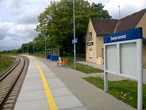
Swarzewo railway station
Railway station in Gnieżdżewo, Poland
Distance: Approx. 792 meters
Latitude and longitude: 54.7539,18.3744
Swarzewo railway station is a railway stop serving the village of Swarzewo, in the Pomeranian Voivodeship, Poland. The station opened in 1903 and is located on the Reda–Hel railway. The train services are operated by Przewozy Regionalne.

Łebcz railway station
Railway station in Łebcz, Poland
Distance: Approx. 3629 meters
Latitude and longitude: 54.76944444,18.33777778
Łebcz is a no longer operational PKP railway station in Łebcz (Pomeranian Voivodeship), Poland.
Celbówko
Village in Pomeranian Voivodeship, Poland
Distance: Approx. 4828 meters
Latitude and longitude: 54.70472222,18.39277778
Celbówko [t͡sɛlˈbufkɔ] is a village in the administrative district of Gmina Puck, within Puck County, Pomeranian Voivodeship, in northern Poland. It lies approximately 1 kilometre (1 mi) north-west of Puck and 41 km (25 mi) north-west of the regional capital Gdańsk. For details of the history of the region, see History of Pomerania.
Dana, Pomeranian Voivodeship
Village in Pomeranian Voivodeship, Poland
Distance: Approx. 2655 meters
Latitude and longitude: 54.77111111,18.375
Dana [ˈdana] (Kashubian: Danóf) is a village in the administrative district of Gmina Puck, within Puck County, Pomeranian Voivodeship, in northern Poland. It lies approximately 9 kilometres (6 mi) north of Puck and 48 km (30 mi) north of the regional capital Gdańsk.

Gnieżdżewo
Village in Pomeranian Voivodeship, Poland
Distance: Approx. 177 meters
Latitude and longitude: 54.74583333,18.37888889
Gnieżdżewo [ɡɲɛʐˈd͡ʐɛvɔ] is a village in the administrative district of Gmina Puck, within Puck County, Pomeranian Voivodeship, in northern Poland. It lies approximately 6 kilometres (4 mi) north of Puck and 46 km (29 mi) north of the regional capital Gdańsk. It is located within the ethnocultural region of Kashubia in the historic region of Pomerania.
Łebcz
Village in Pomeranian Voivodeship, Poland
Distance: Approx. 3636 meters
Latitude and longitude: 54.76805556,18.33555556
Łebcz [wɛpt͡ʂ] is a village in the administrative district of Gmina Puck, within Puck County, Pomeranian Voivodeship, in northern Poland. It lies approximately 9 kilometres (6 mi) north-west of Puck and 49 km (30 mi) north-west of the regional capital Gdańsk. For details of the history of the region, see History of Pomerania.
Podgóry, Puck County
Village in Pomeranian Voivodeship, Poland
Distance: Approx. 3139 meters
Latitude and longitude: 54.77361111,18.36138889
Podgóry [pɔdˈɡurɨ] is a village in the administrative district of Gmina Puck, within Puck County, Pomeranian Voivodeship, in northern Poland. It lies approximately 9 kilometres (6 mi) north of Puck and 49 km (30 mi) north of the regional capital Gdańsk. For details of the history of the region, see History of Pomerania.

Połczyno, Pomeranian Voivodeship
Village in Pomeranian Voivodeship, Poland
Distance: Approx. 4594 meters
Latitude and longitude: 54.70833333,18.35638889
Połczyno [pɔu̯ˈt͡ʂɨnɔ] is a village in the administrative district of Gmina Puck, within Puck County, Pomeranian Voivodeship, in northern Poland. It lies approximately 3 kilometres (2 mi) west of Puck and 42 km (26 mi) north-west of the regional capital Gdańsk. It is located within the ethnocultural region of Kashubia in the historic region of Pomerania.
Pustki, Puck County
Village in Pomeranian Voivodeship, Poland
Distance: Approx. 4348 meters
Latitude and longitude: 54.77444444,18.33055556
Pustki [ˈpustki] is a village in the administrative district of Gmina Puck, within Puck County, Pomeranian Voivodeship, in northern Poland. It lies approximately 10 kilometres (6 mi) north-west of Puck and 50 km (31 mi) north-west of the regional capital Gdańsk. For details of the history of the region, see History of Pomerania.
Swarzewo
Village in Pomeranian Voivodeship, Poland
Distance: Approx. 1658 meters
Latitude and longitude: 54.75861111,18.39638889
Swarzewo [sfaˈʐɛvɔ] is a village in the administrative district of Gmina Puck, within Puck County, Pomeranian Voivodeship, in northern Poland. It lies approximately 7 kilometres (4 mi) north of Puck and 47 km (29 mi) north of the regional capital Gdańsk. It is located on the Bay of Puck within the historic region of Pomerania.
Zele, Poland
Village in Pomeranian Voivodeship, Poland
Distance: Approx. 2683 meters
Latitude and longitude: 54.75583333,18.34027778
Zele [ˈzɛlɛ] is a village in the administrative district of Gmina Puck, within Puck County, Pomeranian Voivodeship, in northern Poland. It lies approximately 8 kilometres (5 mi) north-west of Puck and 48 km (30 mi) north-west of the regional capital Gdańsk. For details of the history of the region, see History of Pomerania.

Płutnica
River in Poland
Distance: Approx. 2463 meters
Latitude and longitude: 54.7279,18.3975
Płutnica is a river of Poland. It leads to the Bay of Puck above the town of Puck.
Weather in this IP's area
overcast clouds
-3 Celsius
-10 Celsius
-3 Celsius
-3 Celsius
1012 hPa
73 %
1012 hPa
1011 hPa
10000 meters
8.22 m/s
12.94 m/s
229 degree
100 %
