Country:
Region:
City:
Latitude and Longitude:
Time Zone:
Postal Code:
IP information under different IP Channel
ip-api
Country
Region
City
ASN
Time Zone
ISP
Blacklist
Proxy
Latitude
Longitude
Postal
Route
Luminati
Country
Region
ga
City
vilagarciadearousa
ASN
Time Zone
Europe/Madrid
ISP
R Cable y Telecable Telecomunicaciones, S.A.U.
Latitude
Longitude
Postal
IPinfo
Country
Region
City
ASN
Time Zone
ISP
Blacklist
Proxy
Latitude
Longitude
Postal
Route
db-ip
Country
Region
City
ASN
Time Zone
ISP
Blacklist
Proxy
Latitude
Longitude
Postal
Route
ipdata
Country
Region
City
ASN
Time Zone
ISP
Blacklist
Proxy
Latitude
Longitude
Postal
Route
Popular places and events near this IP address

Rianxo
Place
Distance: Approx. 6974 meters
Latitude and longitude: 42.65,-8.81667
Rianxo is a port town and municipality in the autonomous community of Galicia in northwestern Spain in the province of A Coruña. It has a population of a little over 10,000 and its two main industries are fishing and tourism. The town's yearly celebration of Our Lady of Guadalupe is popular with tourists.
Portas
Municipality in Spain
Distance: Approx. 8588 meters
Latitude and longitude: 42.58333333,-8.66666667
Portas is a small municipality in the province of Pontevedra, in the autonomous community of Galicia, Spain. It belongs to the comarca of Caldas.

Catoira
Municipality in Galicia, Spain
Distance: Approx. 8613 meters
Latitude and longitude: 42.66666667,-8.72166667
Catoira is a municipality in Galicia, Spain, located in the province of Pontevedra. Catoira is famous for its ruins of the Torres do Oeste (Towers of the West).
Vilanova de Arousa
Municipality
Distance: Approx. 6157 meters
Latitude and longitude: 42.56285,-8.82782
Vilanova de Arousa (Galician: [ˌbilɐˈnɔβɐ ð(e) aˈɾowsɐ]; unofficial Spanish: Villanueva de Arosa) is a municipality in the province of Pontevedra, in the autonomous community of Galicia, Spain. It belongs to the comarca of O Salnés.

A Illa de Arousa
Municipality in Galicia, Spain
Distance: Approx. 9112 meters
Latitude and longitude: 42.55444444,-8.86388889
A Illa de Arousa (Galician: [a ˈiʎɐ ð(e) aˈɾowsɐ]; unofficial Spanish: Isla de Arosa) is the only island municipality in Galicia, Spain in the province of Pontevedra. It is located in the heart of the Ria de Arousa. According to 2021 INE the island's population was 4,951 inhabitants.
Ribadumia
Place
Distance: Approx. 9174 meters
Latitude and longitude: 42.51666667,-8.75
Ribadumia is a municipality in Galicia, Spain in the province of Pontevedra. In 1151, in the parroquia of Barrantes now in Ribadumia, a group tried to found a monastery with the help of the local magnate Gómez Núñez, but their efforts came to nothing.

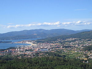
Vilagarcía de Arousa
Municipality in Galicia, Spain
Distance: Approx. 526 meters
Latitude and longitude: 42.597713,-8.763187
Vilagarcía de Arousa (Spanish: [bilaɣaɾˈθi.a ðe aˈɾowsa] , Galician: [ˌbilɐɣaɾˈθi.ɐ ð(e) aˈɾowsɐ]; unofficial Spanish: Villagarcía de Arosa) is a municipality in the province of Pontevedra, in Galicia, Spain. As of 2014 it has a population of 37,712, being ninth largest town in Galicia.
Arosa SC
Association football club in Spain
Distance: Approx. 1154 meters
Latitude and longitude: 42.588589,-8.776056
Arosa Sociedad Cultural is a Spanish football team based in Vilagarcía de Arousa, in the autonomous community of Galicia. Founded in 1945, it plays in Tercera Federación – Group 1, holding home games at Estadio A Lomba, with a capacity of 5,000 seats.

Torres de Oeste
Distance: Approx. 9478 meters
Latitude and longitude: 42.6766,-8.72577
Oeste Towers (Galician and Spanish: Torres de Oeste) is a castle in Catoira, Galicia, Spain. It is located at the head of the Ría de Arousa. It is in the region of Caldas (Pontevedra), in the river Ulla estuary.

Cortegada Island
Island in Galicia, Spain
Distance: Approx. 2632 meters
Latitude and longitude: 42.61861,-8.78486
Cortegada is an almost tidal island (it is possible to go walking when the lowest tides happen, but a small amount of water flow does not disappear) in a coastal inlet near Pontevedra in Galicia, Spain. It is part of the Atlantic Islands of Galicia National Park.
Castro de Achadizo
Archaeological site in Galicia, Spain
Distance: Approx. 9634 meters
Latitude and longitude: 42.61638889,-8.88444444
Castro de Achadizo is a ruined site in Province of A Coruña, Galicia, Spain.
Weather in this IP's area
broken clouds
13 Celsius
13 Celsius
13 Celsius
15 Celsius
1017 hPa
83 %
1017 hPa
1017 hPa
10000 meters
1.92 m/s
3.28 m/s
55 degree
75 %
08:26:57
18:12:45


