213.5.255.11 - IP Lookup: Free IP Address Lookup, Postal Code Lookup, IP Location Lookup, IP ASN, Public IP
Country:
Region:
City:
Location:
Time Zone:
Postal Code:
IP information under different IP Channel
ip-api
Country
Region
City
ASN
Time Zone
ISP
Blacklist
Proxy
Latitude
Longitude
Postal
Route
Luminati
Country
Region
24
City
czechowicedziedzice
ASN
Time Zone
Europe/Warsaw
ISP
KOLNET Sp. z o.o.
Latitude
Longitude
Postal
IPinfo
Country
Region
City
ASN
Time Zone
ISP
Blacklist
Proxy
Latitude
Longitude
Postal
Route
IP2Location
213.5.255.11Country
Region
slaskie
City
czechowice-dziedzice
Time Zone
Europe/Warsaw
ISP
Language
User-Agent
Latitude
Longitude
Postal
db-ip
Country
Region
City
ASN
Time Zone
ISP
Blacklist
Proxy
Latitude
Longitude
Postal
Route
ipdata
Country
Region
City
ASN
Time Zone
ISP
Blacklist
Proxy
Latitude
Longitude
Postal
Route
Popular places and events near this IP address

Czechowice-Dziedzice
Place in Silesian Voivodeship, Poland
Distance: Approx. 120 meters
Latitude and longitude: 49.91305556,19.00638889
Czechowice-Dziedzice [t͡ʂɛxɔˈvit͡sɛ d͡ʑɛˈd͡ʑit͡sɛ] (Silesian: Czechowice-Dziydzice), known until 1958 as Czechowice, is a town in Bielsko County, Silesian Voivodeship, southern Poland. The town has 35,684 inhabitants, as of December 2021. It lies on the northeastern edge of the historical region of Cieszyn Silesia.

Goczałkowice-Zdrój
Village in Silesian Voivodeship, Poland
Distance: Approx. 3520 meters
Latitude and longitude: 49.93333333,18.96666667
Goczałkowice-Zdrój [ɡɔt͡ʂau̯kɔˈvit͡sɛ ˈzdrui̯] is a village in Pszczyna County, Silesian Voivodeship, in southern Poland. It is the seat of the gmina (administrative district) called Gmina Goczałkowice-Zdrój. It lies approximately 6 kilometres (4 mi) south of Pszczyna and 36 km (22 mi) south of the regional capital Katowice.
Biała (Vistula)
River in Poland
Distance: Approx. 4089 meters
Latitude and longitude: 49.94746,19.026153
The Biała (German: Bialka) is a river in southern Poland. The 29 km (18 mi) long Biala is a right tributary of the Vistula. It is the main river of the city of Bielsko-Biała and used to be historically important as a border river dividing not only Bielsko and Biała but also for several centuries the states of Bohemia (succeeded by the Habsburg monarchy) and Poland.
Zabrzeg
Village in Silesian Voivodeship, Poland
Distance: Approx. 4248 meters
Latitude and longitude: 49.91444444,18.94555556
Zabrzeg is a village in Gmina Czechowice-Dziedzice, Bielsko County, Silesian Voivodeship, southern Poland. The name is of topographic origin and is a composition of two words: za (behind) and brzeg (coast or bank of the river).: 189 The village lies on the right bank of the Vistula river, on the edge of the historical region of Cieszyn Silesia.
Ligota, Silesian Voivodeship
Village in Silesian Voivodeship, Poland
Distance: Approx. 5456 meters
Latitude and longitude: 49.88055556,18.94833333
Ligota is a village in Gmina Czechowice-Dziedzice, Bielsko County, Silesian Voivodeship, southern Poland. It lies on the edge of the historical region of Cieszyn Silesia. Ligota is a common name for villages in Western Poland.

Gmina Bestwina
Gmina in Silesian Voivodeship, Poland
Distance: Approx. 4351 meters
Latitude and longitude: 49.89638889,19.05944444
Gmina Bestwina is a rural gmina (administrative district) in Bielsko County, Silesian Voivodeship, in southern Poland. Its seat is the village of Bestwina, which lies approximately 8 kilometres (5 mi) north of Bielsko-Biała and 40 km (25 mi) south of the regional capital Katowice. The gmina covers an area of 37.55 square kilometres (14.5 sq mi), and as of 2019 its total population is 11,816.

Gmina Czechowice-Dziedzice
Gmina in Silesian Voivodeship, Poland
Distance: Approx. 120 meters
Latitude and longitude: 49.91305556,19.00638889
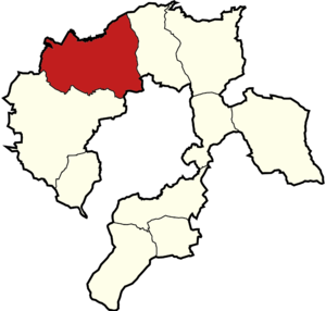
Gmina Czechowice-Dziedzice is an urban-rural gmina (administrative district) in Bielsko County, Silesian Voivodeship, in southern Poland. Its seat is the town of Czechowice-Dziedzice, which lies approximately 13 kilometres (8 mi) north-west of Bielsko-Biała and 36 km (22 mi) south of the regional capital Katowice. The gmina covers an area of 66.28 square kilometres (25.6 sq mi), and as of 2019 its total population is 45,451.
Gmina Goczałkowice-Zdrój
Gmina in Silesian Voivodeship, Poland
Distance: Approx. 3096 meters
Latitude and longitude: 49.93722222,18.9825
Gmina Goczałkowice-Zdrój is a rural gmina (administrative district) in Pszczyna County, Silesian Voivodeship, in southern Poland. Its seat is the village of Goczałkowice-Zdrój, which lies approximately 6 kilometres (4 mi) south-east of Pszczyna and 35 km (22 mi) south of the regional capital Katowice. The gmina covers an area of 48.64 square kilometres (18.8 sq mi), and as of 2019 its total population is 6,761.
Bestwina
Village in Silesian Voivodeship, Poland
Distance: Approx. 4351 meters
Latitude and longitude: 49.89638889,19.05944444
Bestwina [bɛstˈfʲina] is a village in Bielsko County, Silesian Voivodeship, in southern Poland. It is the seat of the gmina (administrative district) called Gmina Bestwina. It lies approximately 8 kilometres (5 mi) north of Bielsko-Biała and 40 km (25 mi) south of the regional capital Katowice.
Bestwinka
Village in Silesian Voivodeship, Poland
Distance: Approx. 4216 meters
Latitude and longitude: 49.91861111,19.06305556
Bestwinka [bɛstˈfinka] is a village in the administrative district of Gmina Bestwina, within Bielsko County, Silesian Voivodeship, in southern Poland. It lies approximately 3 kilometres (2 mi) north of Bestwina, 10 km (6 mi) north of Bielsko-Biała, and 38 km (24 mi) south of the regional capital Katowice.
Kaniów, Silesian Voivodeship
Village in Silesian Voivodeship, Poland
Distance: Approx. 3018 meters
Latitude and longitude: 49.93333333,19.03333333
Kaniów [ˈkaɲuf] is a village in the administrative district of Gmina Bestwina, within Bielsko County, Silesian Voivodeship, in southern Poland. It lies approximately 5 kilometres (3 mi) north-west of Bestwina, 12 km (7 mi) north of Bielsko-Biała, and 36 km (22 mi) south of the regional capital Katowice. The village is located in the historical region Galicia.

Czechowice-Dziedzice railway station
Railway station in Silesia, Poland
Distance: Approx. 212 meters
Latitude and longitude: 49.9148543,19.0028932
Czechowice-Dziedzice railway station is a railway station in Czechowice-Dziedzice (Silesian Voivodeship), Poland. As of 2022, it is served by Koleje Śląskie (Silesian Voivodeship Railways) and PKP Intercity (EIP, InterCity, and TLK services).
Weather in this IP's area
overcast clouds
4 Celsius
1 Celsius
4 Celsius
4 Celsius
1011 hPa
91 %
1011 hPa
971 hPa
10000 meters
2.89 m/s
6.42 m/s
226 degree
91 %


