Country:
 Netherlands
Region:
City:
Latitude and Longitude:
Time Zone:
Postal Code:
IP information under different IP Channel
ip-api
Country
Region
City
ASN
Time Zone
ISP
Blacklist
Proxy
Latitude
Longitude
Postal
Route
IPinfo
Country
Region
City
ASN
Time Zone
ISP
Blacklist
Proxy
Latitude
Longitude
Postal
Route
MaxMind
Country
Region
City
ASN
Time Zone
ISP
Blacklist
Proxy
Latitude
Longitude
Postal
Route
Luminati
Country
NLRegion
ze
City
clinge
ASN
Time Zone
Europe/Amsterdam
ISP
DELTA Fiber Nederland B.V.
Latitude
Longitude
Postal
db-ip
Country
Region
City
ASN
Time Zone
ISP
Blacklist
Proxy
Latitude
Longitude
Postal
Route
ipdata
Country
Region
City
ASN
Time Zone
ISP
Blacklist
Proxy
Latitude
Longitude
Postal
Route
Popular places and events near this IP address
Hontenisse
Former municipality in the Netherlands
Distance: Approx. 1147 meters
Latitude and longitude: 51.35138889,4.04138889
Hontenisse (population in 2002: 8,014) is a former municipality in the southwestern Netherlands, in the municipality of Hulst in the province of Zeeland. The municipality covered an area of 115.78 km² (of which 3.53 km² water). On January 1, 2003 Hontenisse was merged into Hulst.
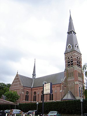
Graauw
Village in Zeeland, Netherlands
Distance: Approx. 3853 meters
Latitude and longitude: 51.32777778,4.10222222
Graauw is a village in the Dutch province of Zeeland. It is a part of the municipality of Hulst, and lies about 22 km southwest of Bergen op Zoom.

Paal, Netherlands
Hamlet in Zeeland, Netherlands
Distance: Approx. 3891 meters
Latitude and longitude: 51.35444444,4.1075
Paal is a hamlet in the southwest Netherlands. It is a part of the municipality of Hulst, Zeeland, and is located 35 km north of Antwerp, Belgium. The village was first mentioned in 1847 as Paal (De), and refers to a beacon.

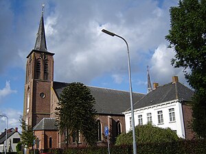
Kloosterzande
Village in Zeeland, Netherlands
Distance: Approx. 3998 meters
Latitude and longitude: 51.37111111,4.015
Kloosterzande is a village in the Dutch province of Zeeland. It is a part of the municipality of Hulst, and lies about 24 km southwest of Bergen op Zoom.

Lamswaarde
Village in Zeeland, Netherlands
Distance: Approx. 273 meters
Latitude and longitude: 51.3425,4.05583333
Lamswaarde is a village in the Dutch province of Zeeland. It is a part of the municipality of Hulst and lies about 23 km southwest of Bergen op Zoom. The village was first mentioned around 1260 as Lamswerd, and means "land on water belonging to Lam(bert)".

Kuitaart
Village in Zeeland, Netherlands
Distance: Approx. 1469 meters
Latitude and longitude: 51.33972222,4.03416667
Kuitaart is a village in the Dutch province of Zeeland. It is a part of the municipality of Hulst, and lies about 24 km southwest of Bergen op Zoom. The village was first mentioned in 1469 as up Coytaerde.

Terhole
Village in Zeeland, Netherlands
Distance: Approx. 3310 meters
Latitude and longitude: 51.31666667,4.0375
Terhole or Ter Hole is a village in the Dutch province of Zeeland. It is a part of the municipality of Hulst, and lies about 26 km southwest of Bergen op Zoom. It was first mentioned in 1542 as Ten Hole.
Hengstdijk
Village in Zeeland, Netherlands
Distance: Approx. 4072 meters
Latitude and longitude: 51.34333333,3.99527778
Hengstdijk is a village in the Dutch province of Zeeland. It is a part of the municipality of Hulst, and lies about 26 km southwest of Bergen op Zoom. The village was first mentioned in 1161 as Hencsdic, and means "dike of Henge (person)".
Kruispolderhaven
Hamlet in Zeeland, Netherlands
Distance: Approx. 3072 meters
Latitude and longitude: 51.355,4.09472222
Kruispolderhaven is a hamlet located in the eastern Zeelandic Flanders portion of the Dutch province of Zeeland. Its name originates from its location at the eastern tip of the Kruispolder, a "crossed" polder adjacent to a (now nonexistent) seaport on the southern bank of the Western Scheldt estuary.
Baalhoek
Hamlet in Zeeland, Netherlands
Distance: Approx. 2700 meters
Latitude and longitude: 51.355,4.08888889
Baalhoek is a hamlet in the Dutch province of Zeeland. It is located in the municipality of Hulst, about 5 km east of Kloosterzande on the dyke of the Westerschelde. The name of the hamlet refers to an old pier to the north, "Ten Ballen", used by a ferry.

Siege of Hulst (1596)
Distance: Approx. 3206 meters
Latitude and longitude: 51.3158,4.0539
The siege of Hulst of 1596 took place between mid-July and August 18, 1596, at the city of Hulst, Province of Zeeland, Low Countries (present-day the Netherlands), during the Eighty Years' War, the Anglo-Spanish War (1585–1604). The siege was won by the Spanish forces of the Archduke of Austria. After a short siege, during which Maurice of Orange launched a failed attempt to relieve the city, the garrison of Dutch and English troops fell into Spanish hands on August 18, 1596.

Siege of Hulst (1591)
1591 siege
Distance: Approx. 3206 meters
Latitude and longitude: 51.3158,4.0539
The siege of Hulst was a siege of the city of Hulst that took place between 20 and 24 September 1591 by a Dutch and English army under the leadership of Maurice of Orange during the Eighty Years' War and the Anglo–Spanish War. The siege was part of Maurice's famous campaign of 1591.
Weather in this IP's area
overcast clouds
19 Celsius
19 Celsius
18 Celsius
20 Celsius
1009 hPa
80 %
1009 hPa
1009 hPa
10000 meters
0.89 m/s
1.79 m/s
202 degree
94 %
07:08:20
20:14:46