Country:
 Netherlands
Region:
City:
Latitude and Longitude:
Time Zone:
Postal Code:
IP information under different IP Channel
ip-api
Country
Region
City
ASN
Time Zone
ISP
Blacklist
Proxy
Latitude
Longitude
Postal
Route
IPinfo
Country
Region
City
ASN
Time Zone
ISP
Blacklist
Proxy
Latitude
Longitude
Postal
Route
MaxMind
Country
Region
City
ASN
Time Zone
ISP
Blacklist
Proxy
Latitude
Longitude
Postal
Route
Luminati
Country
NLRegion
ze
City
zoutelande
ASN
Time Zone
Europe/Amsterdam
ISP
DELTA Fiber Nederland B.V.
Latitude
Longitude
Postal
db-ip
Country
Region
City
ASN
Time Zone
ISP
Blacklist
Proxy
Latitude
Longitude
Postal
Route
ipdata
Country
Region
City
ASN
Time Zone
ISP
Blacklist
Proxy
Latitude
Longitude
Postal
Route
Popular places and events near this IP address

Westkapelle, Netherlands
City in Zeeland, Netherlands
Distance: Approx. 3195 meters
Latitude and longitude: 51.52944444,3.45722222
Westkapelle (zeelandic: Weskappel, locally: Wasschappell) is a small city in the municipality of Veere on the island Walcheren, in the province Zeeland of the Netherlands. On 1 January 2021, it had a population of 2,632. Westkapelle is on the westernmost tip of Walcheren and is surrounded by the sea on three sides.

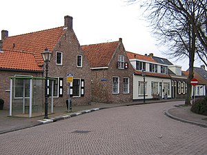
Zoutelande
Village in Zeeland, Netherlands
Distance: Approx. 463 meters
Latitude and longitude: 51.50138889,3.48472222
Zoutelande (Zeelandic: Zóetelande) is a village in the southwestern Netherlands. It is located in the municipality of Veere, Zeeland, between Dishoek and Westkapelle on the former island Walcheren. On 1 January 2005 it had 1,556 inhabitants.

Meliskerke
Village in Zeeland, Netherlands
Distance: Approx. 2406 meters
Latitude and longitude: 51.51527778,3.51194444
Meliskerke is a village in the Dutch province of Zeeland. It is a part of the municipality of Veere, and lies about 8 km west of Middelburg.

Koudekerke
Village in Zeeland, Netherlands
Distance: Approx. 5016 meters
Latitude and longitude: 51.4975,3.55277778
Koudekerke (Zeelandic: Koukerke) is a village in the region of Walcheren in the Dutch province of Zeeland. It is a part of the municipality of Veere. As of 2018, the census reported the village has a population of 3,419, making it the largest settlement in Veere.

Dishoek
Neighbourhood in Veere, Zeeland, Netherlands
Distance: Approx. 4750 meters
Latitude and longitude: 51.47138889,3.52361111
Dishoek is a neighbourhood of Koudekerke in the Dutch province of Zeeland. It is a part of the municipality of Veere, and lies about 4 km west of Vlissingen. The hamlet of Dishoek near Koudekerke became a seaside resort due to its beaches, and contains holiday homes, campsites and hotels.
Biggekerke
Village in Zeeland, Netherlands
Distance: Approx. 3130 meters
Latitude and longitude: 51.49833333,3.52527778
Biggekerke is a village in the Dutch province of Zeeland. It is a part of the municipality of Veere, and lies about 6 km northwest of Vlissingen.
Joossesweg
Neighbourhood in Veere, Zeeland, Netherlands
Distance: Approx. 2110 meters
Latitude and longitude: 51.51555556,3.45611111
Joossesweg is a neighbourhood of Westkapelle in the Dutch province of Zeeland. It is a part of the municipality of Veere. It is a bungalow park near the sea.
Domburg-Buiten
Distance: Approx. 4774 meters
Latitude and longitude: 51.5478,3.4858
Domburg-Buiten is a former municipality in the Dutch province of Zeeland. It existed until 1816, when it merged with Domburg-Binnen to form the new municipality of Domburg. The municipality of Domburg-Buiten covered the countryside of Domburg.
Mariekerke, Netherlands
Distance: Approx. 3825 meters
Latitude and longitude: 51.51666667,3.53333333
Mariekerke is a former municipality in the Dutch province of Zeeland. The municipality was formed in a merger of Aagtekerke, Grijpskerke and Meliskerke in 1966, and existed until 1997 when it merged into the municipality of Veere. The municipality was named after the former village of Mariekerke, which is now a hamlet named Klein Mariekerke.

Valkenisse, Walcheren
Distance: Approx. 2970 meters
Latitude and longitude: 51.48888889,3.51555556
Valkenisse is a former municipality in the Dutch province of Zeeland, on the peninsula of Walcheren. Valkenisse was created in 1966 in a merger of Biggekerke, Koudekerke and Zoutelande, and existed until 1997, when it was merged into Veere. The municipality was named after the two hamlets Groot-Valkenisse and Klein-Valkenisse.
Westkapelle-Binnen
Distance: Approx. 3890 meters
Latitude and longitude: 51.52916667,3.44083333
Westkapelle-Binnen is a former municipality in the Dutch province of Zeeland. It existed until 1816, when it merged with Westkapelle-Buiten en Sirpoppekerke to form the new municipality of Westkapelle. The municipality consisted only of the village of Westkapelle, not including any surrounding countryside.
Westkapelle-Buiten en Sirpoppekerke
Distance: Approx. 3868 meters
Latitude and longitude: 51.53694444,3.45944444
Westkapelle-Buiten en Sirpoppekerke is a former municipality in the Dutch province of Zeeland. It existed until 1816, when it merged with Westkapelle-Binnen to form the new municipality Westkapelle. The municipality covered the countryside north and south of the town of Westkapelle, and the former hamlet Poppekerke.
Weather in this IP's area
broken clouds
18 Celsius
17 Celsius
17 Celsius
19 Celsius
1008 hPa
82 %
1008 hPa
1008 hPa
10000 meters
10.29 m/s
190 degree
62 %
07:10:27
20:17:14