Country:
 Netherlands
Region:
City:
Latitude and Longitude:
Time Zone:
Postal Code:
IP information under different IP Channel
ip-api
Country
Region
City
ASN
Time Zone
ISP
Blacklist
Proxy
Latitude
Longitude
Postal
Route
IPinfo
Country
Region
City
ASN
Time Zone
ISP
Blacklist
Proxy
Latitude
Longitude
Postal
Route
MaxMind
Country
Region
City
ASN
Time Zone
ISP
Blacklist
Proxy
Latitude
Longitude
Postal
Route
Luminati
Country
NLRegion
ze
City
yerseke
ASN
Time Zone
Europe/Amsterdam
ISP
DELTA Fiber Nederland B.V.
Latitude
Longitude
Postal
db-ip
Country
Region
City
ASN
Time Zone
ISP
Blacklist
Proxy
Latitude
Longitude
Postal
Route
ipdata
Country
Region
City
ASN
Time Zone
ISP
Blacklist
Proxy
Latitude
Longitude
Postal
Route
Popular places and events near this IP address

Canal through Zuid-Beveland
Canal in Netherlands
Distance: Approx. 3177 meters
Latitude and longitude: 51.4825,4.00416667
The Canal through Zuid-Beveland (Dutch: Kanaal door Zuid-Beveland) in the southwest Netherlands is the westernmost of two canals crossing the Zuid-Beveland peninsula. It connects the Western Scheldt near Hansweert (to the south of the canal) via a lock complex and the Eastern Scheldt (to the north) with which it has an open connection. The canal is crossed by the Postbrug (which carries N670), a railroad bridge (which carries the Roosendaal–Vlissingen railway), and the Vlake Tunnel (which carries the A58 motorway).

Kruiningen
Village in Zeeland, Netherlands
Distance: Approx. 5294 meters
Latitude and longitude: 51.44805556,4.03416667
Kruiningen is a village in the Dutch province of Zeeland. It is located in the municipality of Reimerswaal, about 5 km south of the village of Yerseke. Kruiningen has a station on the railway line Bergen op Zoom - Vlissingen.

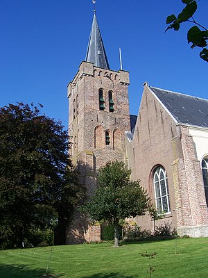
Yerseke
Village in Zeeland, Netherlands
Distance: Approx. 635 meters
Latitude and longitude: 51.5,4.05
Yerseke (Dutch: [ˈirsəkə], Zeeuws: [ˈisə]) is a village situated on the southern shore of the Oosterschelde (Eastern Scheldt) estuary in the Dutch province of Zeeland. A separate municipality until 1970, it today forms part of the municipality of Reimerswaal. As of 2010 Yerseke had a recorded population of 6,695 inhabitants, living in 2,680 households.

Schore, Netherlands
Village in Zeeland, Netherlands
Distance: Approx. 4895 meters
Latitude and longitude: 51.46166667,3.99944444
Schore is a village in the Dutch province of Zeeland. It is located in the municipality of Kapelle, about 8 km southwest of Goes. The village was first mentioned in 1253 as Dodinus de Scoren, and means "land on water".
Wemeldinge
Village in Zeeland, Netherlands
Distance: Approx. 4254 meters
Latitude and longitude: 51.5175,3.99555556
Wemeldinge is the oldest village in the Zuid-Beveland area of the Dutch province of Zeeland. It is located in the municipality of Kapelle, about 4 km northwest of Yerseke. It is located within the Eastern Scheldt national park.

Westkerke, Netherlands
Hamlet in Zeeland, Netherlands
Distance: Approx. 5708 meters
Latitude and longitude: 51.53638889,4.09416667
Westkerke is a hamlet in the southwest Netherlands. It is located in the municipality of Tholen, Zeeland, about 1 km southwest of Scherpenisse. Westkerke is not a statistical entity, and the postal authorities have placed it under Scherpenisse.
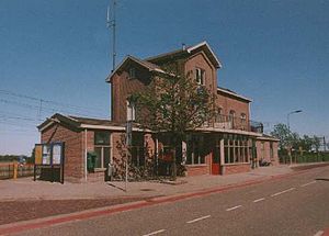
Kruiningen-Yerseke railway station
Railway station in the Netherlands
Distance: Approx. 3370 meters
Latitude and longitude: 51.46527778,4.03694444
Kruiningen-Yerseke is a railway station in Zeeland in the south-west Netherlands. Located between Kruiningen and Yerseke on Nederlandse Spoorwegen's Roosendaal to Vlissingen line, the station was opened by the (privately operated but government-built) State Railways on 1 July 1868 and retains its original building from that date (enlarged in 1890 and 1902).

Biezelinge
Neighbourhood and former village in Kapelle, Zeeland, Netherlands
Distance: Approx. 5606 meters
Latitude and longitude: 51.48333333,3.96666667
Biezelinge is a neighbourhood of Kapelle and former village in the Dutch municipality of Kapelle (province of Zeeland). The village is separated from Kapelle by a railroad. The two villages share a train station.

Reimerswaal (municipality)
Municipality in Zeeland, Netherlands
Distance: Approx. 5089 meters
Latitude and longitude: 51.45,4.03333333
Reimerswaal (Dutch pronunciation: [ˌrɛimərsˈʋaːl] ) is a municipality in the province of Zeeland in the southwestern Netherlands on Zuid-Beveland, named after the lost city. The municipality had a population of 22,896 in 2021, and has a surface area of 242.42 km2 (93.60 sq mi) of which 140.62 km2 (54.29 sq mi) is water. The central town Yerseke is known for trade in mussels and oysters.
Inter Scaldes
Restaurant in Kruiningen, Netherlands
Distance: Approx. 4555 meters
Latitude and longitude: 51.45696389,4.02148333
Inter Scaldes is a restaurant located in Kruiningen in the Netherlands. It is a fine dining restaurant that is awarded one Michelin stars from 1977 to 1983, two stars from 1984 to 2017 and three stars as of 2018 GaultMillau awarded them 19.50 points (out of 20). Restaurant Inter Scaldes earned its second star in 1984 under the leadership of head chef Maartje Boudeling.
Nolet Het Reymerswale
Restaurant in Yerseke, Netherlands
Distance: Approx. 401 meters
Latitude and longitude: 51.49528333,4.05107222
Nolet Het Reymerswale is a defunct restaurant in Yerseke in the Netherlands. It was a fine dining restaurant that was awarded one Michelin star in 1976 and retained that rating until 2010. First head chef to earn the Michelin star, in 1976, was father Theo Nolet.

Oude molen (Kruiningen)
Distance: Approx. 5552 meters
Latitude and longitude: 51.44527778,4.04166667
The Oude molen (''Old Mill'' in Dutch) is a windmill in Kruiningen in the Dutch province of Zeeland. The windmill was built in 1801 and remained in operation until 1953. In 1959 it was purchased by the municipality.
Weather in this IP's area
moderate rain
14 Celsius
14 Celsius
14 Celsius
16 Celsius
1014 hPa
90 %
1014 hPa
1014 hPa
10000 meters
2.79 m/s
4.44 m/s
254 degree
99 %
08:13:12
18:44:17