Country:
Region:
City:
Latitude and Longitude:
Time Zone:
Postal Code:
IP information under different IP Channel
ip-api
Country
Region
City
ASN
Time Zone
ISP
Blacklist
Proxy
Latitude
Longitude
Postal
Route
Luminati
Country
Region
cl
City
salamanca
ASN
Time Zone
Europe/Madrid
ISP
Vodafone Ono, S.A.
Latitude
Longitude
Postal
IPinfo
Country
Region
City
ASN
Time Zone
ISP
Blacklist
Proxy
Latitude
Longitude
Postal
Route
db-ip
Country
Region
City
ASN
Time Zone
ISP
Blacklist
Proxy
Latitude
Longitude
Postal
Route
ipdata
Country
Region
City
ASN
Time Zone
ISP
Blacklist
Proxy
Latitude
Longitude
Postal
Route
Popular places and events near this IP address

University of Salamanca
Public university in Salamanca, Spain
Distance: Approx. 2291 meters
Latitude and longitude: 40.96138889,-5.66666667
The University of Salamanca (Spanish: Universidad de Salamanca) is a public research university in Salamanca, Spain. Founded in 1218 by King Alfonso IX, it is the oldest university in the Hispanic world and one of the oldest in the world in continuous operation. It has over 30,000 students from 50 different nationalities.
Pontifical University of Salamanca
Catholic university in Salamanca, Spain
Distance: Approx. 2311 meters
Latitude and longitude: 40.963,-5.667
The Pontifical University of Salamanca (in Spanish: Universidad Pontificia de Salamanca) is a private Roman Catholic university based in Salamanca, Spain.
Royal Scots College
Distance: Approx. 1682 meters
Latitude and longitude: 40.967973,-5.679868
The Royal Scots College (Spanish: Real Colegio de Escoceses) is a major seminary in Salamanca, Spain, for the Catholic Church in Scotland. It was located originally at Madrid, then Valladolid, and has been in Salamanca since 1988.

Colegio Mayor de Santiago el Zebedeo
Historical edifice in Salamanca, Spain
Distance: Approx. 2164 meters
Latitude and longitude: 40.96555556,-5.67027778
The Colegio Mayor de Santiago, el Zebedeo, Colegio del Arzobispo or Colegio Mayor de Fonseca is a historical edifice in Salamanca, Spain, founded in 1519 by Alonso de Fonseca, archbishop of Santiago de Compostela (hence its name), in order to provide Galician students with a college in which to study within the University of Salamanca. It is one of the Colegios Mayores of Salamanca and was later known as the Colegio de los Irlandeses or the Irish College.

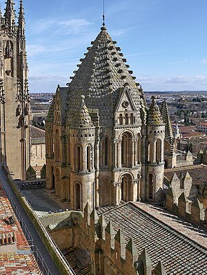
Old Cathedral of Salamanca
Catholic church in Spain
Distance: Approx. 2270 meters
Latitude and longitude: 40.96047222,-5.66666667
The Cathedral of Santa María (Spanish: Catedral Vieja de Santa María), known as the Old Cathedral, is one of the two cathedrals in Salamanca, Castile and León, Spain. Founded by Bishop Jerome of Périgord, its construction began in the first third of the 12th century and was finished at the end of the 14th century, in Romanesque and Gothic style. It was finished thanks to the impulse given to the works by Bishop Alfonso Barasaque.

Colegio Maestro Ávila
School in Salamanca, Spain
Distance: Approx. 2110 meters
Latitude and longitude: 40.964909,-5.67058005
Colegio Maestro Ávila is a Catholic primary and secondary school located in Salamanca, Spain. It was funded by the priests of the Diocesan Labour Priests Brotherhood in honour of Emmanuel Domingo y Sol. It is named after John of Ávila.

General Archive of the Spanish Civil War
Distance: Approx. 2207 meters
Latitude and longitude: 40.95969444,-5.66725
The General Archive of the Spanish Civil War (Spanish: Archivo General de la Guerra Civil Española) is a specialist archive containing material related to the Spanish Civil War. It is part of Spain's National Historical Archive and is located in Salamanca. The origins of the Civil War Archive, and the decision to house such documents in Salamanca, date back to the 1930s.
Casa Lis
Decorative arts museum in Salamanca, Spain
Distance: Approx. 2241 meters
Latitude and longitude: 40.9595,-5.6668
The Casa Lis is a museum located in the ancient city wall of Salamanca, Spain.

Roman bridge of Salamanca
Bridge
Distance: Approx. 1939 meters
Latitude and longitude: 40.95777,-5.67018
The Roman bridge of Salamanca (in Spanish: Puente romano de Salamanca), also known as Puente Mayor del Tormes, is a Roman bridge crossing the Tormes River on the banks of the city of Salamanca, in Castile and León, Spain. The importance of the bridge as a symbol of the city can be seen in the first quartering of city's coat of arms (along with its stone bull-verraco). It has been known traditionally as puente mayor and as puente prinçipal (main bridge) which gives access to the southern part of the city.

Siege of the Salamanca forts
1812 siege during the Peninsular War
Distance: Approx. 2220 meters
Latitude and longitude: 40.961612,-5.667607
The siege of the Salamanca forts (17–27 June 1812) saw an 800-man Imperial French garrison directed by Lieutenant Colonel Duchemin defend three fortified convents in the city of Salamanca against the 48,000-strong Allied army led by Arthur Wellesley, Lord Wellington. During this time, the French commander Marshal Auguste de Marmont led a 40,000-man French army in an unsuccessful attempt to relieve the garrison. An Allied failure to bring sufficient artillery ammunition caused the siege to be prolonged.
Barrio Chino de Salamanca
Former red-light district in Salamanca, Spain
Distance: Approx. 1914 meters
Latitude and longitude: 40.9628517,-5.6719352
The Barrio Chino de Salamanca was the area of the city of Salamanca, Spain, where brothels and similar establishments were located. Throughout its long history, its location has gradually moved from the banks of the Tormes river to the area known as Vaguada de la Palma.

Verraco of the bridge
Verraco in Salamanca, Spain
Distance: Approx. 2039 meters
Latitude and longitude: 40.95916667,-5.66916667
The verraco of the bridge (Spanish: Verraco del puente) in Salamanca, Spain, is an Iron Age stone statue depicting a bull, placed at the entrance of the Roman bridge. Verraco is a general term that refers to the stone statues of animals made by the Vettones, one of the pre-Roman peoples of the Iberian Peninsula. In Spanish the word verraco [beˈrako] means "breeding pig", but other animals such as bulls and bears were also represented.
Weather in this IP's area
overcast clouds
11 Celsius
10 Celsius
11 Celsius
11 Celsius
1018 hPa
93 %
1018 hPa
929 hPa
7000 meters
1.54 m/s
100 degree
99 %
08:10:37
18:04:28
