Country:
 Italy
ItalyRegion:
City:
Latitude and Longitude:
Time Zone:
Postal Code:
IP information under different IP Channel
ip-api
Country
Region
City
ASN
Time Zone
ISP
Blacklist
Proxy
Latitude
Longitude
Postal
Route
IPinfo
Country
Region
City
ASN
Time Zone
ISP
Blacklist
Proxy
Latitude
Longitude
Postal
Route
MaxMind
Country
Region
City
ASN
Time Zone
ISP
Blacklist
Proxy
Latitude
Longitude
Postal
Route
Luminati
Country
ITRegion
21
City
borgosandalmazzo
ASN
Time Zone
Europe/Rome
ISP
IT.Gate S.p.A.
Latitude
Longitude
Postal
db-ip
Country
Region
City
ASN
Time Zone
ISP
Blacklist
Proxy
Latitude
Longitude
Postal
Route
ipdata
Country
Region
City
ASN
Time Zone
ISP
Blacklist
Proxy
Latitude
Longitude
Postal
Route
Popular places and events near this IP address

Stura
Distance: Approx. 6226 meters
Latitude and longitude: 44.38333333,7.53333333
Stura (French: [sty.ʁa]) was a department of the French Consulate and of the First French Empire in present-day Italy. It was named after the river Stura di Demonte. It was formed in 1801, when the Subalpine Republic (formerly the mainland portion of the Kingdom of Sardinia) was planned to be annexed to France.
Bernezzo
Comune in Piedmont, Italy
Distance: Approx. 6712 meters
Latitude and longitude: 44.38333333,7.43333333
Bernezzo (Occitan, Bernès) is a comune (municipality) in the Province of Cuneo in the Italian region Piedmont, located about 80 kilometres (50 mi) southwest of Turin and about 9 kilometres (6 mi) west of Cuneo. Bernezzo borders the following municipalities: Caraglio, Cervasca, Rittana, Roccasparvera, and Valgrana.

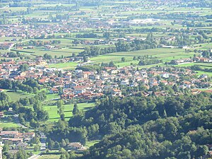
Borgo San Dalmazzo
Comune in Piedmont, Italy
Distance: Approx. 618 meters
Latitude and longitude: 44.33333333,7.48333333
Borgo San Dalmazzo (Occitan: Lo Borg Sant Dalmatz) is a comune (municipality) in the Province of Cuneo in the Italian region Piedmont, located about 80 kilometres (50 mi) south of Turin and about 8 kilometres (5 mi) southwest of Cuneo. Borgo San Dalmazzo takes its name from Saint Dalmatius of Pavia. Sights include the parish church of San Dalmazzo (11th century).
Cervasca
Comune in Piedmont, Italy
Distance: Approx. 5374 meters
Latitude and longitude: 44.38333333,7.46666667
Cervasca is a comune (municipality) in the Province of Cuneo in the Italian region Piedmont, located about 80 kilometres (50 mi) south of Turin and about 7 kilometres (4 mi) west of Cuneo. Cervasca borders the following municipalities: Bernezzo, Caraglio, Cuneo, Roccasparvera, and Vignolo.
Robilante
Comune in Piedmont, Italy
Distance: Approx. 4756 meters
Latitude and longitude: 44.3,7.51666667
Robilante is a comune (municipality) in the Province of Cuneo in the Italian region Piedmont, located about 90 kilometres (56 mi) south of Turin and about 10 kilometres (6 mi) southwest of Cuneo. As of 31 December 2004, it had a population of 2,362 and an area of 24.9 square kilometres (9.6 sq mi). The municipality of Robilante contains the frazioni (subdivisions, mainly villages and hamlets) Tetto Pettavino, Malandre, Montasso and Tetto Chiappello.
Vignolo
Comune in Piedmont, Italy
Distance: Approx. 3665 meters
Latitude and longitude: 44.36666667,7.46666667
Vignolo is a comune (municipality) in the Province of Cuneo in the Italian region Piedmont, located about 80 kilometres (50 mi) south of Turin and about 7 kilometres (4 mi) southwest of Cuneo. As of 31 December 2004, it had a population of 2,112 and an area of 8.1 square kilometres (3.1 sq mi). Vignolo borders the following municipalities: Borgo San Dalmazzo, Cervasca, Cuneo, and Roccasparvera.

Roman Catholic Diocese of Cuneo
Latin Catholic diocese in Italy
Distance: Approx. 7071 meters
Latitude and longitude: 44.3833,7.55
The Diocese of Cuneo (Latin: Dioecesis Cuneensis) is a Latin diocese of the Catholic Church in Italy. It was created in 1817, from territory that previously had belonged to the Diocese of Mondovì. It is suffragan of the Archdiocese of Turin.

Cuneo railway station
Railway station in Piedmont, Italy
Distance: Approx. 6771 meters
Latitude and longitude: 44.38777778,7.53638889
Cuneo railway station, or Cuneo Altipiano railway station (Italian: Stazione di Cuneo or Stazione di Cuneo Altipiano), is the main station serving the city and comune of Cuneo, in the Piedmont region of northwestern Italy. Opened in 1937, it is the junction of the Fossano–Cuneo, Savigliano–Cuneo, Cuneo–Ventimiglia and Cuneo–Mondovì railways. The station is currently managed by Rete Ferroviaria Italiana (RFI), and the commercial area of the passenger building by Centostazioni, while the train services are operated by Trenitalia.
Battle of Roccavione
1275 battle in Sicily
Distance: Approx. 2360 meters
Latitude and longitude: 44.3167,7.48333
The Battle of Roccavione was the last battle of the invasion of the territory of Asti by Angevine troops from the Kingdom of Sicily. Charles I of Sicily was defeated, and his entire invasion failed. The battle was also the end of the Astigiani participation in the wars of the Guelphs and Ghibellines, and the end of Charles' intervention in the rest of the Italian Peninsula.

Stadio Fratelli Paschiero
Distance: Approx. 6238 meters
Latitude and longitude: 44.38313889,7.53397222
Stadio Fratelli Paschiero is a multi-use stadium in Cuneo, Italy. It is currently used mostly for football matches and is the home ground of Cuneo. The stadium holds 3,060.

Borgo San Dalmazzo concentration camp
World War II German-run facility in Italy
Distance: Approx. 1224 meters
Latitude and longitude: 44.32666667,7.48666667
Borgo San Dalmazzo was an internment camp operated by Nazi Germany in Borgo San Dalmazzo, Piedmont, Italy. The camp operated under German control from September to November 1943 and, following that, under the control of the Italian Social Republic from December 1943 to February 1944. Approximately 375 Jewish Italians and 349 refugees from other countries (119 from Poland as well as refugees from France, the Soviet Union, Germany, Austria, Romania, Hungary, Croatia and Greece), were held at Borgo San Dalmazzo until deported to Auschwitz and other German camps where all but a few were murdered.

Vermenagna
Stream in Piedmont, Italy
Distance: Approx. 1689 meters
Latitude and longitude: 44.3254,7.5009
The Vermenagna is a 27.1-kilometre (16.8 mi) long river in northwestern Italy (Piedmont).
Weather in this IP's area
overcast clouds
13 Celsius
13 Celsius
10 Celsius
15 Celsius
1018 hPa
92 %
1018 hPa
944 hPa
10000 meters
0.66 m/s
1.33 m/s
269 degree
97 %
07:48:55
18:41:02