Country:
Region:
City:
Latitude and Longitude:
Time Zone:
Postal Code:
IP information under different IP Channel
ip-api
Country
Region
City
ASN
Time Zone
ISP
Blacklist
Proxy
Latitude
Longitude
Postal
Route
Luminati
Country
ASN
Time Zone
Europe/Berlin
ISP
Wieske's Crew GmbH
Latitude
Longitude
Postal
IPinfo
Country
Region
City
ASN
Time Zone
ISP
Blacklist
Proxy
Latitude
Longitude
Postal
Route
db-ip
Country
Region
City
ASN
Time Zone
ISP
Blacklist
Proxy
Latitude
Longitude
Postal
Route
ipdata
Country
Region
City
ASN
Time Zone
ISP
Blacklist
Proxy
Latitude
Longitude
Postal
Route
Popular places and events near this IP address

Bille (Elbe)
River in Germany
Distance: Approx. 1582 meters
Latitude and longitude: 53.54,10.02416667
The river Bille (German pronunciation: [ˈbɪlə] ) is a small, slow-flowing German river in Stormarn, Schleswig-Holstein and Hamburg, a right tributary of the Elbe. Its source is near Linau, north of the Hahnheide forest. It then flows south of Trittau, representing the border between Stormarn and Lauenburg, continues south of Reinbek and reaches the river Elbe near Billwerder.

Bullenhuser Damm
School in Hamburg, Germany; used as a satellite camp of the Neuengamme concentration camp
Distance: Approx. 808 meters
Latitude and longitude: 53.54194444,10.04805556
The Bullenhuser Damm School is located at 92–94 Bullenhuser Damm in the Rothenburgsort section of Hamburg, Germany – the site of the Bullenhuser Damm Massacre, the murder of 20 children and their adult caretakers at the very end of World War II's Holocaust – to hide evidence they were used as human subjects in brutal medical experimentation. During heavy air raids in the Second World War, many areas of Hamburg were destroyed, and the Rothenburgsort section was heavily damaged. The school was only slightly damaged.

Berliner Tor station
Railway station in Hamburg, Germany
Distance: Approx. 1245 meters
Latitude and longitude: 53.5525,10.02555556
Berliner Tor (German: [bɛʁˈliːnɐ ˈtoːɐ̯]; literally "Berlin Gate") is a transport hub in Hamburg, Germany, served by the Hamburg U-Bahn (underground railway) and the Hamburg S-Bahn (suburban railway). The station is located in St. Georg, part of the borough of Hamburg-Mitte.

Hammerbrook station
Elevated railway station in Germany
Distance: Approx. 1319 meters
Latitude and longitude: 53.54638889,10.02361111
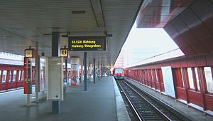
Hammerbrook is an elevated railway station on the Harburg S-Bahn line, served by the city trains of Hamburg S-Bahn. The railway station is located in Hammerbrook, Hamburg-Mitte, Hamburg, Germany.

Rothenburgsort
Quarter of Hamburg in Germany
Distance: Approx. 1524 meters
Latitude and longitude: 53.535,10.04055556
Rothenburgsort () is a quarter (German: Stadtteil) in the Hamburg-Mitte borough of the Free and Hanseatic city of Hamburg in northern Germany. In December 2023, the population was 10,317.

Hammerbrook
Quarter of Hamburg in Germany
Distance: Approx. 914 meters
Latitude and longitude: 53.54527778,10.03055556
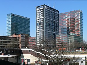
Hammerbrook () is a quarter (Stadtteil) in the Hamburg-Mitte borough of the Free and Hanseatic city of Hamburg in Germany. In 2020, the population was 5,069.

Burgstraße station
Railway station in Hamburg, Germany
Distance: Approx. 781 meters
Latitude and longitude: 53.55555556,10.04166667
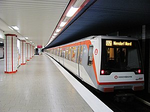
Burgstraße is a metro station located at Hammer Landstraße in Hamm, Hamburg, Germany. Hamm is part of the borough of Hamburg-Mitte. The underground station is served by Hamburg U-Bahn lines U2 and U4.

Hamm, Hamburg
Quarter of Hamburg in Germany
Distance: Approx. 1171 meters
Latitude and longitude: 53.55487,10.05742
is a quarter in the borough of Hamburg-Mitte, in the eastern part of Hamburg, Germany. Once a popular garden suburb of rich traders and merchants, in the first half of the 20th century it grew to become one of the most populated quarters of Hamburg. In the Second World War, however, the area was mostly flattened.

Rothenburgsort station
Railway station in Hamburg, Germany
Distance: Approx. 1112 meters
Latitude and longitude: 53.53861111,10.04333333
Rothenburgsort is a station on the Berlin-Hamburg railway line and served by the trains of Hamburg S-Bahn line S2. The station was opened in 1907 and is located in the Hamburg district of Rothenburgsort, Germany. Rothenburgsort is part of the borough of Hamburg-Mitte.
Landwehr station
Railway station in Hamburg, Germany
Distance: Approx. 1438 meters
Latitude and longitude: 53.56111111,10.03777778
Landwehr is a station on the Hamburg-Altona link line and is served by line S1 of the Hamburg S-Bahn. Opened in late 1906, the station is situated at the meeting point of the three districts of Borgfelde, Hohenfelde and Eilbek as well as that of the three boroughs of Hamburg-Mitte, Hamburg-Nord and Wandsbek.

Hammer Kirche station
Railway station in Hamburg, Germany
Distance: Approx. 1099 meters
Latitude and longitude: 53.55555556,10.055
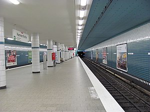
Hammer Kirche is an underground metro station on the Hamburg U-Bahn lines U2 and U4. The underground station was opened in January 1967 and is located in the Hamburg district of Hamm, Germany. Hamm is part of the borough of Hamburg-Mitte.
Borgfelde
Quarter of Hamburg in Germany
Distance: Approx. 896 meters
Latitude and longitude: 53.55475,10.03447
Borgfelde () is a quarter of Hamburg, Germany, in the borough of Hamburg-Mitte. It is located on the northern border of the borough adjacent to the borough of Hamburg-Nord. It is a more densely populated area, approximately 2 km from Hamburg city centre.
Weather in this IP's area
light intensity shower rain
4 Celsius
-1 Celsius
3 Celsius
4 Celsius
1004 hPa
93 %
1004 hPa
1004 hPa
10000 meters
6.17 m/s
240 degree
75 %
07:50:01
16:19:57

