Country:
Region:
City:
Latitude and Longitude:
Time Zone:
Postal Code:
IP information under different IP Channel
ip-api
Country
Region
City
ASN
Time Zone
ISP
Blacklist
Proxy
Latitude
Longitude
Postal
Route
Luminati
Country
ASN
Time Zone
Europe/Berlin
ISP
Wieske's Crew GmbH
Latitude
Longitude
Postal
IPinfo
Country
Region
City
ASN
Time Zone
ISP
Blacklist
Proxy
Latitude
Longitude
Postal
Route
db-ip
Country
Region
City
ASN
Time Zone
ISP
Blacklist
Proxy
Latitude
Longitude
Postal
Route
ipdata
Country
Region
City
ASN
Time Zone
ISP
Blacklist
Proxy
Latitude
Longitude
Postal
Route
Popular places and events near this IP address

Sehnde
Town in Lower Saxony, Germany
Distance: Approx. 9331 meters
Latitude and longitude: 52.31611111,9.96416667
Sehnde is a town in Lower Saxony, Germany. It is located approximately 15 kilometres southeast of Hanover.
Lehrte
Town in Hanover, Lower Saxony, Germany
Distance: Approx. 7181 meters
Latitude and longitude: 52.36666667,9.96666667
Lehrte is a town in the district of Hanover, in Lower Saxony, Germany. It is situated approximately 17 km east of Hanover. In the 19th century Lehrte was the most important railway junction in the former Kingdom of Hanover.

Mehrum Power Station
Distance: Approx. 6099 meters
Latitude and longitude: 52.31416667,10.09138889
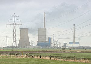
Mehrum Power Station is a coal-fired power station in Mehrum, Lower Saxony, Germany. It lies about 20km east of Hannover. It has an output of 750 megawatts.

Battle of Sievershausen
1553 battle in Germany
Distance: Approx. 2896 meters
Latitude and longitude: 52.37583333,10.11277778
The Battle of Sievershausen occurred on 9 July 1553 near the village of Sievershausen (today part of Lehrte in present-day Germany), where the forces of the Hohenzollern margrave Albert Alcibiades of Brandenburg-Kulmbach fought against the united troops of Elector Maurice of Saxony and Duke Henry V of Brunswick-Wolfenbüttel. With 4,000 men killed, including the Saxon elector and two of Henry's sons, it was one of the bloodiest battles on Lower Saxon territory. Margrave Albert was defeated.
Burgdorf-Peine Geest
Distance: Approx. 1471 meters
Latitude and longitude: 52.38,10.0644
The Burgdorf-Peine Geest (German: Burgdorf-Peiner Geest) is a geest landscape, dominated by end and ground moraines, between Hanover and Brunswick in North Germany, with an area of about 550 square kilometres (210 sq mi). Its natural borders are the Aller depression in the north, the Hildesheim Börde and, in places, the Mittelland Canal in the south the Oker valley in the east and the Hanoverian Moor Geest in the west. Today it is bordered by the cities of Hanover and Brunswick and the towns of Burgdorf, Uetze, Vechelde, Peine and Lehrte.

Lehrte station
Railway station in Lehrte, Lower Saxony, Germany
Distance: Approx. 6725 meters
Latitude and longitude: 52.37666667,9.97444444
Lehrte (German: Bahnhof Lehrte) is a railway station located in Lehrte, Germany. The station opened on 15 August 1843 and is located on the Berlin-Lehrte Railway and Hanover–Brunswick railway. The train services are operated by Deutsche Bahn, WestfalenBahn and Metronom.
Immensen-Arpke station
Railway station in Lehrte, Germany
Distance: Approx. 2741 meters
Latitude and longitude: 52.39132,10.08368
Immensen-Arpke (German: Bahnhof Immensen-Arpke) is a railway station located between Arpke and Immensen, in the municipality of Lehrte in the German state of Lower Saxony. The station opened on 15 August 1893 and is located on the Berlin-Lehrte Railway. The train services are operated by Metronom.
Dollbergen station
Railway station in Uetze, Germany
Distance: Approx. 9215 meters
Latitude and longitude: 52.417,10.18127
Dollbergen (German: Bahnhof Dollbergen) is a railway station located in Dollbergen, in the municipality of Uetze in the German state of Lower Saxony. The station is located on the Berlin-Lehrte Railway. The train services are operated by Metronom.
Arpke
Stadtteil of Lehrte in Lower Saxony, Germany
Distance: Approx. 2804 meters
Latitude and longitude: 52.38777778,10.09722222
Arpke is a village in the town of Lehrte in the district of Hanover, in Lower Saxony, Germany. It is situated approximately 30 km east of Hanover. Since 1893 Arpke has a railway station on the Berlin–Lehrte railway and is connected once per hour to Hanover and Wolfsburg.
Weser-Aller Plains and Geest
Place in North German Plain
Distance: Approx. 4184 meters
Latitude and longitude: 52.39083333,10.12083333
The Weser-Aller Plains and Geest (German: Weser-Aller-Flachland) is a natural regional unit of the North German Plain in Germany. It extends over most of the southern catchment of the Aller including the lower reaches of the Oker and Leine and is bounded in the west by the Middle Weser. It is also bounded, from a natural region perspective, by the Stade Geest, the Luneburg Heath, the Wendland and the Altmark in the north; in the east by the Central German Black Earth Region (Mitteldeutsches Schwarzerdegebiet), in the south by the Northern Harz Foreland and Lower Saxon Börde and, in the west, by the Dümmer-Geest Lowland and Ems-Hunte Geest.

Villa Nordstern
Distance: Approx. 8056 meters
Latitude and longitude: 52.359743,9.954515
The Villa Nordstern is a former grand residence on the Iltener Straße in Lehrte (formerly Ilten), Lower Saxony, Germany. It was built for industrial magnate Hermann Manske in 1892. Since 1990 it has stood abandoned, although there have been a variety efforts to restore it as a historic monument or private development.
Weather in this IP's area
overcast clouds
5 Celsius
5 Celsius
4 Celsius
5 Celsius
1008 hPa
94 %
1008 hPa
999 hPa
10000 meters
0.89 m/s
99 %
07:45:05
16:24:39
