Country:
Region:
City:
Latitude and Longitude:
Time Zone:
Postal Code:
IP information under different IP Channel
ip-api
Country
Region
City
ASN
Time Zone
ISP
Blacklist
Proxy
Latitude
Longitude
Postal
Route
Luminati
Country
ASN
Time Zone
Europe/Lisbon
ISP
Nowo Communications, S.A.
Latitude
Longitude
Postal
IPinfo
Country
Region
City
ASN
Time Zone
ISP
Blacklist
Proxy
Latitude
Longitude
Postal
Route
db-ip
Country
Region
City
ASN
Time Zone
ISP
Blacklist
Proxy
Latitude
Longitude
Postal
Route
ipdata
Country
Region
City
ASN
Time Zone
ISP
Blacklist
Proxy
Latitude
Longitude
Postal
Route
Popular places and events near this IP address

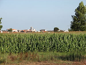
Estarreja
Municipality in Centro, Portugal
Distance: Approx. 480 meters
Latitude and longitude: 40.75,-8.56666667
Estarreja (pronounced [(i)ʃtɐˈʁɐjʒɐ] , [(i)ʃtɐˈʁe(j)ʒɐ] or [(i)ʃtɐˈʁɛʒɐ]) is a municipality in Portugal. The population in 2011 was 26,997, in an area of 108.17 km2. It had 22,746 eligible voters in 2006.

Murtosa
Municipality in Centro, Portugal
Distance: Approx. 5687 meters
Latitude and longitude: 40.73333333,-8.63333333
Murtosa (Portuguese pronunciation: [muɾˈtɔzɐ] ) is a town and a municipality in the District of Aveiro in Portugal. The population in 2011 was 10,585, in an area of 73.09 km2. It had 8,282 eligible voters.
Estádio Marques da Silva
Distance: Approx. 7655 meters
Latitude and longitude: 40.69821944,-8.62618333
Parque Marques da Silva is a multi-use stadium in Ovar, Aveiro, Portugal. It is currently used mostly for football matches and is the home stadium of A.D. Ovarense. It is also the home to Ovarense's U19s, U17s, U15s and B teams.

Antuã River
River in Aveiro, Portugal
Distance: Approx. 5273 meters
Latitude and longitude: 40.73166667,-8.62694444
Antuã (Portuguese pronunciation: [ɐ̃tuˈɐ̃]) is a Portuguese river, located in the Aveiro region. It is the most important tributary of the Ria de Aveiro after the Vouga River. Its name is linked to the former name of Estarreja: Antuão or Anterão.
Angeja
Civil parish in Centro, Portugal
Distance: Approx. 8190 meters
Latitude and longitude: 40.68,-8.557
Angeja is a civil parish in the municipality of Albergaria-a-Velha, in the Portuguese Centro region. In 2011, there were 2073 inhabitants in an area of 21.25 square kilometres (8.20 sq mi).

Ponte da Varela
Bridge in Aveiro District, Portugal
Distance: Approx. 9501 meters
Latitude and longitude: 40.78944444,-8.67277778
Ponte da Varela is a bridge in Aveiro District in Portugal. It was inaugurated on June 22, 1964, after a lengthy design phase. The bridge is constructed of concrete and steel, with the legs far enough apart to allow ships to pass beneath.
Avanca
Civil parish in Centro, Portugal
Distance: Approx. 6036 meters
Latitude and longitude: 40.807,-8.573
Avanca is a civil parish in the municipality of Estarreja, in the central subregion of Baixo Vouga. The population in 2011 was 6,189, in an area of 21.07 km2.
Cacia
Civil parish in Centro, Portugal
Distance: Approx. 8345 meters
Latitude and longitude: 40.69,-8.625
Cacia is a civil parish in the municipality of Aveiro. The population in 2011 was 7,354, in an area of 35.75 km².

Branca, Albergaria-a-Velha
Civil parish in Centro, Portugal
Distance: Approx. 7704 meters
Latitude and longitude: 40.73333333,-8.48333333
Branca is a village and a civil parish of the municipality of Albergaria-a-Velha, Portugal. The population in 2011 was 5,621, in an area of 30.29 km2.
Pardilhó
Civil parish in Centro, Portugal
Distance: Approx. 6729 meters
Latitude and longitude: 40.7975,-8.62472222
Pardilhó is a village and a civil parish of the municipality of Estarreja, Portugal. The population in 2011 was 4,176, in an area of 15.7 km2.

Salreu
Civil parish in Centro, Portugal
Distance: Approx. 1934 meters
Latitude and longitude: 40.73722222,-8.56083333
Salreu is a village and a civil parish of the municipality of Estarreja, Portugal. The population in 2011 was 4,153, in an area of 16.2 km2.
Weather in this IP's area
few clouds
18 Celsius
18 Celsius
18 Celsius
22 Celsius
1018 hPa
72 %
1018 hPa
1016 hPa
10000 meters
0.51 m/s
20 %
07:24:01
17:14:54
