Country:
Region:
City:
Latitude and Longitude:
Time Zone:
Postal Code:
IP information under different IP Channel
ip-api
Country
Region
City
ASN
Time Zone
ISP
Blacklist
Proxy
Latitude
Longitude
Postal
Route
Luminati
Country
Region
24
City
katowice
ASN
Time Zone
Europe/Warsaw
ISP
Silesian University of Technology, Computer Centre
Latitude
Longitude
Postal
IPinfo
Country
Region
City
ASN
Time Zone
ISP
Blacklist
Proxy
Latitude
Longitude
Postal
Route
db-ip
Country
Region
City
ASN
Time Zone
ISP
Blacklist
Proxy
Latitude
Longitude
Postal
Route
ipdata
Country
Region
City
ASN
Time Zone
ISP
Blacklist
Proxy
Latitude
Longitude
Postal
Route
Popular places and events near this IP address

Mikołów
Town in Mikołów County, Poland
Distance: Approx. 4346 meters
Latitude and longitude: 50.16666667,18.9
Mikołów [miˈkɔwuf] (German: Nikolai, Silesian: Mikołōw) is a town in Silesia, in southern Poland, near the city of Katowice. Outer town of the Metropolis GZM, a metropolis with a population of over 2 million, and is within a greater Katowice-Ostrava metropolitan area populated by about 5,294,000 people. The population of the town is 40,898 (2019).

Kosztowy
Mysłowice District in Silesian Voivodeship, Poland
Distance: Approx. 4343 meters
Latitude and longitude: 50.18805556,19.01694444
Kosztowy (German: Kostow) is a quarter of the city of Mysłowice in the Silesian Voivodship of Poland. The formerly independent municipality is approximately 4 km south the city centre of Mysłowice, close to the neighbouring city of Imielin. In the course of a major re-organisation of municipal borders in Upper Silesia it was incorporated into Mysłowice together with Wesoła and Dziećkowice.

Zarzecze, Katowice
Katowice District in Silesian Voivodeship, Poland
Distance: Approx. 3676 meters
Latitude and longitude: 50.20922222,18.98080556
Zarzecze (German: Zarzetsche) is a district of Katowice in southern Poland. It has an area of 5.1 km2 and in 2007 had 1,902 inhabitants. The literal meaning of the name is a land behind a river.

Podlesie, Katowice
Katowice District in Silesian Voivodeship, Poland
Distance: Approx. 902 meters
Latitude and longitude: 50.17689444,18.96921667
Podlesie (German: Podlesche) is a district of Katowice. It has an area of 8.28 km2 and in 2007 had 5,240 inhabitants.

Kostuchna
Katowice District in Silesian Voivodeship, Poland
Distance: Approx. 2611 meters
Latitude and longitude: 50.18884722,18.99119444
Kostuchna (German: Kostuchna) is a district of Katowice. It has an area of 8.59 km2 and in 2007 had 8,233 inhabitants.

Piotrowice-Ochojec
Katowice District in Silesian Voivodeship, Poland
Distance: Approx. 3676 meters
Latitude and longitude: 50.20922222,18.98080556
Piotrowice-Ochojec is a district of Katowice, Poland. It has an area of 12,08 km2 and in 2007 had 25,110 inhabitants.
Zadole Park
Distance: Approx. 4180 meters
Latitude and longitude: 50.21722222,18.96222222
The Zadole Park is a park in Zadole, a part of the city of Katowice in Metropolis GZM. The park features an amphitheater for 800 persons, a swimming-pool complex, a cafe and a playground for children and walking alleys. In 1906–1914 it was a place of the convention of the Polish choirs and bands within the framework of the Singing Societies existing in that region at that time. Students Hostels adjoin the center and not far from them there are tennis courts – free of charge.

Battle of Mikołów
Distance: Approx. 3779 meters
Latitude and longitude: 50.175573,18.904807
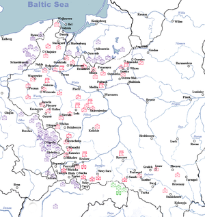
The Battle of Mikołów (Polish: Bitwa pod Mikolowem, Bitwa wyrska) refers to the border engagement on September 1 and 2, 1939, that took place in the area of the town of Mikołów, located in the Silesian Voivodeship, during the early stages of the Invasion of Poland in the Second World War.

Murcki Coal Mine
Mine in Katowice, Silesian Voivodeship, Poland
Distance: Approx. 3588 meters
Latitude and longitude: 50.18106,19.0077
The Murcki coal mine is a large mine in the south of Poland in Katowice, Silesian Voivodeship, 260 km south-west of the capital, Warsaw. Murcki represents one of the largest coal reserve in Poland having estimated reserves of 228.2 million tonnes of coal. The annual coal production is around 3.8 million tonnes.

Kamionka, Mikołów
Mikołów District in Silesian Voivodeship, Poland
Distance: Approx. 2773 meters
Latitude and longitude: 50.18895556,18.92122222
Kamionka is a dzielnica (district) in the north-east of Mikołów, Silesian Voivodeship, southern Poland. It was an independent village but was administratively merged into Mikołów in 1935. It is located alongside national road 81.

Wilkowyje
Distance: Approx. 3573 meters
Latitude and longitude: 50.14833333,18.9475
Wilkowyje (German: Wilkowy) is a dzielnica (district) of Tychy, Silesian Voivodeship, southern Poland. It was an independent village and a seat of gmina, which was absorbed by Tychy in 1951.

Piotrowice (Katowice)
Part of Katowice, Poland
Distance: Approx. 3244 meters
Latitude and longitude: 50.20833333,18.96666667
Piotrowice (German: Petrowitz, Czech: Petrovice) is a part of Katowice, located in the southwestern part of the city, in the Piotrowice-Ochojec district. It is one of the oldest settlements within the modern boundaries of Katowice, with its history dating back to the historic settlement of Uniczowy. The first mention of the village of Piotrowice appears in a document from the mid-15th century.
Weather in this IP's area
clear sky
1 Celsius
-2 Celsius
-0 Celsius
2 Celsius
1029 hPa
96 %
1029 hPa
996 hPa
10000 meters
2.27 m/s
4.53 m/s
86 degree
7 %
06:49:47
16:06:34