Country:
Region:
City:
Latitude and Longitude:
Time Zone:
Postal Code:
IP information under different IP Channel
ip-api
Country
Region
City
ASN
Time Zone
ISP
Blacklist
Proxy
Latitude
Longitude
Postal
Route
IPinfo
Country
Region
City
ASN
Time Zone
ISP
Blacklist
Proxy
Latitude
Longitude
Postal
Route
MaxMind
Country
Region
City
ASN
Time Zone
ISP
Blacklist
Proxy
Latitude
Longitude
Postal
Route
Luminati
Country
Region
gs
City
sopron
ASN
Time Zone
Europe/Budapest
ISP
Vodafone Hungary Ltd.
Latitude
Longitude
Postal
db-ip
Country
Region
City
ASN
Time Zone
ISP
Blacklist
Proxy
Latitude
Longitude
Postal
Route
ipdata
Country
Region
City
ASN
Time Zone
ISP
Blacklist
Proxy
Latitude
Longitude
Postal
Route
Popular places and events near this IP address

Sopron
Place in Western Transdanubia, Hungary
Distance: Approx. 1224 meters
Latitude and longitude: 47.68489,16.58305
Sopron (Hungarian pronunciation: [ˈʃopron]; German: Ödenburg, German pronunciation: [ˈøːdn̩ˌbʊʁk] ) is a city in Hungary on the Austrian border, near Lake Neusiedl/Lake Fertő.

Sopron County
Historic Hungarian county divided between Austria and Hungary
Distance: Approx. 1304 meters
Latitude and longitude: 47.68333333,16.58333333
Sopron (German: Ödenburg, Slovak: Šopron) was an administrative county (comitatus) of the Kingdom of Hungary. Its territory is now divided between Austria and Hungary. The capital of the county was Sopron.

University of Sopron
Hungarian university founded in 1735
Distance: Approx. 1875 meters
Latitude and longitude: 47.68027778,16.57722222
The main campus of the University of Sopron (Hungarian: Soproni Egyetem, abbreviated SOE) is located in Sopron, Hungary. The school traces its roots to 1735. The QS World University Rankings placed the University of Sopron in the 251-300 range in the Emerging Europe and Central Asia in 2022.

Fertőrákos
Place in Győr-Moson-Sopron, Hungary
Distance: Approx. 5273 meters
Latitude and longitude: 47.72017,16.65197
Fertőrákos (German: Kroisbach) is a village in the county of Győr-Moson-Sopron in Hungary. In 2001 it had a population of 2,182. It is located at 47°43′15″N 16°39′0″E, about 10 km (6 mi) from Sopron, near Lake Fertő (German: Neusiedler See) and the Austrian border.

Káposztás utcai Stadion
Distance: Approx. 1014 meters
Latitude and longitude: 47.69171,16.583691
The Káposztás utcai Stadion is a multi-use stadium in Sopron, Hungary. It is currently used mostly for football matches and is the home stadium of MFC Sopron. The stadium is able to hold 5,300 people and was reconstructed in 2003.
Ágfalva
Place in Győr-Moson-Sopron, Hungary
Distance: Approx. 6014 meters
Latitude and longitude: 47.68899,16.51687
Ágfalva (German: Agendorf) is a village in Hungary, in the north-western Győr-Moson-Sopron region, 4 kilometers from Sopron and two kilometers from the border of Austria.

Harka
Place in Győr-Moson-Sopron, Hungary
Distance: Approx. 6367 meters
Latitude and longitude: 47.63333333,16.6
Harka is a village in Győr-Moson-Sopron County, Hungary.

Sopronkőhida
Village in northwestern Hungary
Distance: Approx. 4060 meters
Latitude and longitude: 47.72329167,16.62083333
Sopronkőhida is a village in northwestern Hungary, 4 km north of the city Sopron and 5 km south of the border with Austria.

Aréna Sopron
Distance: Approx. 1075 meters
Latitude and longitude: 47.6926,16.5831
Aréna Sopron (official sponsored name Novomatic Musical Aréna Sopron, previously MKB Aréna) is a multi-purpose indoor arena in Sopron, Hungary. Its best known tenant is the women's basketball club UNIQA Sopron, one of the top teams of the Hungarian championship. They also play in the EuroLeague Women where they have reached the Final Four in 2009.

Sopron District
Districts of Hungary in Győr-Moson-Sopron
Distance: Approx. 825 meters
Latitude and longitude: 47.68461813,16.59039776
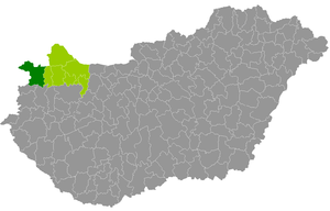
Sopron (Hungarian: Soproni járás; German: Kreis Ödenburg) is a district in western part of Győr-Moson-Sopron County. Sopron is also the name of the town where the district seat is found. The district is located in the Western Transdanubia Statistical Region.

Balf, Hungary
Town in Hungary
Distance: Approx. 6371 meters
Latitude and longitude: 47.6333,16.6
Balf (German: Wolfs) was a village in Sopron then Győr-Sopron County. In 1985 it became part of the town of Sopron. It has approximately 1,000 inhabitants.
Sopronbánfalva
Place in Western Transdanubia, Hungary
Distance: Approx. 3693 meters
Latitude and longitude: 47.67722222,16.55194444
Sopronbánfalva (German: Wandorf), also known as Bánfalva, is a former village that is part of the city of Sopron, Hungary, since 1950. It is also called Kertváros (Garden-City in Hungarian) or Sopron-Kertváros. It is located west of the city center, at the northeastern foot of the Sopron Mountains, next to the road connecting Sopron with Brennbergbánya.
Weather in this IP's area
clear sky
25 Celsius
25 Celsius
24 Celsius
26 Celsius
1013 hPa
47 %
1013 hPa
987 hPa
10000 meters
4.52 m/s
6.95 m/s
159 degree
1 %
06:21:54
19:20:53
