Country:
 Great Britain
Region:
City:
Latitude and Longitude:
Time Zone:
Postal Code:
IP information under different IP Channel
ip-api
Country
Region
City
ASN
Time Zone
ISP
Blacklist
Proxy
Latitude
Longitude
Postal
Route
IPinfo
Country
Region
City
ASN
Time Zone
ISP
Blacklist
Proxy
Latitude
Longitude
Postal
Route
MaxMind
Country
Region
City
ASN
Time Zone
ISP
Blacklist
Proxy
Latitude
Longitude
Postal
Route
Luminati
Country
GBASN
Time Zone
Europe/London
ISP
TalkTalk
Latitude
Longitude
Postal
db-ip
Country
Region
City
ASN
Time Zone
ISP
Blacklist
Proxy
Latitude
Longitude
Postal
Route
ipdata
Country
Region
City
ASN
Time Zone
ISP
Blacklist
Proxy
Latitude
Longitude
Postal
Route
Popular places and events near this IP address
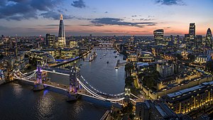
London
Capital and largest city of the United Kingdom
Distance: Approx. 7 meters
Latitude and longitude: 51.50722222,-0.1275
London ( LUN-dən) is the capital and largest city of both England and the United Kingdom, with a population of 8,866,180 in 2022. The wider metropolitan area is the largest in Western Europe, with a population of 14.9 million. London stands on the River Thames in southeast England, at the head of a 50-mile (80 km) estuary down to the North Sea, and has been a major settlement for nearly 2,000 years.
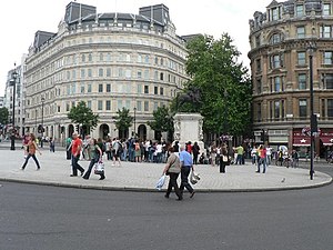
Charing Cross
The point from which distances from London are measured
Distance: Approx. 11 meters
Latitude and longitude: 51.5073,-0.12755
Charing Cross ( CHARR-ing) is a junction in Westminster, London, England, where six routes meet. Since the early 19th century, Charing Cross has been the notional "centre of London" and became the point from which distances from London are measured. Clockwise from north, the routes that meet at Charing Cross are: the east side of Trafalgar Square leading to St Martin's Place and then Charing Cross Road; the Strand leading to the City; Northumberland Avenue leading to the Thames Embankment; Whitehall leading to Parliament Square; The Mall leading to Admiralty Arch and Buckingham Palace; and two short roads leading to Pall Mall.
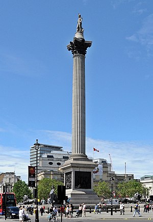
Nelson's Column
Monument in Trafalgar Square, London
Distance: Approx. 64 meters
Latitude and longitude: 51.50772222,-0.12797222
Nelson's Column is a monument in Trafalgar Square in the City of Westminster, Central London, built to commemorate Vice-Admiral Horatio Nelson's decisive victory at the Battle of Trafalgar over the combined French and Spanish navies, during which he was killed by a French sniper. The monument was constructed between 1840 and 1843 to a design by William Railton at a cost of £47,000 (equivalent to £5,828,216 in 2023). It is a column of the Corinthian order built from Dartmoor granite.

Great Smog of London
1952 air pollution event in London, England
Distance: Approx. 47 meters
Latitude and longitude: 51.507,-0.127
The Great Smog of London, or Great Smog of 1952, was a severe air pollution event that affected London, England, in December 1952. A period of unusually cold weather, combined with an anticyclone and windless conditions, collected airborne pollutants—mostly arising from the use of coal—to form a thick layer of smog over the city. It lasted from Friday 5 December to Tuesday 9 December 1952, then dispersed quickly when the weather changed.
Social Market Foundation
British think tank
Distance: Approx. 20 meters
Latitude and longitude: 51.5073509,-0.1277583
The Social Market Foundation (SMF) is an independent British political public policy think-tank based in Westminster, London. It is one of the 'Top 12 Think Tanks in Britain' and was named 'UK Think Tank of the Year' by Prospect in 2012. Its purpose is to "advance the education of the public in the economic, social and political sciences" and to "champion ideas that marry a pro-market orientation with concern for social justice".
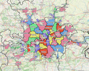
Greater London Built-up Area
Conurbation in south-east England
Distance: Approx. 13 meters
Latitude and longitude: 51.5073,-0.1277
The Greater London Built-up Area, or Greater London Urban Area, is a conurbation in south-east England that constitutes the continuous urban sprawl of London, and includes surrounding adjacent urban towns as defined by the Office for National Statistics. It is the largest urban area in the United Kingdom with a population of 9,787,426 in 2011.

Drummonds Bank
Formerly independent private bank in London, England
Distance: Approx. 36 meters
Latitude and longitude: 51.5069,-0.1278
Messrs. Drummond, Bankers is a formerly independent private bank in the United Kingdom that is now part of NatWest Group. The Royal Bank of Scotland incorporating Messrs Drummond, Bankers is based at 49 Charing Cross in central London.

High Commission of Uganda, London
Diplomatic mission
Distance: Approx. 49 meters
Latitude and longitude: 51.5072,-0.1283
The High Commission of Uganda in London is the diplomatic mission of Uganda in the United Kingdom. It is located in Uganda House, next to Admiralty Arch on Trafalgar Square; it shares the building with the Embassy of Burundi. In 2011 a protest was held outside by High Commission by diaspora Ugandans opposed to the Presidency of Yoweri Museveni, and also in 2012 by people opposed to the Uganda Anti-Homosexuality Bill.

Farmers Club
Distance: Approx. 30 meters
Latitude and longitude: 51.50708333,-0.12719444
The Farmers Club is a London private members' club based at Whitehall Court, founded in 1842. Members are required to have an association with farming, agriculture or food.
Acme Studios
Charity based in London
Distance: Approx. 7 meters
Latitude and longitude: 51.50722222,-0.1275
Acme, also styled ACME, is a charity based in London, England which provides affordable studio and living space, residencies and awards for visual artists. Its studios are known as Acme Studios. It formerly provided two gallery spaces, first the Acme Gallery and later the Acme Project Space.

Equestrian statue of Charles I, Charing Cross
Statue in London by Hubert Le Sueur
Distance: Approx. 17 meters
Latitude and longitude: 51.50734,-0.12768
The equestrian statue of Charles I at Charing Cross, London, England, is a work by the French sculptor Hubert Le Sueur, probably cast in 1633 during Charles’ lifetime. It is the oldest bronze statue in London and is considered the central point of the city. Its location at Charing Cross is on the former site of the most elaborate of the Eleanor crosses erected by Edward I, which had stood for three and a half centuries until 1647.
1962 London smog
1962 air pollution event in London, England
Distance: Approx. 47 meters
Latitude and longitude: 51.507,-0.127
The 1962 London smog was a severe smog episode that affected London, England, in December 1962. It occurred ten years after the Great Smog of London, in which serious air pollution had killed as many as 12,000 people. While the 1952 smog had led to the passing of the 1956 Clean Air Act, which restricted the burning of domestic fuels in urban areas with the introduction of smokeless zones, fogs continued to be smoky in London for some years after the act as residents and operators were given time to convert from domestic fuels.
Weather in this IP's area
overcast clouds
14 Celsius
14 Celsius
13 Celsius
16 Celsius
1004 hPa
93 %
1004 hPa
1002 hPa
10000 meters
3.09 m/s
100 degree
85 %
06:24:54
19:31:39