213.207.174.78 - IP Lookup: Free IP Address Lookup, Postal Code Lookup, IP Location Lookup, IP ASN, Public IP
Country:
Region:
City:
Location:
Time Zone:
Postal Code:
IP information under different IP Channel
ip-api
Country
Region
City
ASN
Time Zone
ISP
Blacklist
Proxy
Latitude
Longitude
Postal
Route
Luminati
Country
Region
02
City
limassol
ASN
Time Zone
Asia/Nicosia
ISP
EPIC LTD
Latitude
Longitude
Postal
IPinfo
Country
Region
City
ASN
Time Zone
ISP
Blacklist
Proxy
Latitude
Longitude
Postal
Route
IP2Location
213.207.174.78Country
Region
ammochostos
City
deryneia
Time Zone
Asia/Nicosia
ISP
Language
User-Agent
Latitude
Longitude
Postal
db-ip
Country
Region
City
ASN
Time Zone
ISP
Blacklist
Proxy
Latitude
Longitude
Postal
Route
ipdata
Country
Region
City
ASN
Time Zone
ISP
Blacklist
Proxy
Latitude
Longitude
Postal
Route
Popular places and events near this IP address

Paralimni
Town and Municipality in Famagusta District, Cyprus
Distance: Approx. 4359 meters
Latitude and longitude: 35.03333333,33.98333333
Paralimni (Greek: Παραλίμνι) is a town within the Famagusta District of Cyprus, situated on the island's east coast. Since the Turkish invasion in 1974, it has increased in size and status, primarily due to the migration of refugees fleeing from the north. Many workers in the tourist sectors of Protaras and Ayia Napa live in Paralimni, which is now the temporary administrative centre of the Famagusta District and the biggest municipality of the district under the control of the Republic of Cyprus.

Paralimni Stadium
Multi-purpose stadium in Paralimni, Cyprus
Distance: Approx. 4784 meters
Latitude and longitude: 35.03083333,33.98722222
Paralimni Stadium is a multi-purpose stadium in Paralimni, Cyprus. It was inaugurated in 1996 and currently used mostly for football matches. It is the home ground of Enosis Neon Paralimni.
Varosha, Famagusta
Place in Famagusta District, Cyprus
Distance: Approx. 4931 meters
Latitude and longitude: 35.11083333,33.95361111
Varosha (Greek: Βαρώσια, romanized: Varósia, locally [vaˈɾoʃa]; Turkish: Maraş [maˈɾaʃ] or Kapalı Maraş) is the southern quarter of Famagusta, a de jure territory of Cyprus, currently under the control of Northern Cyprus. Varosha has a population of 226 in the 2011 Northern Cyprus census. The area of Varosha is 6.19 km2 (2.39 sq mi).
GSE Stadium
Football stadium in Famagusta, Cyprus
Distance: Approx. 5798 meters
Latitude and longitude: 35.11861111,33.95305556
The Evagoras Gymnastic Association Stadium (GSE Stadium) (Gymnastikos Syllogos Evagoras, Greek: Γυμναστικός Σύλλογος Ευαγόρας) is a football stadium located in Famagusta, Cyprus and was the home ground of Anorthosis and Nea Salamina. The stadium remains abandoned and in bad condition since 1974 when Turkey invaded the island of Cyprus and occupied 37.6% of it including the city of Famagusta. After the summer of 1974, Anorthosis used many football stadiums all around Cyprus like Dasaki Stadium, Aradippou Municipal Stadium, Paralimni Stadium, Tsirion Stadium, old GSZ Stadium, and new GSZ Stadium.
Frenaros
Place in Famagusta District, Cyprus
Distance: Approx. 4584 meters
Latitude and longitude: 35.04083333,33.91916667
Frenaros (Greek: Φρέναρος; locally [ˈfrenːaɾos]) is a village in the Famagusta District of Cyprus, located 4 miles west of Paralimni and 9 miles northwest of Ayia Napa. In 2011, it had a population of 4,298.

Xenion High School
Cypriot high school
Distance: Approx. 3353 meters
Latitude and longitude: 35.04146,33.97837
Xenion High School is a high school in Paralimni, Cyprus. It was established in 2001 and functions under the supervision of the Ministry of Education and Culture in accordance with the Private Schools Act, 1971. The school is similar to state schools.
Strovilia
Place in Akrotiri and Dhekelia, United Kingdom
Distance: Approx. 6068 meters
Latitude and longitude: 35.09611111,33.90222222
Strovilia (Greek: Στροβίλια), (Turkish: Akyar) is a small Cypriot village located at the border of the de facto Turkish Republic of Northern Cyprus (TRNC) with the British Sovereign Base Area (SBA) of Dhekelia. It is the site of a Green Line crossing between Cyprus and Northern Cyprus. Some of Strovilia lies in Northern Cyprus, some in UK's SBA. The Cyprus UN buffer zone boundaries are defined as the cease fire lines of 16 August 1974.

Deryneia
Municipality in Famagusta, Cyprus
Distance: Approx. 1247 meters
Latitude and longitude: 35.05555556,33.95694444
Deryneia (Greek: Δερύνεια; Turkish: Derinya) is a large village in the island of Cyprus. It is located on the east side of the island, 2 km (1 mi) south of the city of Famagusta. The population of the village is 5,758 (October 2011 census) and it consists of a municipality since 1994.

Sotira, Famagusta
Municipality in Famagusta District, Cyprus
Distance: Approx. 4516 meters
Latitude and longitude: 35.02666667,33.95027778
Sotira (Greek: Σωτήρα) is a town in the Famagusta District of Cyprus, west of Paralimni. In 2011, it had a population of 5,474.
Famagusta Namık Kemal High School
Public secondary school in Famagusta, Northern Cyprus
Distance: Approx. 5898 meters
Latitude and longitude: 35.11777778,33.94111111
Famagusta Namık Kemal High School is a secondary school located in Famagusta, Northern Cyprus. It was founded in 1944. Many famous Cypriots have graduated from Famagusta Namık Kemal High School.

Palazzo del Provveditore
Royal palace in Famagusta
Distance: Approx. 6624 meters
Latitude and longitude: 35.1245,33.941
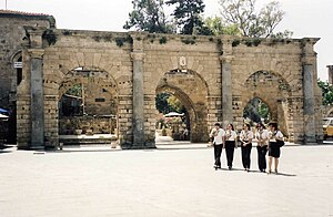
Palazzo del Provveditore, commonly known as the Venetian Palace, was a royal palace in Famagusta, originally built by the Lusignan Kings of Cyprus. It was later modified and used as the governor's official residence during the Venetian rule. The central sections of the palace have been completely destroyed, with only its grand facade and back courtyard walls being left.

Kapparis
Village in Cyprus
Distance: Approx. 4696 meters
Latitude and longitude: 35.05277778,34.00694444
Kapparis (Greek: Κάπαρης) is a village in the Famagusta District of Cyprus, close to the east coast. Although it is administered as part of Paralimni, it actually lies between Paralimni and Protaras. Kapparis is a relatively new location in the tourism industry, offering a quieter alternative to nearby Ayia Napa and Protaras, and has undergone heavy construction work to implement the appropriate infrastructure.
Weather in this IP's area
broken clouds
12 Celsius
11 Celsius
10 Celsius
13 Celsius
1016 hPa
76 %
1016 hPa
1008 hPa
10000 meters
7.84 m/s
10.5 m/s
202 degree
64 %

