Country:
Region:
City:
Latitude and Longitude:
Time Zone:
Postal Code:
IP information under different IP Channel
ip-api
Country
Region
City
ASN
Time Zone
ISP
Blacklist
Proxy
Latitude
Longitude
Postal
Route
IPinfo
Country
Region
City
ASN
Time Zone
ISP
Blacklist
Proxy
Latitude
Longitude
Postal
Route
MaxMind
Country
Region
City
ASN
Time Zone
ISP
Blacklist
Proxy
Latitude
Longitude
Postal
Route
Luminati
Country
Region
by
City
munich
ASN
Time Zone
Europe/Berlin
ISP
M-net Telekommunikations GmbH
Latitude
Longitude
Postal
db-ip
Country
Region
City
ASN
Time Zone
ISP
Blacklist
Proxy
Latitude
Longitude
Postal
Route
ipdata
Country
Region
City
ASN
Time Zone
ISP
Blacklist
Proxy
Latitude
Longitude
Postal
Route
Popular places and events near this IP address

Arabella Hochhaus
Hotel/Apartment in Munich, Germany
Distance: Approx. 1533 meters
Latitude and longitude: 48.15111111,11.61833333
The Arabella-Hochhaus is a 23-storey, 75 m (246 ft), combined hotel, office and apartment building at Arabellapark, in the Bogenhausen neighborhood in eastern Munich, Germany.

Arabellapark station
Station of the Munich U-Bahn
Distance: Approx. 1248 meters
Latitude and longitude: 48.15361111,11.62166667
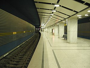
Arabellapark is a Munich U-Bahn station in Bogenhausen borough. It is the eastern terminus of the U4. Arabellapark station is located in the Arabellapark district of Bogenhausen, a large housing and commercial district developed during the 1970s.

Musicland Studios
Recording studio in Munich established by Giorgio Moroder
Distance: Approx. 1637 meters
Latitude and longitude: 48.15010833,11.61950278
Musicland Studios was a recording studio located in Munich, Germany established by Italian record producer, songwriter and musician Giorgio Moroder in the early 1970s. The studios were known for their work with artists such as Donna Summer, Electric Light Orchestra, and Queen, among others.

Goetz Collection
Art museum in Munich, Germany
Distance: Approx. 234 meters
Latitude and longitude: 48.16611111,11.62305556
The Goetz Collection (Sammlung Goetz) is a private collection of contemporary art in Munich, Germany. It opened in 1992. The collection is owned and continually being enlarged by the former gallery dealer Ingvild Goetz, who presents the collection to the public in a series of themed exhibitions in a purpose built museum.

Hypo-Haus
High-rise building is an administrative building of the HypoVereinsbank in Munich
Distance: Approx. 1697 meters
Latitude and longitude: 48.14972222,11.61722222
The listed HVB Tower or formerly Hypo-house (Hypo-Haus) or Hypo high-rise building (Hypo-Hochhaus) is an administrative building of the HypoVereinsbank in Munich.
Arabellapark
Distance: Approx. 1436 meters
Latitude and longitude: 48.1519,11.6203
Arabellapark is a residential and commercial area in the Bogenhausen district of Munich, Germany, which was developed with the construction of multiple buildings from 1965 to 1998. It is one of the largest urban expansion projects of the period after World War II in Munich. It takes its name from the Arabellastrasse, which runs through the project site.
Brunnbach (Isar)
River in Germany
Distance: Approx. 1654 meters
Latitude and longitude: 48.1792,11.6261
Brunnbach is a small river of Bavaria, Germany. It is about 3 kilometres (1.9 mi) long and flows through the district Bogenhausen in Munich. It is a right tributary of the Isar.
Oberer Wehrbach
River in Germany
Distance: Approx. 1111 meters
Latitude and longitude: 48.1675,11.6062
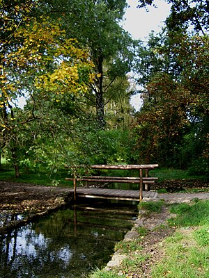
Oberer Wehrbach is of small river in the Englischer Garten, a public park in Munich, Bavaria, Germany. It branches off the Schwabinger Bach and flows into the Oberstjägermeisterbach.
Reitbach
River in Germany
Distance: Approx. 890 meters
Latitude and longitude: 48.169,11.6104
Reitbach is a small river of Bavaria, Germany. It flows through the Englischer Garten in Munich. It is a short branch of the Oberstjägermeisterbach.

Unterer Wehrbach
River in Bavaria, Germany
Distance: Approx. 583 meters
Latitude and longitude: 48.169,11.6159
Unterer Wehrbach is of small river in the Englischer Garten, a public park in Munich, Bavaria, Germany. It branches off the Oberstjägermeisterbach and flows into the Isar.

Nordfriedhof (Munich)
Cemetery in Munich, Germany
Distance: Approx. 1744 meters
Latitude and longitude: 48.175,11.602778
The Nordfriedhof ("Northern Cemetery"), with 34,000 burial plots, is one of the largest cemeteries in Munich, Bavaria, Germany. It is situated in the suburb of Schwabing-Freimann. It was established by the former community of Schwabing in 1884.

Isarring
Street in Munich, Germany
Distance: Approx. 1538 meters
Latitude and longitude: 48.16018,11.60108
The Isarring is a four-lane section of the Mittlerer Ring, the Bundesstraße 2 R (federal highway), in Munich. It is used by 110,000 cars every day and was constructed in 1966.
Weather in this IP's area
clear sky
18 Celsius
18 Celsius
17 Celsius
19 Celsius
1017 hPa
69 %
1017 hPa
958 hPa
10000 meters
1.34 m/s
4.02 m/s
47 degree
2 %
06:56:22
19:18:12
