213.176.113.15 - IP Lookup: Free IP Address Lookup, Postal Code Lookup, IP Location Lookup, IP ASN, Public IP
Country:
 Sweden
Region:
City:
Location:
Time Zone:
Postal Code:
ISP:
ASN:
language:
User-Agent:
Proxy IP:
Blacklist:
IP information under different IP Channel
ip-api
Country
Region
City
ASN
Time Zone
ISP
Blacklist
Proxy
Latitude
Longitude
Postal
Route
db-ip
Country
Region
City
ASN
Time Zone
ISP
Blacklist
Proxy
Latitude
Longitude
Postal
Route
IPinfo
Country
Region
City
ASN
Time Zone
ISP
Blacklist
Proxy
Latitude
Longitude
Postal
Route
IP2Location
213.176.113.15Country
seRegion
stockholms lan
City
haggvik
Time Zone
Europe/Stockholm
ISP
Language
User-Agent
Latitude
Longitude
Postal
ipdata
Country
Region
City
ASN
Time Zone
ISP
Blacklist
Proxy
Latitude
Longitude
Postal
Route
Popular places and events near this IP address
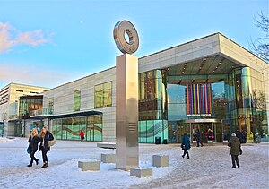
Sollentuna Municipality
Municipality in Stockholm County, Sweden
Distance: Approx. 1772 meters
Latitude and longitude: 59.43333333,17.95
Sollentuna Municipality (Sollentuna kommun [ˈsɔ̂lːɛnˌtʉːna kʊˈmʉːn] ) is a municipality in Stockholm County in east-central Sweden, north of Stockholm. Its seat of local government is located in Tureberg, which is a part of Sollentuna urban area.

Norrortsleden
Distance: Approx. 2586 meters
Latitude and longitude: 59.46166667,17.9675
Norrortsleden is a road in Stockholm County, Sweden, providing connection from the European route E4 in the municipality of Sollentuna to European route E18 in the municipality of Österåker. The road is a motorway between Sollentuna and Täby kyrkby, and a 2+1 road the rest of the way to the E18. The road was opened on 4 October 2008.

Edsbacka krog
Restaurant in Sollentuna Municipality, Stockholm County, Sweden
Distance: Approx. 1212 meters
Latitude and longitude: 59.44069444,17.95069444
Edsbacka krog ("Edsbacka inn") is a restaurant on the banks of the Edsviken in Sollentuna, Sweden, just north of Stockholm. It closed in February 2010, and was then one of two Swedish restaurants with two stars in the Michelin Guide.
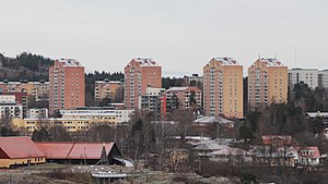
Edsberg, Sollentuna
Urban district in Sollentuna Municipality, Stockholm County, Sweden
Distance: Approx. 1891 meters
Latitude and longitude: 59.44611111,17.96611111
Edsberg () is an urban district in Sollentuna Municipality, Stockholm County, Sweden. It is located at the bottom of the Edsviken Bay, which forms a long inlet all the way from the Baltic Sea. It forms part of Stockholm.

Uppland Runic Inscription 100
Distance: Approx. 1775 meters
Latitude and longitude: 59.4333,17.95
Uppland Runic Inscription 100 is the Rundata designation for a memorial runestone that is located in the forest where a path meets a bog near Skälby, which is about two kilometers northeast of Sollentuna, Stockholm County, Sweden, which was part of the historical province of Uppland.

Edsberg Castle
Distance: Approx. 1431 meters
Latitude and longitude: 59.44111111,17.95555556
Edsbergs slott (Edsberg Manor) is a manor house and estate located by the bay of Edsviken in Sollentuna Municipality, north of Stockholm, Sweden.

Edsviks konsthall
Distance: Approx. 1628 meters
Latitude and longitude: 59.44055556,17.95888889
Edsviks konsthall (Edsvik Art Gallery) was a Swedish art gallery situated at Edsberg, an 18th-century estate at Edsviken in the north of Stockholm, Sweden. The gallery focused on Swedish and international contemporary art. Some 15–20 exhibitions of Swedish and international artists were held at the gallery each year.

Sollentuna Church
Distance: Approx. 2377 meters
Latitude and longitude: 59.46666667,17.91833333
Sollentuna Church is located in Sollentuna Municipality. It is one of the churches in Sollentuna Parish. A partial runic inscription, designated Upplands runinskrifter 95, appears on the side of the church.

Sollentuna socken
Historical location
Distance: Approx. 2377 meters
Latitude and longitude: 59.46666667,17.91833333
Sollentuna socken is a former socken of Sollentuna Hundred in Uppland, Sweden. The area largely corresponds to the modern Sollentuna Municipality, but not completely. Hansta was incorporated into Stockholm Municipality in 1980, while other localities (such as Silverdal) were incorporated into the municipality from other parishes.

Sollentuna railway station
Railway station in Sollentuna, Sweden
Distance: Approx. 2224 meters
Latitude and longitude: 59.42833333,17.94861111
Sollentuna is one of the five stations of the Stockholm commuter rail in Sollentuna Municipality. It is situated in the neighbourhood of Tureberg 13.3 km north of Stockholm Central Station. The station was originally called Tureberg and was opened in 1866 in a rural setting along the railway Stockholm–Uppsala.

Sollentuna köping
Distance: Approx. 1772 meters
Latitude and longitude: 59.43333333,17.95
Sollentuna Köping was a köping in Sollentuna Hundred. In 1971, it was reformed into Sollentuna Municipality.

Tureberg
Distance: Approx. 2010 meters
Latitude and longitude: 59.42861111,17.93583333
Tureberg () is a neighbourhood in Sollentuna Municipality, Stockholm County, Sweden with 18,866 inhabitants (2018). It is a Stockholm suburb and houses the seat of local government for the municipality as well as a large shopping mall and a Stockholm commuter rail station. Tureberg has also evolved as a law enforcement center for the northern part of metropolitan Stockholm, with police station, court house, prosecutor's office, and a jail, all in buildings built in the 1980s and onwards.
Weather in this IP's area
clear sky
-5 Celsius
-7 Celsius
-5 Celsius
-4 Celsius
1025 hPa
90 %
1025 hPa
1021 hPa
10000 meters
1.54 m/s
290 degree