Country:
 Poland
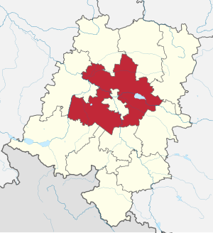
Region:
City:
Latitude and Longitude:
Time Zone:
Postal Code:
IP information under different IP Channel
ip-api
Country
Region
City
ASN
Time Zone
ISP
Blacklist
Proxy
Latitude
Longitude
Postal
Route
IPinfo
Country
Region
City
ASN
Time Zone
ISP
Blacklist
Proxy
Latitude
Longitude
Postal
Route
MaxMind
Country
Region
City
ASN
Time Zone
ISP
Blacklist
Proxy
Latitude
Longitude
Postal
Route
Luminati
Country
PLRegion
16
City
opole
ASN
Time Zone
Europe/Warsaw
ISP
Netia SA
Latitude
Longitude
Postal
db-ip
Country
Region
City
ASN
Time Zone
ISP
Blacklist
Proxy
Latitude
Longitude
Postal
Route
ipdata
Country
Region
City
ASN
Time Zone
ISP
Blacklist
Proxy
Latitude
Longitude
Postal
Route
Popular places and events near this IP address

Opole
Place in Opole Voivodeship, Poland
Distance: Approx. 1188 meters
Latitude and longitude: 50.66666667,17.93333333
Opole (Polish: [ɔˈpɔlɛ] ; German: Oppeln [ˈɔpl̩n] ; Silesian: Ôpole) is a city located in southern Poland on the Oder River and the historical capital of Upper Silesia. With a population of approximately 127,387 as of the 2021 census, it is the capital of Opole Voivodeship (province) and the seat of Opole County. Its built-up (or metro area) was home to 146,522 inhabitants.
Opole County, Opole Voivodeship
County in Opole Voivodeship, Poland
Distance: Approx. 1188 meters
Latitude and longitude: 50.66666667,17.93333333
Opole County (Polish: powiat opolski) is a unit of territorial administration and local government (powiat) in Opole Voivodeship, south-western Poland. It came into being on January 1, 1999, as a result of the Polish local government reforms passed in 1998. Its administrative seat is the city of Opole, although the city is not part of the county (it constitutes a separate city county).

New Synagogue (Opole)
Former Reform synagogue in Oppeln, Germany; now Poland
Distance: Approx. 495 meters
Latitude and longitude: 50.66638889,17.92083333
The New Synagogue (German: Neue Synagoge Oppeln; Polish: Nowa Synagoga w Opolu) was a former Reform Jewish congregation and synagogue, located in Oppeln, Germany (today Opole, Poland). The synagogue was destroyed by Nazis on November 9, 1938, during Kristallnacht. Designed by Felix Henry in the Moorish Revival style, the synagogue was built in 1893–1897.

Kowalczyk brothers
Distance: Approx. 606 meters
Latitude and longitude: 50.6689,17.9258
Ryszard Kowalczyk (20 February 1937 – 17 October 2017) and his younger brother Jerzy Kowalczyk (born 1942) were Polish brothers who planted a bomb as a protest against communist rule in Poland. The Kowalczyk brothers were scientists at Opole University. They planted a bomb there on 6 October 1971 as a protest against the violence perpetrated by the communist authorities against the workers' protest.

Roman Catholic Diocese of Opole
Roman Catholic diocese in Poland
Distance: Approx. 198 meters
Latitude and longitude: 50.6703,17.9203
The Diocese of Opole (Latin: Dioecesis Opoliensis) is a Latin diocese of the Catholic Church located in the city of Opole in the ecclesiastical province of Katowice in Poland.

University of Opole
Distance: Approx. 609 meters
Latitude and longitude: 50.66888889,17.92583333
The University of Opole (Polish: Uniwersytet Opolski) is a public university in the city of Opole. It was founded in 1994 from a merger of two parallel educational institutions. The university has 17,500 students completing 32 academic majors and 53 specializations.

Duchy of Opole
Silesian duchy (1172–1202; 1281–1532)
Distance: Approx. 463 meters
Latitude and longitude: 50.673521,17.92166
Duchy of Opole (Polish: Księstwo opolskie; Czech: Opolské knížectví; German: Herzogtum Oppeln) was one of the duchies of Silesia ruled by the branch of Polish Piast dynasty, formed during the medieval fragmentation of Poland into provincial duchies. Its capital was Opole in Upper Silesia.

Opole Główne railway station
Railway station in Opole, Poland
Distance: Approx. 1102 meters
Latitude and longitude: 50.6623,17.9267
Opole Główne (Polish for Opole main station) is a major railway station in the southern Polish city of Opole. It also is the biggest station in Opole Voivodeship, with connections to all major Polish cities, several local towns of the area, as well as international locations, such as Berlin and Hamburg. The first station building for Opole Główne was completed in 1853, and back then it was called Oppeln Hauptbahnhof, as the city belonged to the German Empire.

Solaris Center
Building in Opole
Distance: Approx. 607 meters
Latitude and longitude: 50.6702,17.9261
Solaris Center is a commercial and entertainment complex in Opole, Poland, located on the Copernicus Square (pl. Plac Kopernika), next to the University of Opole. The Center was opened in 2009 and underwent expansion 10 years later.

Duchy of Opole and Racibórz
Distance: Approx. 463 meters
Latitude and longitude: 50.673521,17.92166
The Duchy of Opole and Racibórz (Polish: Księstwo opolsko-raciborskie, German: Herzogtum Oppeln und Ratibor) was one of the numerous Duchies of Silesia ruled by the Silesian branch of the royal Polish Piast dynasty. It was formed in 1202 from the union of the Upper Silesian duchies of Opole and the Racibórz, in a rare exception to the continuing feudal fragmentation of the original Duchy of Silesia. In 1281 it was split again.

Opole Town Hall
Town hall in Opole, Poland
Distance: Approx. 381 meters
Latitude and longitude: 50.6685,17.9221
Opole Town Hall - a town hall built in the Neo-Renaissance architectural style in the Śródmieście borough in Opole. The town hall was built on the exemplar of the Palazzo Vecchio in Florence, Italy.

Opole Cathedral
Church in Opole, Poland
Distance: Approx. 198 meters
Latitude and longitude: 50.6703,17.9203
The Cathedral of the Holy Cross (Polish: Katedra Podwyższenia Krzyża Świętego) also called Opole Cathedral is a religious building affiliated with the Catholic Church that serves as a parish church and the cathedral city of Opole in Poland. The church belongs to the parish of the Holy Cross in Opole in the deanery of Opole, part of the Roman Catholic Diocese of Opole (established in 1972). On April 3, 1964, the temple was entered in the register of regional monuments of Opole under number 763/64.
Weather in this IP's area
overcast clouds
16 Celsius
14 Celsius
16 Celsius
16 Celsius
1018 hPa
42 %
1018 hPa
1000 hPa
10000 meters
3.95 m/s
11.45 m/s
61 degree
100 %
06:25:45
19:00:39