Country:
 Cyprus
Region:
City:
Latitude and Longitude:
Time Zone:
Postal Code:
IP information under different IP Channel
ip-api
Country
Region
City
ASN
Time Zone
ISP
Blacklist
Proxy
Latitude
Longitude
Postal
Route
IPinfo
Country
Region
City
ASN
Time Zone
ISP
Blacklist
Proxy
Latitude
Longitude
Postal
Route
MaxMind
Country
Region
City
ASN
Time Zone
ISP
Blacklist
Proxy
Latitude
Longitude
Postal
Route
Luminati
Country
CYRegion
04
City
paralimni
ASN
Time Zone
Asia/Famagusta
ISP
A.C. NetFlash Technologies Ltd
Latitude
Longitude
Postal
db-ip
Country
Region
City
ASN
Time Zone
ISP
Blacklist
Proxy
Latitude
Longitude
Postal
Route
ipdata
Country
Region
City
ASN
Time Zone
ISP
Blacklist
Proxy
Latitude
Longitude
Postal
Route
Popular places and events near this IP address

Ayia Napa
Municipality in Famagusta District, Cyprus
Distance: Approx. 6431 meters
Latitude and longitude: 34.98,34
Ayia Napa (Greek: Άγια Νάπα Turkish: Aya Napa, locally [aˈʝanːapa]), officially romanised Agia Napa, is a tourist resort at the far eastern end of the southern coast of Cyprus.

Protaras
Town in Famagusta District, Cyprus
Distance: Approx. 468 meters
Latitude and longitude: 35.015,34.05416667
Protaras (Greek: Πρωταράς) is a predominantly tourist resort which comes under the administrative jurisdiction of Paralimni Municipality in Cyprus. In ancient times, where Protaras is now located, stood the old city-state of Leukolla. The city possessed a small safe harbour where Demetrius Poliorketes sought refuge in the year 306 BC, lying in wait for Ptolemy, one of the successors of Alexander the Great.

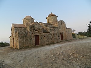
Paralimni
Town and Municipality in Famagusta District, Cyprus
Distance: Approx. 7217 meters
Latitude and longitude: 35.03333333,33.98333333
Paralimni (Greek: Παραλίμνι) is a town within the Famagusta District of Cyprus, situated on the island's east coast. Since the Turkish invasion in 1974, it has increased in size and status, primarily due to the migration of refugees fleeing from the north. Many workers in the tourist sectors of Protaras and Ayia Napa live in Paralimni, which is now the temporary administrative centre of the Famagusta District and the biggest municipality of the district under the control of the Republic of Cyprus.

Paralimni Stadium
Distance: Approx. 6793 meters
Latitude and longitude: 35.03083333,33.98722222
Paralimni Stadium is a multi-purpose stadium in Paralimni, Cyprus. It was inaugurated in 1996 and currently used mostly for football matches. It is the home ground of Enosis Neon Paralimni.

Cape Greco
Headland in southeastern Cyprus
Distance: Approx. 4043 meters
Latitude and longitude: 35,34.01666667
Cape Greco, also known as Capo Greco (Italian for "Greek cape"; Greek: Κάβο Γκρέκο), is a headland in the southeastern part of the island of Cyprus. It is at the southern end of Famagusta Bay and forms part of Ayia Napa Municipality. It lies between the towns of Ayia Napa and Protaras, both tourist resorts, and is visited by tourists for its natural environment.

Xenion High School
Cypriot high school
Distance: Approx. 7968 meters
Latitude and longitude: 35.04146,33.97837
Xenion High School is a high school in Paralimni, Cyprus. It was established in 2001 and functions under the supervision of the Ministry of Education and Culture in accordance with the Private Schools Act, 1971. The school is similar to state schools.

Nissi Beach
Beach in the resort of Ayia Napa, Cyprus
Distance: Approx. 8588 meters
Latitude and longitude: 34.988,33.969
Nissi Beach is a popular beach in the resort of Ayia Napa, Cyprus. The beach stretches for 500 metres and the water is clean enough for the beach to have been awarded the blue flag designation. The beach, which runs the length of its own cove, takes its name from the small islet of Nissi (Greek: Νησί) located close to the coast.
Sotira, Famagusta
Municipality in Famagusta District, Cyprus
Distance: Approx. 9973 meters
Latitude and longitude: 35.02666667,33.95027778
Sotira (Greek: Σωτήρα) is a town in the Famagusta District of Cyprus, west of Paralimni. In 2011, it had a population of 5,474.
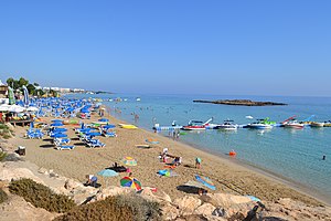
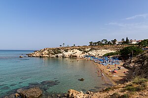
Fig Tree Bay
Sandy beach in Protaras of Paralimni in Cyprus
Distance: Approx. 64 meters
Latitude and longitude: 35.0128,34.0589
Fig Tree Bay is a sandy beach in Protaras of Paralimni in Cyprus. In 2011, TripAdvisor declared it to be the third best beach in Europe, though it dropped to 13th place in 2013.
Kapparis
Village in Cyprus
Distance: Approx. 6482 meters
Latitude and longitude: 35.05277778,34.00694444
Kapparis (Greek: Κάπαρης) is a village in the Famagusta District of Cyprus, close to the east coast. Although it is administered as part of Paralimni, it actually lies between Paralimni and Protaras. Kapparis is a relatively new location in the tourism industry, offering a quieter alternative to nearby Ayia Napa and Protaras, and has undergone heavy construction work to implement the appropriate infrastructure.
Weather in this IP's area
scattered clouds
22 Celsius
23 Celsius
21 Celsius
23 Celsius
1010 hPa
83 %
1010 hPa
1009 hPa
10000 meters
3.13 m/s
3.58 m/s
350 degree
43 %
06:30:25
18:43:56