213.163.228.147 - IP Lookup: Free IP Address Lookup, Postal Code Lookup, IP Location Lookup, IP ASN, Public IP
Country:
Region:
City:
Location:
Time Zone:
Postal Code:
IP information under different IP Channel
ip-api
Country
Region
City
ASN
Time Zone
ISP
Blacklist
Proxy
Latitude
Longitude
Postal
Route
Luminati
Country
Region
8
City
thuringen
ASN
Time Zone
Europe/Vienna
ISP
iPlace Internet & Network Services GmbH
Latitude
Longitude
Postal
IPinfo
Country
Region
City
ASN
Time Zone
ISP
Blacklist
Proxy
Latitude
Longitude
Postal
Route
IP2Location
213.163.228.147Country
Region
vorarlberg
City
dornbirn
Time Zone
Europe/Vienna
ISP
Language
User-Agent
Latitude
Longitude
Postal
db-ip
Country
Region
City
ASN
Time Zone
ISP
Blacklist
Proxy
Latitude
Longitude
Postal
Route
ipdata
Country
Region
City
ASN
Time Zone
ISP
Blacklist
Proxy
Latitude
Longitude
Postal
Route
Popular places and events near this IP address
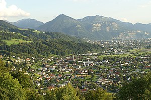
Dornbirn
Municipality in Vorarlberg, Austria
Distance: Approx. 914 meters
Latitude and longitude: 47.41388889,9.74444444
Dornbirn (German pronunciation: [ˈdɔʁnbɪʁn] ) is a city in the westernmost Austrian state of Vorarlberg. It is the administrative centre for the district of Dornbirn, which also includes the town of Hohenems, and the market town Lustenau. Dornbirn is the largest city in Vorarlberg and the tenth largest city in Austria.
Zumtobel Group
Austrian lighting technology company
Distance: Approx. 1039 meters
Latitude and longitude: 47.4076,9.7354
The Zumtobel Group is an Austrian company specialising in lighting and headquartered in Dornbirn. Zumtobel engages in the development, production and sales of lighting, luminaires, lighting management and lighting components for indoor and outdoor applications. The company is a European market leader for professional lighting systems and the number two for lighting components in Europe.
Schwarzach, Vorarlberg
Municipality in Vorarlberg, Austria
Distance: Approx. 1273 meters
Latitude and longitude: 47.41666667,9.75
Schwarzach is a municipality in the Austrian state of Vorarlberg.
Dornbirn District
District in Vorarlberg, Austria
Distance: Approx. 1273 meters
Latitude and longitude: 47.41666667,9.75
The Bezirk Dornbirn is an administrative district (Bezirk) in Vorarlberg, Austria. A rather young district, it was separated from the Feldkirch district in 1969. The area of the district is 172.7 km2, the population 82,721 (January 1, 2012), which makes a population density of 479 persons per km2.

Vorarlberg University of Applied Sciences
Distance: Approx. 1453 meters
Latitude and longitude: 47.40611111,9.74416667
The Vorarlberg University of Applied Sciences (German: Fachhochschule Vorarlberg) in Dornbirn in Vorarlberg (Austria) is a leading Austrian University of Applied Sciences. It was founded in 1989 going under the name of "Technical School, Vorarlberg". Its charter is to provide degree programmes with a direct link to work practice.
Hatlerdorf
Distance: Approx. 1704 meters
Latitude and longitude: 47.4019,9.7383
Hatlerdorf is the second precinct of the City of Dornbirn (Vorarlberg, Austria).

FLATZ Museum
Distance: Approx. 913 meters
Latitude and longitude: 47.4117,9.7426
The FLATZ Museum is a contemporary art museum in Dornbirn, Vorarlberg (Austria). The museum dates back to an oeuvre donation to the city of Dornbirn by Wolfgang Flatz, also known as FLATZ, an action artist. The opening took place in 2009 by the former "documenta" director Jan Hoet.
Stadion Birkenwiese
Football stadium in Dornbirn in Austria
Distance: Approx. 680 meters
Latitude and longitude: 47.41647,9.72409
The Stadion Birkenwiese is a football stadium in Dornbirn in the Austrian state of Vorarlberg. It is the home ground of FC Dornbirn 1913, which plays in the 2nd division.
Messepark
Shopping centre in Vorarlberg, Austria
Distance: Approx. 1665 meters
Latitude and longitude: 47.41138889,9.7125
Messepark is the largest shopping centre in Vorarlberg, Austria. It is located in Dornbirn right next to the Dornbirn exhibition area and the highway leading south of Dornbirn.

Dornbirn railway station
Railway station in Vorarlberg, Austria
Distance: Approx. 446 meters
Latitude and longitude: 47.417522,9.738919
Dornbirn railway station (German: Bahnhof Dornbirn) is a railway station in Dornbirn in the Dornbirn district of the Austrian federal state of Vorarlberg. It was opened on 1 July 1872, together with the rest of the Vorarlberg railway. The station is owned and operated by the Austrian Federal Railways (ÖBB).

Dornbirn-Schoren railway station
Railway station in Vorarlberg, Austria
Distance: Approx. 668 meters
Latitude and longitude: 47.413065,9.726153
Dornbirn-Schoren railway station (German: Bahnhof Dornbirn-Schoren) is a railway station in Dornbirn in the Dornbirn district of the Austrian federal state of Vorarlberg. The station is owned and operated by the Austrian Federal Railways (ÖBB).
Parish Church Hatlerdorf
Roman Catholic church in Vorarlberg, Austria
Distance: Approx. 1700 meters
Latitude and longitude: 47.40198,9.73856
The Roman Catholic Parish Church of Dornbirn-Hatlerdorf' (also: Parish Church of Dornbirn-St. Leopold) stands in the district of Hatlerdorf in the municipality of Dornbirn in the Austrian state of Vorarlberg. It is dedicated to Saint Leopold and belongs to the Deanery of Dornbirn in the Diocese of Feldkirch.
Weather in this IP's area
clear sky
2 Celsius
2 Celsius
1 Celsius
6 Celsius
1034 hPa
83 %
1034 hPa
981 hPa
10000 meters
0.62 m/s
0.39 m/s
298 degree
3 %


