Country:
Region:
City:
Latitude and Longitude:
Time Zone:
Postal Code:
IP information under different IP Channel
ip-api
Country
Region
City
ASN
Time Zone
ISP
Blacklist
Proxy
Latitude
Longitude
Postal
Route
Luminati
Country
Region
vc
City
torrent
ASN
Time Zone
Europe/Madrid
ISP
NIXVAL
Latitude
Longitude
Postal
IPinfo
Country
Region
City
ASN
Time Zone
ISP
Blacklist
Proxy
Latitude
Longitude
Postal
Route
db-ip
Country
Region
City
ASN
Time Zone
ISP
Blacklist
Proxy
Latitude
Longitude
Postal
Route
ipdata
Country
Region
City
ASN
Time Zone
ISP
Blacklist
Proxy
Latitude
Longitude
Postal
Route
Popular places and events near this IP address

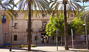
Torrent, Valencia
Municipality in Valencian Community, Spain
Distance: Approx. 1049 meters
Latitude and longitude: 39.43888889,-0.46555556
Torrent (Valencian: [toˈrent]; Spanish: Torrente [toˈrente]) is a city located within the metropolitan area of the city of Valencia, Spain. It is the largest municipality of the Horta Oest comarca, with 83,962 inhabitants (2020). It is situated some 7 km from Valencia city proper, to which it is connected via the metro.

Horta Oest
Comarca in Valencian Community, Spain
Distance: Approx. 5306 meters
Latitude and longitude: 39.47611111,-0.48111111
Horta Oest (Valencian: [ˈɔɾta oˈest], also [ˈɔɾtɔ oˈest]; Spanish: Huerta Oeste [ˈweɾta oˈeste]) was a comarca in the province of Valencia, Valencian Community, Spain.
Xirivella
Municipality in Valencian Community, Spain
Distance: Approx. 5329 meters
Latitude and longitude: 39.46555556,-0.42666667
Xirivella (Valencian pronunciation: [tʃiɾiˈveʎa]) is a municipality in the Valencian Community, Spain. It borders the city of Valencia, Alaquàs, Picanya and Mislata. The municipality is divided by the V-30 motorway and the river Turia, with the La Luz district on the eastern part of the river.
Manises UFO incident
Distance: Approx. 6166 meters
Latitude and longitude: 39.4833,-0.45
The Manises UFO incident took place on 11 November 1979, forcing a commercial flight of the Spanish company Transportes Aéreos Españoles, with 109 passengers, to make an emergency landing at the Manises' airport in Valencia, Spain, when they were flying over Ibiza. After the emergency landing, a Spanish Air Force Dassault Mirage F1 took off from Los Llanos Base in order to intercept the mysterious object. It is the most famous UFO sighting in Spain.

Albal
Municipality in Valencian Community, Spain
Distance: Approx. 5747 meters
Latitude and longitude: 39.39722222,-0.41555556
Albal is a municipality in the comarca of Horta Sud in the Valencian Community, Spain. Albal is in the comarque of Horta Sud, at 10 km south from Valencia. The municipality limits with Catarroja, Beniparrell, Silla, Valencia and Alcacer.
Alaquàs
Municipality in Valencian Community, Spain
Distance: Approx. 3225 meters
Latitude and longitude: 39.45833333,-0.46277778
Alaquàs (Valencian pronunciation: [alaˈkwas]; Spanish: Alacuás) is a municipality in the Horta Oest comarca in the Valencian Community.
Aldaia
Municipality in Valencian Community, Spain
Distance: Approx. 3839 meters
Latitude and longitude: 39.46388889,-0.46277778
Aldaia (Valencian: [alˈdaja]; Spanish: Aldaya [alˈdaʝa]) is a municipality in the comarca of Horta Oest, province of Valencia, Valencian Community, Spain.
Benetússer
Municipality in Valencian Community, Spain
Distance: Approx. 6168 meters
Latitude and longitude: 39.425,-0.39611111
Benetússer (Valencian: [beneˈtuseɾ]; Spanish: Benetúser) is a municipality in the comarca of Horta Sud in the Valencian Community, Spain. At the 2001 census the municipality had a population of 13,425 inhabitants and a land area of only 0.78 km2 (0.301 sq mi). Its population density of 17,211.5 persons/km2 was the third highest in Spain (after Mislata and L'Hospitalet de Llobregat).

Catarroja
Municipality in Valencian Community, Spain
Distance: Approx. 6198 meters
Latitude and longitude: 39.40277778,-0.40444444
Catarroja (Valencian: [kataˈrɔdʒa], also [kataˈrɔdʒɔ]; Spanish: [kataˈroxa]) is a municipality in the comarca of Horta Sud in the Valencian Community, Spain.
Manises
Municipality in Valencian Community, Spain
Distance: Approx. 6170 meters
Latitude and longitude: 39.48333333,-0.45
Manises (Valencian pronunciation: [maˈnizes], Spanish: [maˈnises]) is a municipality in the comarca of Horta Oest in the Valencian Community, Spain. Located in the province of Valencia, it had 30,693 inhabitants in 2018 (NSI) and is famous for its pottery and being the location of Valencia Airport.

Paiporta
Municipality in Valencian Community, Spain
Distance: Approx. 4241 meters
Latitude and longitude: 39.42777778,-0.41833333
Paiporta (Valencian pronunciation: [pajˈpɔɾta]) is a municipality of Spain belonging to the province of Valencia and the Valencian Community. It is part of the comarca of Horta Sud. Paiporta was billed as the ground zero of the October 2024 floods affecting the province of Valencia.

Picanya
Municipality in Valencian Community, Spain
Distance: Approx. 2895 meters
Latitude and longitude: 39.43611111,-0.435
Picanya (Valencian pronunciation: [piˈkaɲa]) is a municipality in the comarca of Horta Sud in the Valencian Community, Spain.
Weather in this IP's area
broken clouds
16 Celsius
16 Celsius
14 Celsius
17 Celsius
1022 hPa
89 %
1022 hPa
1016 hPa
10000 meters
3.58 m/s
5.81 m/s
271 degree
75 %
07:46:09
17:47:07


