Country:
Region:
City:
Latitude and Longitude:
Time Zone:
Postal Code:
IP information under different IP Channel
ip-api
Country
Region
City
ASN
Time Zone
ISP
Blacklist
Proxy
Latitude
Longitude
Postal
Route
Luminati
Country
ASN
Time Zone
Europe/Madrid
ISP
NIXVAL
Latitude
Longitude
Postal
IPinfo
Country
Region
City
ASN
Time Zone
ISP
Blacklist
Proxy
Latitude
Longitude
Postal
Route
db-ip
Country
Region
City
ASN
Time Zone
ISP
Blacklist
Proxy
Latitude
Longitude
Postal
Route
ipdata
Country
Region
City
ASN
Time Zone
ISP
Blacklist
Proxy
Latitude
Longitude
Postal
Route
Popular places and events near this IP address

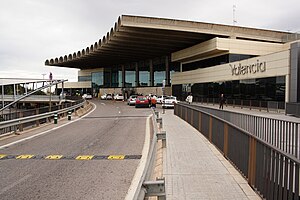
Valencia Airport
Airport in Manises
Distance: Approx. 3581 meters
Latitude and longitude: 39.48944444,-0.48166667
Valencia Airport (Spanish: Aeropuerto de Valencia, Valencian: Aeroport de València) (IATA: VLC, ICAO: LEVC), also known as Manises Airport, is the tenth-busiest Spanish airport in terms of passengers and second in the Valencian Community after Alicante. It is situated 8 km (5.0 mi) west of the city of Valencia, in Manises. The airport has flight connections to about 20 European countries and 8.53 million passengers passed through the airport in 2019.

Paterna
Municipality in Valencian Community, Spain
Distance: Approx. 2954 meters
Latitude and longitude: 39.50277778,-0.44055556
Paterna is a city and a municipality in the province of Valencia in the Valencian Community, Spain. It is located northeast of the comarca of L'Horta de Valencia, 5 kilometres (3 miles) northwest of the inland suburbs of Valencia, and on the left bank of the river Turia. Its population in 2014 was 67,156 inhabitants, being the eleventh city by population in the Valencian Community.
Instituto de Física Corpuscular
Distance: Approx. 3657 meters
Latitude and longitude: 39.515,-0.425
The Instituto de Física Corpuscular (IFIC, English: Institute for Corpuscular Physics) is a CSIC and University of Valencia joint center dedicated to experimental and theoretical research in the fields of particle physics, nuclear physics, cosmology, astroparticles and medical physics. It is located at the scientific park of the University of Valencia, in Paterna (Valencia, Spain).
Ciudad Deportiva de Paterna
Distance: Approx. 2737 meters
Latitude and longitude: 39.5425,-0.45555556
The Ciudad Deportiva de Paterna is a state-of-the-art training complex, home to Primera Division club Valencia CF. Located in Paterna, it was opened in 1992. The Ciudad Deportiva extends across an area of 180,000 square-metres. It is not only a school for future footballers and residence, but also a modern rehabilitation centre provided with different rooms for the recovery of footballers that are injured or in rehabilitation period.

Tower of Paterna
Distance: Approx. 2986 meters
Latitude and longitude: 39.50285278,-0.43999722
The Tower of Paterna (Valencian: Torre de Paterna [ˈtore ðe paˈtɛɾna]) is a historical monument of the town of Paterna, in the province of Valencia, Spain. It is the most emblematic monument of this valencian town. The origin of its construction is unknown, but it is thought that it was constructed during the Arab age, as a defense system to protect the city's inhabitants.
The Cavanilles Institute
Institute in Valencia, Spain
Distance: Approx. 3632 meters
Latitude and longitude: 39.5183,-0.4249
The Cavanilles Institute (Valencia) is located on the Parque Científico de Paterna, and was established in 1998 by the University of Valencia. The goal of this research center is to tackle questions relating to biodiversity from multiple perspectives, studying from morphology to animal behavior, from molecular genetic variation to quantitative variation, and integrating experts in complementary fields such as molecular biology, genetics, population biology, taxonomy, ecology, neurobiology or ethology.

University of Valencia Science Park
Distance: Approx. 3870 meters
Latitude and longitude: 39.51605083,-0.42233
The University of Valencia Science Park (Valencian: Parc Científic de la Universitat de València also known by the acronym PCUV) provides spaces and services to companies resulting from university research, –spin-off–, and other companies and R & D departments with content related to the innovative nature of the PCUV. The PCUV encompasses a scientific area that includes six research institutes, two centers, and services and facilities for research. Additionally, it features a business area that currently hosts more than seventy young or already established companies, primarily from the sectors of biotechnology and information and communication technologies (ICT). In addition, The University of Valencia Science Park houses the technical office of the Emprendia Network (Iberoamerican University Network of Business Incubation), which enables the expansion of businesses in the science parks of universities that make up the network.

Aeroport (Metrovalencia)
Distance: Approx. 3193 meters
Latitude and longitude: 39.4915,-0.4746
Aeroport is a metro station of Metrovalencia network situated west of Valencia, Spain. The station is located at Valencia Manises Airport, near Avinguda d'els Arcs and the adjacent bus terminal, making it a major access point towards the Valencia city center and Valencia port. In the first 10 years since the station's opening, line 5 of Metrovalencia between Aeroport and Marítim-Serrería stations was used by 186.6 million passengers.
Lycée Français de Valence
Distance: Approx. 2722 meters
Latitude and longitude: 39.5184,-0.4355
Lycée Français de Valence (LFV; Spanish: Liceo Francés de Valencia) is a French international school in Paterna, Spain, near Valencia. It serves petite section of maternelle/infantil (preschool) through terminale, the final year of lycée/bachillerato (senior high school/sixth form college). It is directly operated by the Agency for French Education Abroad (AEFE), an agency of the French government.

Lloma de Betxí
Distance: Approx. 3742 meters
Latitude and longitude: 39.5269,-0.5097
The Lloma de Betxí is a Bronze Age archaeological site in the municipality of Paterna (Valencian Community (Spain). It is on the top of a hill at 99m over the sea level and 30m over the surroundings. It is in the county of Paterna, nearby the Turia river, close to Valencia city.

Manises Air Base
Distance: Approx. 3581 meters
Latitude and longitude: 39.48944444,-0.48166667
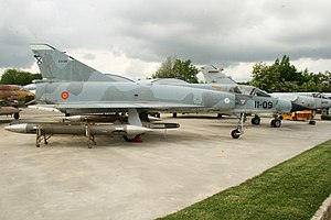
Manises Air Base (Spanish: Base Aérea de Manises) is a defunct Spanish Air Force base. It was located in Manises by Valencia Airport, the civilian airport for the city and metropolitan area of Valencia, Spain.
Feria Valencia
Building in Benimàmet, Spain
Distance: Approx. 3972 meters
Latitude and longitude: 39.50411944,-0.42548889
International Sample Fair of Valencia or, as a trademark, Feria Valencia is the oldest institution organizing fair events in Spain, its year of foundation being in 1917. Recently remodeled and expanded, the work of architect José María Tomás Llavador, It constitutes one of the most important within the European circuit.
Weather in this IP's area
broken clouds
16 Celsius
15 Celsius
15 Celsius
17 Celsius
1023 hPa
85 %
1023 hPa
1014 hPa
10000 meters
2.24 m/s
3.58 m/s
270 degree
75 %
07:46:22
17:46:55