213.153.85.209 - IP Lookup: Free IP Address Lookup, Postal Code Lookup, IP Location Lookup, IP ASN, Public IP
Country:
Region:
City:
Location:
Time Zone:
Postal Code:
ISP:
ASN:
language:
User-Agent:
Proxy IP:
Blacklist:
IP information under different IP Channel
ip-api
Country
Region
City
ASN
Time Zone
ISP
Blacklist
Proxy
Latitude
Longitude
Postal
Route
db-ip
Country
Region
City
ASN
Time Zone
ISP
Blacklist
Proxy
Latitude
Longitude
Postal
Route
IPinfo
Country
Region
City
ASN
Time Zone
ISP
Blacklist
Proxy
Latitude
Longitude
Postal
Route
IP2Location
213.153.85.209Country
Region
baden-wurttemberg
City
bad waldsee
Time Zone
Europe/Berlin
ISP
Language
User-Agent
Latitude
Longitude
Postal
ipdata
Country
Region
City
ASN
Time Zone
ISP
Blacklist
Proxy
Latitude
Longitude
Postal
Route
Popular places and events near this IP address
Waldburg-Wurzach
Distance: Approx. 967 meters
Latitude and longitude: 47.91666667,9.76666667
Waldburg-Wurzach was a County and later Principality within Holy Roman Empire, ruled by the House of Waldburg, located on the southeastern border of Baden-Württemberg, Germany, located around Wurzach (located about 15 km (9 mi) west of Bad Waldsee). Waldburg-Wurzach was a partition of Waldburg-Zeil. Waldburg-Wurzach was a county prior to 1803, when it was raised to a principality shortly before being mediatised to Württemberg in 1806.

Waldburg-Waldsee
Distance: Approx. 967 meters
Latitude and longitude: 47.91666667,9.76666667
Waldburg-Waldsee was a County and later Principality within Holy Roman Empire, ruled by the House of Waldburg, located in southeastern Baden-Württemberg, Germany, around Bad Waldsee. Waldburg-Waldsee was a partition of Waldburg-Wolfegg. When the Wolfegg branch extinguished in 1798, the Waldsee branch inherited Wolfegg.
Königsegg-Aulendorf
Former county of southeastern Baden-Württemberg, Germany
Distance: Approx. 9438 meters
Latitude and longitude: 47.95416667,9.63888889
Königsegg-Aulendorf was a county of southeastern Baden-Württemberg, Germany. It was created in 1622 as a baronial partition of the Barony of Königsegg, and it was raised to a county in 1629. By 1806, the territories of Königsegg-Aulendorf were four separate exclaves, centred on Königsegg in the west, Aulendorf in the east, and two smaller territories (north and south) of the Teutonic Knights' territory at Altshausen.
Königsegg
State in Germany, 1192 to 1806
Distance: Approx. 9438 meters
Latitude and longitude: 47.95416667,9.63888889
Königsegg was a state in the southeastern part of what is now Baden-Württemberg, Germany. It emerged in 1192 as a lordship and was raised to a barony in 1470. It was partitioned in 1622 between itself, Königsegg-Aulendorf and Königsegg-Rothenfels.

Bad Waldsee
Town in Baden-Württemberg, Germany
Distance: Approx. 238 meters
Latitude and longitude: 47.92111111,9.75194444
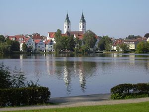
Bad Waldsee (German: [baːt ˈvaltˌzeː] ) is a town in Upper Swabia in Baden-Württemberg, Germany. It is part of the district of Ravensburg. It is situated 20 km south of Biberach an der Riß, and 20 km northeast of Ravensburg.

Aulendorf
Place in Baden-Württemberg, Germany
Distance: Approx. 9438 meters
Latitude and longitude: 47.95416667,9.63888889
Aulendorf (pronounced [ˈaʊləndɔʁf] ) is a town in the district of Ravensburg, in Baden-Württemberg, Germany. It is situated 20 kilometres (12 miles) southwest of Biberach an der Riß, and 19 kilometres (12 miles) north of Ravensburg. Aulendorf exists of the town itself along with the incorporated villages Tannhausen, Bloenried and Zollenreute.

Bergatreute
Municipality in Baden-Württemberg, Germany
Distance: Approx. 7782 meters
Latitude and longitude: 47.85055556,9.74777778
Bergatreute is a municipality in the district of Ravensburg in Baden-Württemberg in Germany.
Ulm–Friedrichshafen railway
Railway line in Baden-Württemberg, Germany
Distance: Approx. 6155 meters
Latitude and longitude: 47.90277778,9.67666667
The Ulm–Friedrichshafen railway, also known as the Württembergische Südbahn (Württemberg Southern Railway), is an electrified main line in the state of Baden-Württemberg, southern Germany. It was built from 1846 to 1850 and doubled from 1905 to 1913. During that time many of the station buildings were rebuilt.
Warme Riss
River in Germany
Distance: Approx. 8142 meters
Latitude and longitude: 47.9921,9.7341
Warme Riss (German: Warme Riß) or Mühlbach is a small river of Baden-Württemberg, Germany. It is a headstream of the Riss in Winterstettendorf.

Aulendorf station
Railway station in Aulendorf, Germany
Distance: Approx. 9059 meters
Latitude and longitude: 47.95333333,9.64388889
Aulendorf station is a junction station on the Ulm–Friedrichshafen railway in the German state of Baden-Württemberg running between Ulm and Friedrichshafen. It was opened in 1847.

Battle of Wurzach
Battle in the German Peasants' War
Distance: Approx. 9743 meters
Latitude and longitude: 47.9063,9.8838
The Battle of Wurzach (German: Gefecht bei Wurzach or Schlacht am Leprosenberg), was a battle during the German Peasants' War that took place near Bad Wurzach in the present-day district of Ravensburg in Upper Swabia.
Weather in this IP's area
clear sky
-1 Celsius
-4 Celsius
-1 Celsius
-1 Celsius
1022 hPa
83 %
1022 hPa
947 hPa
10000 meters
2.36 m/s
2.3 m/s
207 degree
7 %
