Country:
 Germany
Region:
City:
Latitude and Longitude:
Time Zone:
Postal Code:
IP information under different IP Channel
ip-api
Country
Region
City
ASN
Time Zone
ISP
Blacklist
Proxy
Latitude
Longitude
Postal
Route
IPinfo
Country
Region
City
ASN
Time Zone
ISP
Blacklist
Proxy
Latitude
Longitude
Postal
Route
MaxMind
Country
Region
City
ASN
Time Zone
ISP
Blacklist
Proxy
Latitude
Longitude
Postal
Route
Luminati
Country
DEASN
Time Zone
Europe/Berlin
ISP
SYBCOM GmbH
Latitude
Longitude
Postal
db-ip
Country
Region
City
ASN
Time Zone
ISP
Blacklist
Proxy
Latitude
Longitude
Postal
Route
ipdata
Country
Region
City
ASN
Time Zone
ISP
Blacklist
Proxy
Latitude
Longitude
Postal
Route
Popular places and events near this IP address
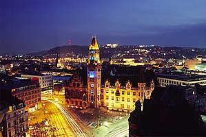
Saarbrücken
Capital of Saarland, Germany
Distance: Approx. 708 meters
Latitude and longitude: 49.23333333,7
Saarbrücken (German: [zaːɐ̯ˈbʁʏkn̩] ; Rhenish Franconian: Sabrigge [zaːˈbʁɪɡə]; French: Sarrebruck [saʁbʁyk]; Luxembourgish: Saarbrécken [zaːˈbʀekən] ; Latin: Saravipons; lit. 'Saar Bridges') is the capital and largest city of the state of Saarland, Germany. Saarbrücken has 181,959 inhabitants and is Saarland's administrative, commercial and cultural centre. It is located on the Saar River (a tributary of the Moselle), directly borders the French department of Moselle, and is Germany's second-westernmost state capital after Düsseldorf.
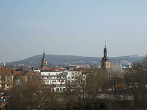
Sankt Johann (Saarbrücken)
Distance: Approx. 985 meters
Latitude and longitude: 49.232658,6.996285
Sankt Johann is part of the city of Saarbrücken in Saarland, Germany. It lies on the right bank of the Saar, opposite historic Saarbrücken, and is 79 kilometres (49 mi) northeast of Metz, France. Sankt Johann got its name from a chapel erected there.

Landtag of Saarland
State diet of the German state of Saarland
Distance: Approx. 1336 meters
Latitude and longitude: 49.229,6.994
The Landtag of the Saarland is the state diet of the German federal state of Saarland. It convenes in Saarbrücken and currently consists of 51 members of five parties. The Social Democratic Party of Germany (SPD) is the largest party in the Landtag with 29 seats, an absolute majority that allows the party to govern without a coalition.
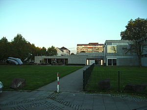
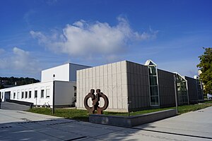
Saarland Museum
Distance: Approx. 870 meters
Latitude and longitude: 49.23083333,7
The Saarland Museum is an art museum in Saarbrücken, Saarland, Germany. It is spread across three sites, each with a different specialism.

Saarbrücken Castle
Distance: Approx. 1366 meters
Latitude and longitude: 49.2301,6.9924
Saarbrücken Castle (German: Schloss Saarbrücken) is a Baroque château in Saarbrücken, the capital of Saarland. It is located in the district of Alt-Saarbrücken on the left bank of the Saar. Earlier, a medieval castle and a Renaissance castle stood on the same site.

Saarbrücken Ost station
Railway station in Saarbrücken, Germany
Distance: Approx. 977 meters
Latitude and longitude: 49.23027778,7.01861111
Saarbrücken Ost station is a station in Saarbrücken, the capital of the German state of Saarland, which is served by Regional-Express and Regionalbahn services.

Platz des Unsichtbaren Mahnmals
Distance: Approx. 1396 meters
Latitude and longitude: 49.2305,6.9916
The Platz des Unsichtbaren Mahnmals – or in English, the Place of the Invisible Memorial – is a memorial to Jewish cemeteries. It is located in Saarbrücken, capital of the German state of the Saarland. To the visitor, the memorial is completely invisible – it only appears as a sign at the place, reading "Platz des Unsichtbaren Mahnmals".
Hochschule für Musik Saar
Distance: Approx. 1029 meters
Latitude and longitude: 49.2303,6.9978
The Hochschule für Musik Saar is a conservatory of music in Saarbrücken, Germany and dates back to 1947. From 1994 until 2002, it was named Hochschule des Saarlandes für Musik und Theater (University of Music and Drama Saarbrücken). Since 2012, the rector is Prof.

Deutsch-Französisches Gymnasium Saarbrücken
French-german school (dfg/lfa) school in Germany
Distance: Approx. 880 meters
Latitude and longitude: 49.2301,7.0164
DFG LFA Saarbrücken (French: Lycée Franco-Allemand de Sarrebruck, German: Deutsch-Französisches Gymnasium Saarbrücken is a French-German international gymnasium/collège and lycée (grades 5 to 12) in Saarbrücken, Germany. It is jointly administered by the French education agency AEFE and the local Regionalverband Saarbrücken district. The school is one of the DFG / LFA established in the 1963 Élysée Treaty between France and West Germany; the school was established in 1961 (1961) as a cooperation between a French and a German school and later became one school.
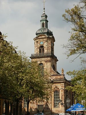
Basilica of St. John the Baptist, Saarbrücken
Church in Saarbrücken, Germany
Distance: Approx. 829 meters
Latitude and longitude: 49.233,6.9984
The Basilica of St. John the Baptist (German: Basilika St. Johannes der Täufer ) also called Saarbrücken Basilica Is a catholic basilica located in the market of St.

Landesbank Saar
Distance: Approx. 1169 meters
Latitude and longitude: 49.239461,6.993411
Landesbank Saar (short SaarLB) is a public-law corporation established in Saarbrücken and the largest credit and mortgage bond institute in Saarland. In 2017, the balance sheet total was around €14 billion. Core markets are Saarland and France, especially the northeast of the country.
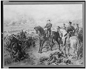
Battle of Saarbrücken
A Short skirmish that took place during the Franco-Prussian War
Distance: Approx. 708 meters
Latitude and longitude: 49.23333333,7
The Battle of Saarbrücken was the first major engagement between the French Empire and the Kingdom of Prussia during the Franco-Prussian War. The battle took place on 2 August 1870, around the city of Saarbrücken.
Weather in this IP's area
clear sky
14 Celsius
14 Celsius
12 Celsius
15 Celsius
1018 hPa
84 %
1018 hPa
994 hPa
10000 meters
5.66 m/s
40 degree
07:15:56
19:34:46