Country:
 Poland
Region:
City:
Latitude and Longitude:
Time Zone:
Postal Code:
IP information under different IP Channel
ip-api
Country
Region
City
ASN
Time Zone
ISP
Blacklist
Proxy
Latitude
Longitude
Postal
Route
IPinfo
Country
Region
City
ASN
Time Zone
ISP
Blacklist
Proxy
Latitude
Longitude
Postal
Route
MaxMind
Country
Region
City
ASN
Time Zone
ISP
Blacklist
Proxy
Latitude
Longitude
Postal
Route
Luminati
Country
PLRegion
06
City
lublin
ASN
Time Zone
Europe/Warsaw
ISP
Netia SA
Latitude
Longitude
Postal
db-ip
Country
Region
City
ASN
Time Zone
ISP
Blacklist
Proxy
Latitude
Longitude
Postal
Route
ipdata
Country
Region
City
ASN
Time Zone
ISP
Blacklist
Proxy
Latitude
Longitude
Postal
Route
Popular places and events near this IP address

Lublin
City in Lublin Voivodeship, Poland
Distance: Approx. 708 meters
Latitude and longitude: 51.25,22.56666667
Lublin is the ninth-largest city in Poland and the second-largest city of historical Lesser Poland. It is the capital and the centre of Lublin Voivodeship with a population of 336,339 (December 2021). Lublin is the largest Polish city east of the Vistula River, located 153 km (95 mi) southeast of Warsaw.
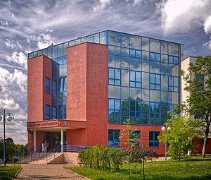
Medical University of Lublin
Distance: Approx. 763 meters
Latitude and longitude: 51.248325,22.54883889
The Medical University of Lublin dates back to 1944 in Lublin, Poland. The university gained its autonomy in 1950. Over the years, new departments were added such as the Department of Dentistry in 1973.

Lublin Holocaust Memorial
Monument in Lublin, Poland
Distance: Approx. 408 meters
Latitude and longitude: 51.24950569,22.56054361
The Holocaust Memorial in Lublin (Polish: Pomnik ku czci masowej eksterminacji ludności żydowskiej, Pomnik ofiar getta) commemorates the Jewish inhabitants of the city who were killed during the Holocaust. It was unveiled in 1963.
Maharam's Synagogue
Former synagogue in Lublin, Poland
Distance: Approx. 879 meters
Latitude and longitude: 51.25305556,22.57
The Maharam's Synagogue was a former Orthodox Jewish congregation and synagogue, that was part of synagogical complex in Podzamcze, located at 3 Jateczna Street, in Lublin, in the Lublin Voivodeship of Poland. Designed in the Renaissance style and completed in the late 16th or early 17th centuries, the synagogue served as a house of prayer, with several interruptions due to desecration and partial destruction, until World War II when it was destroyed by Nazis in 1942.

Grand Hotel Lublinianka
Hotel in Lublin, Poland
Distance: Approx. 568 meters
Latitude and longitude: 51.2475,22.55777778
Grand Hotel Lublinianka is a four-star hotel in Lublin, Poland. The building was constructed between 1899 and 1900 and has served many purposes throughout its history.

Evangelical-Augsburg Church, Lublin
Distance: Approx. 474 meters
Latitude and longitude: 51.24861111,22.555
The Evangelical-Augsburg Holy Trinity Church in Lublin – is the fourth largest community of the Evangelical-Augsburg Church in Poland within the Warsaw Diocese.

Church of St. Josaphat, Lublin
Distance: Approx. 678 meters
Latitude and longitude: 51.24805556,22.56388889
Church of St. Josaphat in Lublin was built by Greek merchants in 1786 upon the consent of king Stanisław August Poniatowski. In the second half of the 19th century the temple which was originally dependent on the patriarch of Constantinople was taken over by the Russian Orthodox Church and in 1922 it became the property of the Roman Catholic Church.

Lublin Ghetto
Nazi ghetto in Lublin, German-occupied Poland
Distance: Approx. 987 meters
Latitude and longitude: 51.25304,22.57155
The Lublin Ghetto was a World War II ghetto created by Nazi Germany in the city of Lublin on the territory of General Government in occupied Poland. The ghetto inmates were mostly Polish Jews, although a number of Roma were also brought in. Set up in March 1941, the Lublin ghetto was one of the first Nazi-era ghettos slated for liquidation during the deadliest phase of the Holocaust in occupied Poland.
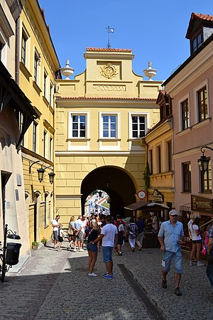
Grodzka Gate – NN Theatre
Distance: Approx. 928 meters
Latitude and longitude: 51.24944444,22.56972222
The "Grodzka Gate – NN Theatre" Centre (Polish: Ośrodek "Brama Grodzka — Teatr NN") is a cultural institution based in Lublin. It is housed in the Grodzka Gate also known as the Jewish Gate that historically used to be a passage from the Christian to the Jewish part of the city. In its activities the Center focuses on issues of cultural heritage.

St. Joseph's Church, Lublin
Distance: Approx. 662 meters
Latitude and longitude: 51.2494,22.5654
St. Joseph's Church is a 17th-century Roman Catholic church in Lublin. The building's construction was founded by Katarzyna from Kretków Sanguszkowa.

Lipowa 7 camp
Distance: Approx. 966 meters
Latitude and longitude: 51.24547,22.5495
The Lipowa 7 camp (German: Lindenstraße 7 Lager) was a Nazi forced labor concentration camp, primarily for Jews, by Lipowa Street in Lublin, Poland during December 1939 - 1944. In November 1943 nearly all Jewish inmates were exterminated.
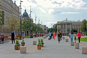
Lithuanian Square
Square in Lublin, Poland
Distance: Approx. 473 meters
Latitude and longitude: 51.24861111,22.55972222
Litewski Square (Lithuanian Square) is a square in the center of Lublin, Poland, with an area of about 35 thousand square meters, created in the 1820s to hold military parades. Originally named Drill Square. Litewski Square is the central place in Lublin, where state ceremonies, happenings and other events take place.
Weather in this IP's area
clear sky
16 Celsius
15 Celsius
15 Celsius
17 Celsius
1019 hPa
66 %
1019 hPa
998 hPa
10000 meters
4.12 m/s
60 degree
06:06:51
18:42:27