213.109.80.210 - IP Lookup: Free IP Address Lookup, Postal Code Lookup, IP Location Lookup, IP ASN, Public IP
Country:
Region:
City:
Location:
Time Zone:
Postal Code:
IP information under different IP Channel
ip-api
Country
Region
City
ASN
Time Zone
ISP
Blacklist
Proxy
Latitude
Longitude
Postal
Route
Luminati
Country
Region
21
City
uzhhorod
ASN
Time Zone
Europe/Kyiv
ISP
New Information Systems PP
Latitude
Longitude
Postal
IPinfo
Country
Region
City
ASN
Time Zone
ISP
Blacklist
Proxy
Latitude
Longitude
Postal
Route
IP2Location
213.109.80.210Country
Region
zakarpatska oblast
City
uzhgorod
Time Zone
Europe/Uzhgorod
ISP
Language
User-Agent
Latitude
Longitude
Postal
db-ip
Country
Region
City
ASN
Time Zone
ISP
Blacklist
Proxy
Latitude
Longitude
Postal
Route
ipdata
Country
Region
City
ASN
Time Zone
ISP
Blacklist
Proxy
Latitude
Longitude
Postal
Route
Popular places and events near this IP address

Uzhhorod
City and administrative center of Zakarpattia Oblast, Ukraine
Distance: Approx. 881 meters
Latitude and longitude: 48.62388889,22.295
Uzhhorod (Ukrainian: Ужгород, IPA: [ˈuʒɦorod] ; Hungarian: Ungvár, IPA: [ˈuŋɡvaːr]; Slovak: Užhorod) is a city and municipality on the Uzh River in western Ukraine, at the border with Slovakia and near the border with Hungary. The city is approximately equidistant from the Baltic, the Adriatic and the Black Sea (650–690 km) making it the most inland city in this part of Europe. It is the administrative center of Zakarpattia Oblast (region), as well as the administrative center of Uzhhorod Raion (district) within the oblast.

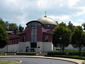
Ruthenian Greek Catholic Church
Eastern Catholic church of the Byzantine Rite
Distance: Approx. 741 meters
Latitude and longitude: 48.6232,22.3022
The Ruthenian Greek Catholic Church, also known in the United States as the Byzantine Catholic Church, is a sui iuris (autonomous) Eastern Catholic church based in Eastern Europe and North America. As a particular church of the Catholic Church, it is in full communion with the Holy See. It uses the Byzantine Rite for its liturgies, laws, and cultural identity.

Ung County
County of the Kingdom of Hungary
Distance: Approx. 4 meters
Latitude and longitude: 48.61666667,22.3
Ung County (in Latin: comitatus Unghvariensis; Hungarian: Ung (vár)megye; also in Slovak: Užský komitát/ Užská župa / Užská stolica; Romanian: Comitatul Ung) was an administrative county (comitatus) of the Kingdom of Hungary. Its territory is now mostly in western Ukraine, a smaller part in eastern Slovakia, and a very small area in Hungary.
Museum of Folk Architecture and Life, Uzhhorod
Museum in Ukraine
Distance: Approx. 638 meters
Latitude and longitude: 48.62086111,22.30595833
Museum of Folk Architecture and Life is an open-air museum located in Uzhhorod, Ukraine. It features over 30 traditional structures collected from villages across Zakarpattia Oblast, the Ukrainian province of which Uzhhorod is the capital. According to Michael Benanav of The New York Times, "the museum's centerpiece is 16th-century St.

Uzhhorod Synagogue
Former synagogue in Uzhhorod, Ukraine
Distance: Approx. 651 meters
Latitude and longitude: 48.6225,22.30111111
The Uzhhorod Synagogue is a former Orthodox Jewish synagogue in Uzhhorod, in the present day Zakarpattia Oblast of western Ukraine. When it was established in 1904, it was located within the Austro-Hungarian Empire. The congregation worshipped in the Ashkenazi rite.

Uzhhorod railway station
Railway station in Uzhhorod, Ukraine
Distance: Approx. 799 meters
Latitude and longitude: 48.60953056,22.30045833
Uzhhorod railway station (Ukrainian: Залізнична станція Ужгород) is the main railway station in Uzhhorod, Ukraine. It also is used as a port on the Slovakia–Ukraine border for freight transport. The rail border checkpoint is part of the Chop customs.

Uzhhorod Castle
Distance: Approx. 739 meters
Latitude and longitude: 48.62166667,22.30666667
Uzhhorod Castle (Ukrainian: Ужгородський замок; Hungarian: Ungvári vár) is an extensive citadel on a hill in Uzhhorod, Ukraine. It was built in a mixture of architectural styles and materials between the 13th and 18th centuries and figured heavily in the history of Hungary. The very name of Uzhhorod/Ungvár refers to the castle, translating as "the Uzh castle".

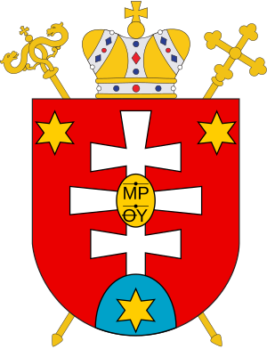
Greek Catholic Eparchy of Mukachevo
Greek Catholic eparchy in Ukraine
Distance: Approx. 741 meters
Latitude and longitude: 48.6232,22.3022
The Greek Catholic Eparchy of Mukachevo is an eparchy of the Ruthenian Greek Catholic Church that was erected by Pope Clement XIV in 1771. The geographic remit of the eparchy includes the south-western parts of Ukraine that are roughly within Zakarpattia Oblast. The eparchy is directly subject to the Holy See.
Uzhhorod Orthodox Cathedral
Orthodox church in Transcarpathia, Ukraine
Distance: Approx. 617 meters
Latitude and longitude: 48.61388889,22.29277778
The Cathedral of Christ the Saviour is the principal Orthodox church in Transcarpathia. It dominates the Cyril and Methodius Square in the city of Uzhhorod. The 60-metre-tall five-domed church was built in the 1990s after the cathedral of the Holy Cross had been restituted to the Greek Catholic Eparchy of Mukachevo.

Greek Catholic Cathedral, Uzhhorod
Distance: Approx. 696 meters
Latitude and longitude: 48.62277778,22.30222222
Holy Cross Cathedral is a Ruthenian Greek Catholic cathedral of Eparchy of Mukachevo in Uzhhorod, Ukraine. It is dedicated to the Exaltation of the Holy Cross. The Baroque church was built in 1646 at the behest of the Jesuits from funds donated by the Drugeth noble family.

Maria Theresia Garden Square (Uzhhorod)
Distance: Approx. 660 meters
Latitude and longitude: 48.622455,22.302183
The Maria Theresia Square (Ukrainian: Сквер Марії Терезії) situated in Uzhhorod, Ukraine.The idea of establishment belongs to Uzhhorod diplomat, lawyer and public figure Alen Panov. It was presented to public in May 2013, supported by Most Reverend Milan the bishop of Mukachevo Greek Catholic eparchy.
Malyi Galagov
Neighborhood in Uzhhorod, Ukraine
Distance: Approx. 1294 meters
Latitude and longitude: 48.62555556,22.28861111
Malyi Galagov (Ukrainian: Малий Ґалаґов, Малий Галагов; Czech: Malé Galago) is a neighborhood in Uzhhorod, Ukraine. It is located to the west of the historic centre of the city. It functions as a government and residential quarter.
Weather in this IP's area
overcast clouds
1 Celsius
-3 Celsius
1 Celsius
3 Celsius
1023 hPa
77 %
1023 hPa
1008 hPa
10000 meters
4.1 m/s
8.02 m/s
1 degree
99 %

