212.93.126.96 - IP Lookup: Free IP Address Lookup, Postal Code Lookup, IP Location Lookup, IP ASN, Public IP
Country:
 Latvia
Region:
City:
Location:
Time Zone:
Postal Code:
ISP:
ASN:
language:
User-Agent:
Proxy IP:
Blacklist:
IP information under different IP Channel
ip-api
Country
Region
City
ASN
Time Zone
ISP
Blacklist
Proxy
Latitude
Longitude
Postal
Route
db-ip
Country
Region
City
ASN
Time Zone
ISP
Blacklist
Proxy
Latitude
Longitude
Postal
Route
IPinfo
Country
Region
City
ASN
Time Zone
ISP
Blacklist
Proxy
Latitude
Longitude
Postal
Route
IP2Location
212.93.126.96Country
lvRegion
adazu novads
City
adazi
Time Zone
Europe/Riga
ISP
Language
User-Agent
Latitude
Longitude
Postal
ipdata
Country
Region
City
ASN
Time Zone
ISP
Blacklist
Proxy
Latitude
Longitude
Postal
Route
Popular places and events near this IP address

Ādaži
Town in Latvia
Distance: Approx. 185 meters
Latitude and longitude: 57.07694444,24.32361111
Ādaži ([ˈaː.da.ʒi]) (formerly German: Neuermühlen) is a town in Pierīga, on the left bank of the Gauja river. The town is the administrative center of Ādaži Municipality, in the Vidzeme region of Latvia. It is located by the highway A1, 21.6 km from the center of Riga.

Ādaži Municipality
Municipality of Latvia
Distance: Approx. 1247 meters
Latitude and longitude: 57.06666667,24.33333333
Ādaži Municipality (Latvian: Ādažu novads) is a municipality in the historical region of Vidzeme, and the Riga Planning Region in Latvia, which consists of Ādaži and Carnikava Parish plus the administrative centre, Ādaži. The municipality is located 25 km from the center of Riga. The municipality was formed in 2006 from Ādaži Parish of Riga District and became a first level unit in 2009.

Ādaži Airfield
Airport in Latvia
Distance: Approx. 4187 meters
Latitude and longitude: 57.0985,24.2662
Ādaži Airfield (Latvian: Ādažu lidlauks) (ICAO: EVAD) is an airfield in Latvia. It is situated near Eimuri, Ādaži Parish, 30 km (19 mi) north of Riga. The first private certified airfield in Latvia, which may receive up to 60 small private planes.
Alderi
Village in Latvia
Distance: Approx. 3353 meters
Latitude and longitude: 57.05,24.35
Alderi is a village in Ādaži Parish, Ādaži Municipality in the historical region of Vidzeme, and the Riga Planning Region in Latvia. The population in 2021 was 416.

Atari, Ādaži Municipality
Village in Latvia
Distance: Approx. 3279 meters
Latitude and longitude: 57.0675,24.2694
Atari is a village in Ādaži Municipality in the historical region of Vidzeme, and the Riga Planning Region in Latvia.
Kadaga
Village in Latvia
Distance: Approx. 3841 meters
Latitude and longitude: 57.1,24.36666667
Kadaga (also known as Ādaži-2) is a village in the Ādaži Parish of Ādaži Municipality in the Vidzeme region of Latvia, near the town of Ādaži. The village was established across the Gauja from Ādaži during the Soviet occupation of Latvia as a military town for Soviet soldiers stationed at the Ādaži Training Area. Today, the main complex of the training area – the Ādaži Military Base – is located within Kadaga, and various modern civilian housing projects have been built in the village as well.
Eimuri, Ādaži Parish
Village in Latvia
Distance: Approx. 2446 meters
Latitude and longitude: 57.08777778,24.2875
Eimuri is a village in Ādaži Parish of Ādaži Municipality in the Vidzeme region of Latvia. The village is located at the western part of the parish, 6 kilometers from Ādaži. Its population in February 2022 was 40.

Baltezers, Ādaži Municipality
Village in Latvia
Distance: Approx. 3941 meters
Latitude and longitude: 57.04055556,24.31527778
Baltezers is a village in Ādaži Parish, Ādaži Municipality in the historical region of Vidzeme, and the Riga Planning Region in Latvia.
Birznieki, Ādaži Municipality
Village in Latvia
Distance: Approx. 3419 meters
Latitude and longitude: 57.1044,24.3008
Birznieki is a village in Ādaži Municipality in the historical region of Vidzeme, and the Riga Planning Region in Latvia.
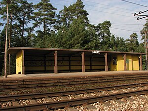
Garupe Station
Railway station in Latvia
Distance: Approx. 6291 meters
Latitude and longitude: 57.11418611,24.24505833
Garupe Station is a railway station on the Zemitāni – Skulte Railway.

Carnikava Station
Railway station in Latvia
Distance: Approx. 6376 meters
Latitude and longitude: 57.1283,24.279225
Carnikava Station is a railway station on the Zemitāni–Skulte Railway.
Eimuri, Carnikava Parish
Dispersed village in Ādaži, Latvia
Distance: Approx. 5463 meters
Latitude and longitude: 57.07583333,24.23111111
Eimuri is a village in Carnikava Parish of Ādaži Municipality in the Vidzeme region of Latvia. It is located in the south of the parish, 11 kilometers from the parish center in Carnikava, 10,6 km from the municipal center of Ādaži and 28 km from Rīga. Its population was 12 in 2022, a drop from 24 in 2015.
Weather in this IP's area
clear sky
-7 Celsius
-12 Celsius
-7 Celsius
-7 Celsius
1042 hPa
71 %
1042 hPa
1041 hPa
10000 meters
2.96 m/s
6.56 m/s
49 degree