Country:
 Germany
Region:
City:
Latitude and Longitude:
Time Zone:
Postal Code:
IP information under different IP Channel
ip-api
Country
Region
City
ASN
Time Zone
ISP
Blacklist
Proxy
Latitude
Longitude
Postal
Route
IPinfo
Country
Region
City
ASN
Time Zone
ISP
Blacklist
Proxy
Latitude
Longitude
Postal
Route
MaxMind
Country
Region
City
ASN
Time Zone
ISP
Blacklist
Proxy
Latitude
Longitude
Postal
Route
Luminati
Country
DERegion
be
City
berlin
ASN
Time Zone
Europe/Berlin
ISP
DNS:NET Internet Service GmbH
Latitude
Longitude
Postal
db-ip
Country
Region
City
ASN
Time Zone
ISP
Blacklist
Proxy
Latitude
Longitude
Postal
Route
ipdata
Country
Region
City
ASN
Time Zone
ISP
Blacklist
Proxy
Latitude
Longitude
Postal
Route
Popular places and events near this IP address

Friedrichshain
Quarter of Berlin in Germany
Distance: Approx. 590 meters
Latitude and longitude: 52.51583333,13.45416667
Friedrichshain (German pronunciation: [ˈfʁiːdʁɪçsˌhaɪn] ) is a quarter (Ortsteil) of the borough of Friedrichshain-Kreuzberg in Berlin, Germany. From its creation in 1920 until 2001, it was a freestanding city borough. Formerly part of East Berlin, it is adjacent to Mitte, Prenzlauer Berg, Kreuzberg and Lichtenberg.

Weberwiese (Berlin U-Bahn)
Station of the Berlin U-Bahn
Distance: Approx. 1087 meters
Latitude and longitude: 52.51666667,13.445
Weberwiese is a Berlin U-Bahn station located on the U5 line, which currently runs from Berlin Central Station to Hönow. The station is located under Karl-Marx-Allee directly east of Straße der Pariser Kommune. Although the next station on the line is called Frankfurter Tor, the historical city gate Frankfurter Tor actually stood at the location of the Weberwiese station.

Frankfurter Tor
Square in Berlin
Distance: Approx. 599 meters
Latitude and longitude: 52.51581,13.45403
The Frankfurter Tor ("Frankfurt Gate") is a large square in the inner-city Friedrichshain locality of Berlin. It is situated in the centre of the district, at the intersection of Karl-Marx-Allee and Frankfurter Allee (the eastbound federal highways No. 1 and No.

Samariterstraße (Berlin U-Bahn)
Station of the Berlin U-Bahn
Distance: Approx. 611 meters
Latitude and longitude: 52.51472222,13.46444444
Samariterstraße is a Berlin U-Bahn station located on the U5. It is located underneath Frankfurter Allee, at the intersection with Samariterstraße in the district of Friedrichshain. It was opened as part of the then-Line E of the Berlin U-Bahn on 21 December 1930.

Bersarinplatz
Town square in the Berlin district Friedrichshain
Distance: Approx. 499 meters
Latitude and longitude: 52.519,13.453
Bersarinplatz is a square in Friedrichshain, Berlin. On 4 April 1895 the square was named Baltenplatz, after the Balts. However, on 31 July 1947, after World War II, the square was renamed Bersarinplatz after Nikolai Berzarin, the Russian Red Army General and former Commander of Berlin.

Rigaer Straße
Distance: Approx. 512 meters
Latitude and longitude: 52.516,13.465
Rigaer Straße is a street in Friedrichshain, Berlin that runs from Bersarinplatz in the west to the railway station Frankfurter Allee in the east. The street is named after the Latvian capital Riga. Many of the houses on the street are protected as historic buildings, although some of the older houses have turned into squats.
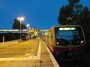
Berlin Storkower Straße station
Railway station in Berlin, Germany
Distance: Approx. 554 meters
Latitude and longitude: 52.52388889,13.46444444
Storkower Straße is a railway station in the Prenzlauer Berg locality of Berlin, close to the locality's border with Fennpfuhl. Located at the Ringbahn it is served by the S-Bahn lines S41, S42, S8 and S85.

Berlin Landsberger Allee station
Railway station in Pankow, Germany
Distance: Approx. 1165 meters
Latitude and longitude: 52.52944444,13.45444444
Landsberger Allee is a railway station in the Prenzlauer Berg district of Berlin, close to the district's border with Fennpfuhl. It is served by the S-Bahn lines S41, S42, S8 and S85. The station was named Leninallee in 1950 and has changed name several times since.

Frankfurter Tor (Berlin U-Bahn)
Station of the Berlin U-Bahn
Distance: Approx. 590 meters
Latitude and longitude: 52.51583333,13.45416667
Frankfurter Tor is a station on U-Bahn line U5 in Berlin, Germany. It is situated under Frankfurter Tor, a large square.
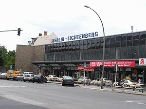
Lichtenberg (locality)
Quarter of Berlin in Germany
Distance: Approx. 1345 meters
Latitude and longitude: 52.52111111,13.48
Lichtenberg (German: [ˈlɪçtn̩ˌbɛʁk] ) is a quarter (Ortsteil) of Berlin in the homonymous borough (Bezirk) of Lichtenberg. Until 2001 it was an autonomous district with the localities of Fennpfuhl, Rummelsburg, Friedrichsfelde and Karlshorst.

Computerspielemuseum
Video game museum in Berlin, Germany
Distance: Approx. 1266 meters
Latitude and longitude: 52.5176,13.4419
The Computerspielemuseum (German for Computer Game Museum) is a German video game museum founded in 1997. From 1997 to 2000, it had a permanent exhibition in Berlin. Afterward, it became an online-only museum.

Hochhaus an der Weberwiese
Residential in Berlin-Friedrichshain, Germany
Distance: Approx. 1225 meters
Latitude and longitude: 52.515036,13.443846
The Hochhaus an der Weberwiese (literally "high house on the weaver's meadow") is a residential building in Berlin, located in the district of Friedrichshain. Built as part of the plan for post-war reconstruction, it was the first example of socialist classicism in the German Democratic Republic.
Weather in this IP's area
clear sky
17 Celsius
17 Celsius
16 Celsius
18 Celsius
1017 hPa
64 %
1017 hPa
1011 hPa
10000 meters
6.71 m/s
11.62 m/s
148 degree
07:37:16
18:04:55