212.87.171.234 - IP Lookup: Free IP Address Lookup, Postal Code Lookup, IP Location Lookup, IP ASN, Public IP
Country:
Region:
City:
Location:
Time Zone:
Postal Code:
ISP:
ASN:
language:
User-Agent:
Proxy IP:
Blacklist:
IP information under different IP Channel
ip-api
Country
Region
City
ASN
Time Zone
ISP
Blacklist
Proxy
Latitude
Longitude
Postal
Route
db-ip
Country
Region
City
ASN
Time Zone
ISP
Blacklist
Proxy
Latitude
Longitude
Postal
Route
IPinfo
Country
Region
City
ASN
Time Zone
ISP
Blacklist
Proxy
Latitude
Longitude
Postal
Route
IP2Location
212.87.171.234Country
Region
odeska oblast
City
bilhorod-dnistrovskyi
Time Zone
Europe/Kiev
ISP
Language
User-Agent
Latitude
Longitude
Postal
ipdata
Country
Region
City
ASN
Time Zone
ISP
Blacklist
Proxy
Latitude
Longitude
Postal
Route
Popular places and events near this IP address

Bilhorod-Dnistrovskyi
City in Odesa Oblast, Ukraine
Distance: Approx. 1322 meters
Latitude and longitude: 46.18333333,30.35
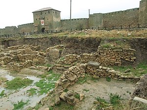
Bilhorod-Dnistrovskyi (Ukrainian: Білгород-Дністровський, IPA: [ˈb⁽ʲ⁾iɫɦorod d⁽ʲ⁾n⁽ʲ⁾iˈstrɔu̯sʲkɪj]; Romanian: Cetatea Albă; Russian: Белгород-Днестровский, romanized: Belgorod-Dnestrovskiy), historically known as Aq Kirmān (Turkish: Akkerman) or by other names, is a port city in Odesa Oblast, southwestern Ukraine. It is situated on the right bank of the Dniester Estuary leading to the Black Sea, in the historical region of Budjak. It also serves as the administrative center of Bilhorod-Dnistrovskyi Raion and is coterminous with Bilhorod-Dnistrovskyi urban hromada, one of the hromadas of Ukraine.

Tyras
Ancient Greek city-state in Ukraine
Distance: Approx. 651 meters
Latitude and longitude: 46.20083333,30.35166667
Tyras (Ancient Greek: Τύρας) was an ancient Greek city on the northern coast of the Black Sea. It was founded by colonists from Miletus, probably about 600 BC. The city was situated some 10 km from the mouth of the Tyras River, which is now called the Dniester. The surrounding native tribe was called the Tyragetae.

Dniester Estuary
Distance: Approx. 4245 meters
Latitude and longitude: 46.23333333,30.35
Dniester Estuary, or Dniester Liman (Ukrainian: Дністровський лиман; Romanian: Limanul Nistrului) is a liman, formed at the point where the river Dniester flows into the Black Sea. It is located in Ukraine, in Odesa Oblast, and connects Budjak to the Ukrainian mainland. The city of Bilhorod-Dnistrovskyi lies on its western shore and Ovidiopol on its eastern shore.

Ovidiopol
Rural settlement in Odesa Oblast, Ukraine
Distance: Approx. 9181 meters
Latitude and longitude: 46.24472222,30.44472222
Ovidiopol (Ukrainian: Ові́діополь; Russian: Овидиополь; Turkish: Hacıdere) is a coastal rural settlement in Odesa Oblast, Ukraine. It is located on the eastern bank of Dniester Estuary directly across Bilhorod-Dnistrovskyi and 40 km (25 mi) west of Odesa. Ovidiopol hosts the administration of Ovidiopol settlement hromada, one of the hromadas of Ukraine.

Shabo, Ukraine
Rural locality in Odesa Oblast, Ukraine
Distance: Approx. 7367 meters
Latitude and longitude: 46.13333333,30.38333333
Shabo (Ukrainian: Шабо; Romanian: Șaba-Târg or Șaba) is a selo of Bilhorod-Dnistrovskyi Raion, Odesa Oblast, Ukraine, situated at the Dniester Liman, some 7 km downstream of Bilhorod-Dnistrovskyi. It hosts the administration of Shabo rural hromada, one of the hromadas of Ukraine.

Nikōnion
Ancient Greek city
Distance: Approx. 6875 meters
Latitude and longitude: 46.18333333,30.43694444
Nikōnion (Ancient Greek: Νικώνιον; Latin: Niconium) and Nikōnia (Ancient Greek: Νικωνία) was an ancient Greek city on the east bank of the Dniester estuary. Its ruins are located 300 meters to the northwest of the modern village Roksolany, in the Odesa Raion of the Odesa Oblast, Ukraine.

Bilhorod-Dnistrovsky Seaport
Port in Ukraine
Distance: Approx. 2395 meters
Latitude and longitude: 46.183,30.375
Port of Bilhorod-Dnistrovskyi (Ukrainian: Білгород-Дністровський Морський Порт) is a port in the city of Bilhorod-Dnistrovskyi, Ukraine. It is located on the north-western shore of Black Sea at Dniester Estuary, to the south-west from Odesa. Bilhorod-Dnistrovskyi Seaport is mainly a freight seaport.
Moloha rural hromada
Hromada in Odesa Oblast, Ukraine
Distance: Approx. 9406 meters
Latitude and longitude: 46.21611111,30.23111111
Moloha rural hromada (Ukrainian: Мологівська сільська громада) is a hromada in Bilhorod-Dnistrovskyi Raion of Odesa Oblast in southwestern Ukraine.
Weather in this IP's area
broken clouds
7 Celsius
3 Celsius
7 Celsius
7 Celsius
1016 hPa
98 %
1016 hPa
1013 hPa
9106 meters
5.91 m/s
10.17 m/s
155 degree
58 %