Country:
 Germany
Region:
City:
Latitude and Longitude:
Time Zone:
Postal Code:
IP information under different IP Channel
ip-api
Country
Region
City
ASN
Time Zone
ISP
Blacklist
Proxy
Latitude
Longitude
Postal
Route
IPinfo
Country
Region
City
ASN
Time Zone
ISP
Blacklist
Proxy
Latitude
Longitude
Postal
Route
MaxMind
Country
Region
City
ASN
Time Zone
ISP
Blacklist
Proxy
Latitude
Longitude
Postal
Route
Luminati
Country
DEASN
Time Zone
Europe/Berlin
ISP
circular Informationssysteme GmbH
Latitude
Longitude
Postal
db-ip
Country
Region
City
ASN
Time Zone
ISP
Blacklist
Proxy
Latitude
Longitude
Postal
Route
ipdata
Country
Region
City
ASN
Time Zone
ISP
Blacklist
Proxy
Latitude
Longitude
Postal
Route
Popular places and events near this IP address
SchwabenQuellen
Distance: Approx. 2510 meters
Latitude and longitude: 48.722364,9.160837
Schwaben Quellen (in English, "Swabian Springs") is a large spa/waterpark complex located in Stuttgart, Germany. The Schwaben Quellen is associated with the SI-Centrum (Stuttgart International Centrum), an entertainment complex in Stuttgart. It is a member of the European Waterparks Association (EWA), and provides saunas, steamrooms, and various kinds of baths.
Stuttgart-Möhringen directional radio tower
Distance: Approx. 830 meters
Latitude and longitude: 48.72638889,9.13333333
The Directional Radio Tower Stuttgart-Möhringen is a 93-metre-high (305 ft) lattice steel tower for directional radio services of the EnBW AG on the area of the substation Stuttgart-Möhringen. The Directional Radio Tower Stuttgart-Möhringen was built in 1975 and is not accessible to the public.

Stuttgarter Straßenbahnen
German public transport operating company
Distance: Approx. 474 meters
Latitude and longitude: 48.724,9.13
Stuttgarter Straßenbahnen AG (SSB) is the principal public transport operating company in the German city of Stuttgart. The SSB is a member of the Verkehrs- und Tarifverbund Stuttgart (VVS), and operates the Stuttgart Stadtbahn, bus lines, a rack railway, and a funicular railway.

Dekra
German expert organization
Distance: Approx. 235 meters
Latitude and longitude: 48.72027778,9.13
Dekra (stylized in all uppercase in its logo) is the world’s largest non-listed expert organization in the TIC sector (Testing, Inspection, Certification) founded in Berlin, Germany in 1925 as Deutscher Kraftfahrzeug-Überwachungs-Verein (German Motor Vehicle Inspection Association). At 28 million per year worldwide, Dekra inspects more vehicles than any other organization. Dekra is active in the field in more than 20 countries across the globe, from Sweden to South Africa, from the U.S. to New Zealand.

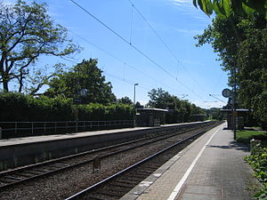
Stuttgart-Vaihingen station
Railway station in Vaihingen, Germany
Distance: Approx. 1233 meters
Latitude and longitude: 48.72666667,9.11305556
Vaihingen station is located on the Stuttgart–Horb railway in the German state of Baden-Württemberg. It is served by regional services and Stuttgart S-Bahn lines S1, S2 and S3. It is also a hub for public transport to the Filder plain.
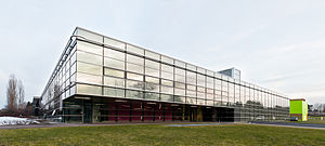
High Performance Computing Center, Stuttgart
Supercomputer research institute in Stuttgart, Germany
Distance: Approx. 3043 meters
Latitude and longitude: 48.73944444,9.09722222
The High Performance Computing Center (HLRS) in Stuttgart, Germany, is a research institute and a supercomputer center. HLRS has currently a flagship installation of a HPE Apollo 9000 system called Hawk 26 PFLOPS peak performance replacing the Cray XC40 system called Hazel Hen, providing ~7,4 PFLOPS peak performance. Additional systems include NEC clusters (NEC SX-ACE systems for testing, NEC Vulcan + Vulcan2 for non-critical computing) and Cray CS-Storm cluster.
Aischbach (Körsch)
River in Germany
Distance: Approx. 1679 meters
Latitude and longitude: 48.7244,9.1488
The Aischbach is a small river in Baden-Württemberg, Germany. It is the left headstream of the Körsch, in Möhringen, a district of Stuttgart.
Sindelbach (Körsch)
River in Germany
Distance: Approx. 1679 meters
Latitude and longitude: 48.7244,9.1488
Sindelbach is a river of Baden-Württemberg, Germany. It is the right headstream of the Körsch, in Möhringen, a district of Stuttgart.

Stuttgart Österfeld station
Railway station in Stuttgart, Germany
Distance: Approx. 2054 meters
Latitude and longitude: 48.7375,9.11666667
Österfeld station is located in the Stuttgart district of Vaihingen in the German state of Baden-Württemberg. It was built in 1985 at the junction of the main line of the Stuttgart S-Bahn where it emerges from the Hasenberg tunnel and connects with the Stuttgart–Horb railway, which runs above ground. Attached to the station is a park-and-ride car park with 500 places, which is directly accessible from the A 831 autobahn.
Oberaichen station
Railway station in Leinfelden-Echterdingen, Germany
Distance: Approx. 1704 meters
Latitude and longitude: 48.705,9.1275
Oberaichen station is located in Leinfelden-Echterdingen at the 18.9 kilometre point of the Stuttgart-Rohr–Filderstadt railway in the German state of Baden-Württemberg and is a station on the Stuttgart S-Bahn network.

Leinfelden station
Railway station in Leinfelden-Echterdingen, Germany
Distance: Approx. 2901 meters
Latitude and longitude: 48.69638889,9.1425
Leinfelden station is located in Leinfelden-Echterdingen at the 20.6 kilometre point of the Stuttgart-Rohr–Filderstadt railway in the German state of Baden-Württemberg and is a station on the Stuttgart S-Bahn network. From 23 June 1928 to 1 October 1971, Leinfelden was at the junction of the Siebenmuehlental Railway (dismantled 1972) and the Rohr–Neuhausen line. Passenger services ended on both lines on 22 May 1955.

Stuttgart Media University
University in Stuttgart
Distance: Approx. 3008 meters
Latitude and longitude: 48.7415,9.1014
The Stuttgart Media University or Media University (German: Hochschule der Medien) is a state university of media studies in Stuttgart, Germany, offering nearly 30 accredited bachelor's and master's degree programs within three faculties.
Weather in this IP's area
clear sky
13 Celsius
13 Celsius
12 Celsius
15 Celsius
1019 hPa
77 %
1019 hPa
969 hPa
10000 meters
2.06 m/s
10 degree
07:07:35
19:26:11