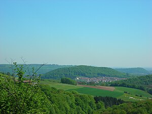
Country:
Region:
City:
Latitude and Longitude:
Time Zone:
Postal Code:
IP information under different IP Channel
ip-api
Country
Region
City
ASN
Time Zone
ISP
Blacklist
Proxy
Latitude
Longitude
Postal
Route
Luminati
Country
ASN
Time Zone
Europe/Berlin
ISP
VSE NET GmbH
Latitude
Longitude
Postal
IPinfo
Country
Region
City
ASN
Time Zone
ISP
Blacklist
Proxy
Latitude
Longitude
Postal
Route
db-ip
Country
Region
City
ASN
Time Zone
ISP
Blacklist
Proxy
Latitude
Longitude
Postal
Route
ipdata
Country
Region
City
ASN
Time Zone
ISP
Blacklist
Proxy
Latitude
Longitude
Postal
Route
Popular places and events near this IP address

Longwave transmitter Europe 1
German radio station
Distance: Approx. 4521 meters
Latitude and longitude: 49.28027778,6.67805556
The Longwave transmitter Europe 1 was the oldest privately owned radio station in Germany, situated between Felsberg and Berus/Saar, Germany. It transmitted on 183 kHz with a power of 2,000 kilowatts a French speaking programme, Europe 1 toward France. It was the highest power radio broadcasting transmitter in Germany.
Überherrn
Municipality in Saarland, Germany
Distance: Approx. 909 meters
Latitude and longitude: 49.25,6.7
Überherrn is a municipality in the district of Saarlouis, in Saarland, Germany. It is situated along the river Bist on the border with France, approx. 10 km (6.21 mi) southwest of Saarlouis, and 20 km (12.43 mi) west of Saarbrücken.

Wadgassen
Municipality in Saarland, Germany
Distance: Approx. 5675 meters
Latitude and longitude: 49.26666667,6.76666667
Wadgassen is a municipality in the district of Saarlouis, in Saarland, Germany. It is situated on the river Saar, approx. 6 km southeast of Saarlouis, and 15 km west of Saarbrücken.

Creutzwald
Commune in Grand Est, France
Distance: Approx. 4792 meters
Latitude and longitude: 49.2,6.6833
Creutzwald (French pronunciation: [kʁøtsvald]; German: Kreuzwald) is a commune in the Moselle département in Grand Est in north-eastern France, located on the German border, just south of Überherrn (with which it is twinned) and west of Lauterbach-Völklingen, both in the Saarland. With Germany, it manages the Warndt forest.
Berviller-en-Moselle
Commune in Grand Est, France
Distance: Approx. 4947 meters
Latitude and longitude: 49.2722,6.6486
Berviller-en-Moselle (German: Berweiler) is a commune in the Moselle department in Grand Est in northeastern France.
Dalem, Moselle
Commune in Grand Est, France
Distance: Approx. 6324 meters
Latitude and longitude: 49.2411,6.6114
Dalem (German: Dalem) is a commune in the Moselle department in Grand Est in north-eastern France.
Falck, Moselle
Commune in Grand Est, France
Distance: Approx. 5145 meters
Latitude and longitude: 49.23,6.63
Falck (French pronunciation: [falk]; German: Falk) is a commune in the Moselle department in Grand Est in north-eastern France.
Merten
Commune in Grand Est, France
Distance: Approx. 2375 meters
Latitude and longitude: 49.2494,6.6678
Merten (French pronunciation: [mɛʁtən]) is a commune in the Moselle department in Grand Est in north-eastern France. In 1973 it absorbed two former communes: Berviller-en-Moselle and Rémering-lès-Hargarten.
Rémering
Commune in Grand Est, France
Distance: Approx. 5650 meters
Latitude and longitude: 49.2653,6.6294
Rémering (German: Reimeringen, before 1993: Rémering-lès-Hargarten) is a commune in the Moselle department in Grand Est in north-eastern France.
Villing
Commune in Grand Est, France
Distance: Approx. 6581 meters
Latitude and longitude: 49.2819,6.6317
Villing (French pronunciation: [vilɛ̃]; German: Willingen) is a commune in the Moselle department in Grand Est in north-eastern France. Localities of the commune: Trois-Maisons, Gaweistroff, Bedem.

Berus
Ortsteil of Überherrn in Saarland, Germany
Distance: Approx. 2465 meters
Latitude and longitude: 49.26388889,6.69444444
Berus is a village in the municipality of Überherrn in the district of Saarlouis, Saarland, southwestern Germany. Until December 1973, Berus was a municipality of its own.

Bisten, Saarland
Village of Überherrn in Saarland, Germany
Distance: Approx. 1440 meters
Latitude and longitude: 49.25388889,6.70583333
Bisten is a village in the municipality of Überherrn in Saarland, Germany. It was an independent municipality until January 1974, when it was merged with Überherrn. It is situated on the river Bist, close to the border with France.
Weather in this IP's area
clear sky
7 Celsius
7 Celsius
6 Celsius
8 Celsius
1027 hPa
99 %
1027 hPa
1001 hPa
10000 meters
0.69 m/s
0.65 m/s
64 degree
4 %
07:36:01
16:58:24


