212.77.88.74 - IP Lookup: Free IP Address Lookup, Postal Code Lookup, IP Location Lookup, IP ASN, Public IP
Country:
Region:
City:
Location:
Time Zone:
Postal Code:
IP information under different IP Channel
ip-api
Country
Region
City
ASN
Time Zone
ISP
Blacklist
Proxy
Latitude
Longitude
Postal
Route
Luminati
Country
Region
52
City
empoli
ASN
Time Zone
Europe/Rome
ISP
Uan Company S.r.l.
Latitude
Longitude
Postal
IPinfo
Country
Region
City
ASN
Time Zone
ISP
Blacklist
Proxy
Latitude
Longitude
Postal
Route
IP2Location
212.77.88.74Country
Region
toscana
City
empoli
Time Zone
Europe/Rome
ISP
Language
User-Agent
Latitude
Longitude
Postal
db-ip
Country
Region
City
ASN
Time Zone
ISP
Blacklist
Proxy
Latitude
Longitude
Postal
Route
ipdata
Country
Region
City
ASN
Time Zone
ISP
Blacklist
Proxy
Latitude
Longitude
Postal
Route
Popular places and events near this IP address

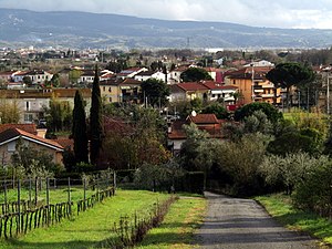
Empoli
Comune in Tuscany, Italy
Distance: Approx. 698 meters
Latitude and longitude: 43.71666667,10.95
Empoli (Italian pronunciation: [ˈempoli]) is a town and comune in the Metropolitan City of Florence, Tuscany, Italy, about 30 km (20 miles) southwest of Florence, to the south of the Arno in a plain formed by the river. The plain has been usable for agriculture since Roman times. The commune's territory becomes hilly as it departs from the river.

Stadio Carlo Castellani
Multi-purpose stadium in Empoli, Italy
Distance: Approx. 1475 meters
Latitude and longitude: 43.72638889,10.955
The Stadio comunale Carlo Castellani is a multi-purpose stadium in Empoli, Italy. It is currently used mostly for football matches and the home of Empoli F.C. The stadium holds 16,284. Built in 1923, the Stadio Carlo Castellani is currently the home of Empoli.
Capraia e Limite
Comune in Tuscany, Italy
Distance: Approx. 4946 meters
Latitude and longitude: 43.75,10.98333333
Capraia e Limite is a comune (municipality) in the Metropolitan City of Florence, located in the Tuscany region of Italy. Situated about 20 kilometres (12 mi) west of Florence, the municipality comprises two main localities: Capraia Fiorentina and Limite sull'Arno, with the latter being the municipal seat. Historically, Limite sull'Arno became a major shipbuilding center starting in the 18th century, contributing significantly to the Grand Duchy of Tuscany's maritime industries.

Montelupo Fiorentino
Comune in Tuscany, Italy
Distance: Approx. 6306 meters
Latitude and longitude: 43.73333333,11.01666667
Montelupo Fiorentino is a comune (municipality) in the Metropolitan City of Florence in the Italian region of Tuscany, located about 20 kilometres (12 miles) southwest of Florence.

Pesa
River in Italy
Distance: Approx. 6221 meters
Latitude and longitude: 43.733,11.0157
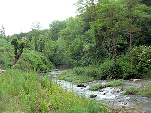
The Pesa is a river in Tuscany, central Italy. It has a length of 53 km, and, after crossing the provinces of Siena and Florence, flows into the Arno River near Montelupo Fiorentino.

Pozzale
City in Italy
Distance: Approx. 2704 meters
Latitude and longitude: 43.6958,10.9565
Pozzale is a frazione in Empoli commune, Metropolitan City of Florence. It was the site of a medium-security women's prison. In 2010, it was announced that it would be converted into a facility exclusively for transgender prisoners, making it the first such facility in the world.

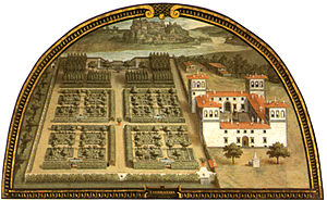
Villa Medicea L'Ambrogiana
Building in Montelupo Fiorentino, Italy
Distance: Approx. 6061 meters
Latitude and longitude: 43.73083333,11.01444444
The Villa L'Ambrogiana was a rural palace or villa built during the late-Renaissance by Ferdinand I de' Medici; it is located at the confluence of the rivers Pesa and Arno, in the municipality of Montelupo Fiorentino.

Isola, San Miniato
Frazione in Tuscany, Italy
Distance: Approx. 5271 meters
Latitude and longitude: 43.71361111,10.87611111
Isola is a village in Tuscany, central Italy, administratively a frazione of the comune of San Miniato, province of Pisa. At the time of the 2001 census its population was 536. Isola is about 52 km from Pisa and 4 km from San Miniato.

Ponte a Elsa
Frazione in Tuscany, Italy
Distance: Approx. 4908 meters
Latitude and longitude: 43.68888889,10.895
Ponte a Elsa is a town in Tuscany, central Italy, administratively a frazione of the comuni of Empoli (Metropolitan City of Florence) and San Miniato (province of Pisa). At the time of the 2011 census its population was 3,609. Ponte a Elsa is about 40 km (25 mi) from Florence, 50 km (31 mi) from Pisa, 7 km (4.3 mi) from Empoli and 5 km (3 mi) from San Miniato.

La Scala, San Miniato
Frazione in Tuscany, Italy
Distance: Approx. 6626 meters
Latitude and longitude: 43.69166667,10.86722222
La Scala is a village in Tuscany, central Italy, administratively a frazione of the comune of San Miniato, province of Pisa. La Scala is about 48 km from Pisa and 2 km from San Miniato.

Elsa (river)
A river in Tuscany, tributary of the [Arno].
Distance: Approx. 5167 meters
Latitude and longitude: 43.71916667,10.87722222
The Elsa () is a river in the Italian region of Tuscany. It flows northward to empty into the left bank of the Arno. From its source at Molli, Sovicelle, the flow of the river is low until its reaches its major tributaries at Vene di Onci and Caldane.

Toiano, Vinci
Frazione in Tuscany, Italy
Distance: Approx. 6816 meters
Latitude and longitude: 43.77,10.89777778
Toiano is a village in Tuscany, central Italy, administratively a frazione of the comune of Vinci, Metropolitan City of Florence. At the time of the 2001 census its population was 213. Toiano is about 43 km from Florence and 2 km from Vinci.
Weather in this IP's area
clear sky
7 Celsius
7 Celsius
5 Celsius
8 Celsius
1031 hPa
64 %
1031 hPa
1027 hPa
10000 meters
0.45 m/s
1.79 m/s
45 degree
4 %
