212.77.234.57 - IP Lookup: Free IP Address Lookup, Postal Code Lookup, IP Location Lookup, IP ASN, Public IP
Country:
Region:
City:
Location:
Time Zone:
Postal Code:
IP information under different IP Channel
ip-api
Country
Region
City
ASN
Time Zone
ISP
Blacklist
Proxy
Latitude
Longitude
Postal
Route
Luminati
Country
ASN
Time Zone
Europe/Berlin
ISP
OMCnet Internet Service GmbH
Latitude
Longitude
Postal
IPinfo
Country
Region
City
ASN
Time Zone
ISP
Blacklist
Proxy
Latitude
Longitude
Postal
Route
IP2Location
212.77.234.57Country
Region
schleswig-holstein
City
quickborn
Time Zone
Europe/Berlin
ISP
Language
User-Agent
Latitude
Longitude
Postal
db-ip
Country
Region
City
ASN
Time Zone
ISP
Blacklist
Proxy
Latitude
Longitude
Postal
Route
ipdata
Country
Region
City
ASN
Time Zone
ISP
Blacklist
Proxy
Latitude
Longitude
Postal
Route
Popular places and events near this IP address

Quickborn
Town in Schleswig-Holstein, Germany
Distance: Approx. 973 meters
Latitude and longitude: 53.73333333,9.89722222
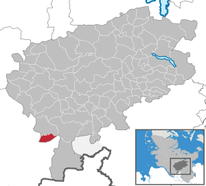
Quickborn (German pronunciation: [ˈkvɪkˌbɔʁn] ) is a town in the district of Pinneberg, in Schleswig-Holstein, Germany. It belongs to Metropolregion Hamburg and is located on the north part of Hamburg on Autobahn A7. It is a 700 year old town which also belonged to Denmark in the past.

Ellerau
Municipality in Schleswig-Holstein, Germany
Distance: Approx. 3279 meters
Latitude and longitude: 53.7575,9.91583333
Ellerau is a municipality in the Kreis (district) of Segeberg in Schleswig-Holstein, north Germany. It is situated some 24 km north of Hamburg, and 8 km northwest of Norderstedt.

Bilsen
Municipality in Schleswig-Holstein, Germany
Distance: Approx. 5256 meters
Latitude and longitude: 53.77138889,9.87666667
Bilsen is a village in the district of Pinneberg, in Schleswig-Holstein, Germany.

Hasloh
Municipality in Schleswig-Holstein, Germany
Distance: Approx. 3253 meters
Latitude and longitude: 53.69916667,9.91305556
Hasloh is a municipality in the district of Pinneberg, in Schleswig-Holstein, Germany.

Hemdingen
Municipality in Schleswig-Holstein, Germany
Distance: Approx. 6192 meters
Latitude and longitude: 53.765,9.83861111
Hemdingen is a municipality in the district of Pinneberg, in Schleswig-Holstein, Germany.

Alveslohe
Municipality in Schleswig-Holstein, Germany
Distance: Approx. 4298 meters
Latitude and longitude: 53.76666667,9.91666667
Alveslohe is a municipality in the district of Segeberg, in Schleswig-Holstein, Germany.
Norderstedt Mitte station
Rapid transit station in Germany
Distance: Approx. 5921 meters
Latitude and longitude: 53.70777778,9.99222222
Norderstedt Mitte station is a railway station in Norderstedt, Germany. It is a terminus for the rapid transit trains of the line U1 of the Hamburg U-Bahn and connects the underground railway with the commuter trains of the AKN railway company line A2 (Alster Northern Railway).

Paninternational Flight 112
1971 aviation accident in Germany
Distance: Approx. 3585 meters
Latitude and longitude: 53.70277778,9.9425
Paninternational Flight 112 was a BAC One-Eleven operated by German airline Paninternational that crashed in Hamburg on 6 September 1971 while attempting to land on an autobahn following the failure of both engines. The accident killed 22 passengers and crew out of 121 on board.

Bilsener Bek
River in Schleswig-Holstein, Germany
Distance: Approx. 4956 meters
Latitude and longitude: 53.7725,9.9003
Bilsener Bek (in Low German Bilsener Beek) is a small river of Schleswig-Holstein, Germany. It flows into the Pinnau near Bilsen.
Ebach
River in Schleswig-Holstein, Germany
Distance: Approx. 4085 meters
Latitude and longitude: 53.7647,9.9014
Ebach is a river of Schleswig-Holstein, Germany. It flows into the Pinnau near Ellerau.

Gronau (Pinnau)
River in Schleswig-Holstein, Germany
Distance: Approx. 2891 meters
Latitude and longitude: 53.75222222,9.89222222
Gronau (German pronunciation: [ˈɡʁoːnaʊ] ) is a river of Schleswig-Holstein, Germany. It flows into the Pinnau near Ellerau.
Krumbek
River in Schleswig-Holstein, Germany
Distance: Approx. 2304 meters
Latitude and longitude: 53.749,9.9091
Krumbek is a small river of Schleswig-Holstein, Germany. It flows into the Gronau near Ellerau.
Weather in this IP's area
clear sky
-1 Celsius
-6 Celsius
-2 Celsius
-0 Celsius
1033 hPa
86 %
1033 hPa
1031 hPa
10000 meters
4.63 m/s
220 degree
