Country:
Region:
City:
Latitude and Longitude:
Time Zone:
Postal Code:
IP information under different IP Channel
ip-api
Country
Region
City
ASN
Time Zone
ISP
Blacklist
Proxy
Latitude
Longitude
Postal
Route
Luminati
Country
ASN
Time Zone
Europe/Kyiv
ISP
Viaduk-Telecom, LLC
Latitude
Longitude
Postal
IPinfo
Country
Region
City
ASN
Time Zone
ISP
Blacklist
Proxy
Latitude
Longitude
Postal
Route
db-ip
Country
Region
City
ASN
Time Zone
ISP
Blacklist
Proxy
Latitude
Longitude
Postal
Route
ipdata
Country
Region
City
ASN
Time Zone
ISP
Blacklist
Proxy
Latitude
Longitude
Postal
Route
Popular places and events near this IP address

Vyrlytsia (Kyiv Metro)
Kyiv Metro Station
Distance: Approx. 3223 meters
Latitude and longitude: 50.40333333,30.66611111
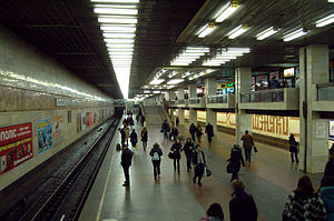
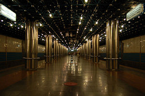
Vyrlytsia (Ukrainian: Вирлиця, ) is a station on the Kyiv Metro's Syretsko-Pecherska Line. It was opened on 4 March 2006 on the already functioning stretch, Kharkivska-Boryspilska. The station is by far the most unusual in the system.

Pozniaky
Distance: Approx. 768 meters
Latitude and longitude: 50.4087,30.6289
Pozniaky (Ukrainian: Позняки) is a historical neighbourhood, a residential area and the remains of a village on the territory of the Darnitskyi district, on the left bank of Kyiv, the capital of Ukraine. Pozniaky metro station is situated in this neighborhood. Pozniaky is a historical area, of Kyiv.
Osokorky
Neighbourhood in Kyiv, Ukraine
Distance: Approx. 1130 meters
Latitude and longitude: 50.39460556,30.61551667
Osokorky (Ukrainian: Осокорки) is a historical neighbourhood, on the left bank of Kyiv, the capital of Ukraine. Osokorky metro station is situated in this neighborhood.

Berezniaky
Neighborhood in Kyiv, Ukraine
Distance: Approx. 2995 meters
Latitude and longitude: 50.42944444,30.60611111
Berezniaky (Ukrainian: Березняки) is a historical neighbourhood, on the left bank of Kyiv, the capital of Ukraine. Estate construction began there in 1967. Berezniaky railway station is located in the neighborhood.
Embassy of the Blessed Kingdom of God for All Nations
Church in Kyiv, Ukraine
Distance: Approx. 1513 meters
Latitude and longitude: 50.39756,30.60209
Embassy of the Blessed Kingdom of God for All Nations (also known as Embassy of God) is an Evangelical Christian Charismatic megachurch, denomination, and parachurch organization headquartered in Kyiv, Ukraine. The senior pastor is Sunday Adelaja.

Kharkivska (Kyiv Metro)
Kyiv Metro Station
Distance: Approx. 2268 meters
Latitude and longitude: 50.40083333,30.65222222
Kharkivska (Ukrainian: Харківська, ) is a station of Kyiv Metro's Syretsko-Pecherska Line. It is between the Pozniaky and Vyrlytsia stations. This station was opened on 28 December 1994.

Pozniaky (Kyiv Metro)
Kyiv Metro Station
Distance: Approx. 1128 meters
Latitude and longitude: 50.39805556,30.63333333
Pozniaky (Ukrainian: Позняки, ) is a station of Kyiv Metro's Syretsko–Pecherska line. It is situated between Osokorky and Kharkivska stations. This station was opened on 28 December 1994.
Osokorky (Kyiv Metro)
Kyiv Metro Station
Distance: Approx. 1022 meters
Latitude and longitude: 50.39555556,30.61583333
Osokorky (Ukrainian: Осокорки, ) is a station of Kyiv Metro's Syretsko-Pecherska Line. It is situated between Slavutych and Pozniaky stations. This station was opened on 30 December 1992.

Slavutych (Kyiv Metro)
Kyiv Metro Station
Distance: Approx. 1620 meters
Latitude and longitude: 50.39416667,30.60416667
Slavutych (Ukrainian: Славутич, ) is a station on Kyiv Metro's Syretsko–Pecherska line. It is situated between Vydubychi and Osokorky stations and was opened on 30 December 1992. The station was designed by architect Alyoshkin.
Kyiv Academic Theatre of Ukrainian Folklore
Theatre in Kyiv
Distance: Approx. 3425 meters
Latitude and longitude: 50.43070833,30.59619722
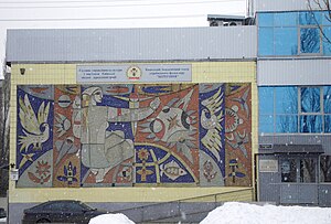
The Kyiv Academic Theatre of Ukrainian Folklore (Bereginya) (Ukrainian: Київський академічний театр українського фольклору «Берегиня») is a theatre in Kyiv in Ukraine. It was founded in 1983.

Struve Railroad Bridge
Bridge in Kyiv, Russian Empire
Distance: Approx. 2821 meters
Latitude and longitude: 50.41638889,30.58583333
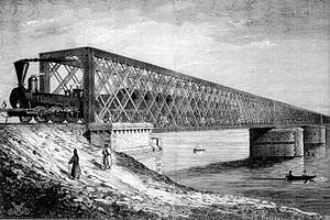
The Struve Railroad Bridge (Russian: Железнодорожный мост Струве), was the first all-metal railroad bridge over the Dnieper that existed from 1855 to 1920 in Kyiv. The bridge was one of the longest in the empire, yielding in length only to the bridges in Syzran and Yekaterinoslav.

Pivdennyi Bridge (Kyiv)
Bridge in Kyiv, Ukraine
Distance: Approx. 2536 meters
Latitude and longitude: 50.39481,30.58814
The Pivdennyi Bridge (Ukrainian: Південний міст - Southern bridge) in Kyiv, Ukraine was designed by the architect A. Gavrilov ("Mostobud") and a group of engineers headed by G. Fux, was built in 1990.
Weather in this IP's area
overcast clouds
12 Celsius
11 Celsius
12 Celsius
12 Celsius
993 hPa
82 %
993 hPa
981 hPa
10000 meters
0.89 m/s
3.58 m/s
103 degree
100 %
07:20:15
16:06:29

