Country:
 Switzerland
Region:
City:
Latitude and Longitude:
Time Zone:
Postal Code:
IP information under different IP Channel
ip-api
Country
Region
City
ASN
Time Zone
ISP
Blacklist
Proxy
Latitude
Longitude
Postal
Route
IPinfo
Country
Region
City
ASN
Time Zone
ISP
Blacklist
Proxy
Latitude
Longitude
Postal
Route
MaxMind
Country
Region
City
ASN
Time Zone
ISP
Blacklist
Proxy
Latitude
Longitude
Postal
Route
Luminati
Country
CHRegion
ag
City
menziken
ASN
Time Zone
Europe/Zurich
ISP
Quickline AG
Latitude
Longitude
Postal
db-ip
Country
Region
City
ASN
Time Zone
ISP
Blacklist
Proxy
Latitude
Longitude
Postal
Route
ipdata
Country
Region
City
ASN
Time Zone
ISP
Blacklist
Proxy
Latitude
Longitude
Postal
Route
Popular places and events near this IP address
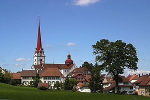
Beromünster
Municipality in Lucerne, Switzerland
Distance: Approx. 4126 meters
Latitude and longitude: 47.2,8.2
Beromünster is a municipality in the district of Sursee in the canton of Lucerne in Switzerland. On 1 January 2004 the former municipality of Schwarzenbach merged into the municipality of Beromünster. On 1 January 2009 the former municipality of Gunzwil merged into the municipality of Beromünster followed by Neudorf on 1 January 2013.
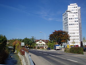
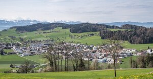
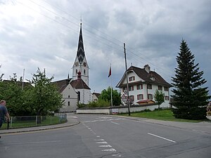
Menziken
Municipality in Aargau, Switzerland
Distance: Approx. 1921 meters
Latitude and longitude: 47.23333333,8.2
Menziken is a municipality in the district of Kulm in the canton of Aargau in Switzerland. On 1 January 2023 the former municipality of Burg merged to form the municipality of Menziken.
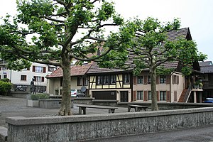
Burg, Aargau
Former municipality in Aargau, Switzerland
Distance: Approx. 663 meters
Latitude and longitude: 47.23333333,8.18333333
Burg is a former municipality in the district of Kulm in the canton of Aargau in Switzerland. On 1 January 2023 the former municipality of Burg merged to form the municipality of Menziken.

Leimbach, Aargau
Municipality in Aargau, Switzerland
Distance: Approx. 3817 meters
Latitude and longitude: 47.26666667,8.16666667
Leimbach (German: [ˈlaɪmbax] ) is a municipality in the district of Kulm in the canton of Aargau in Switzerland.
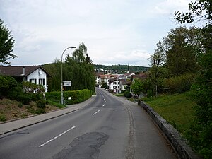
Reinach, Aargau
Municipality in Aargau, Switzerland
Distance: Approx. 2025 meters
Latitude and longitude: 47.25,8.18333333
Reinach is a municipality in the district of Kulm in the canton of Aargau in Switzerland.
Rickenbach, Lucerne
Municipality in Lucerne, Switzerland
Distance: Approx. 2585 meters
Latitude and longitude: 47.21666667,8.15
Rickenbach is a municipality in the district of Sursee in the canton of Lucerne in Switzerland. On 1 January 2013 the former municipality of Pfeffikon merged into the municipality of Rickenbach.
Gunzwil
Former municipality in Lucerne, Switzerland
Distance: Approx. 1913 meters
Latitude and longitude: 47.21666667,8.18333333
Gunzwil was a municipality within the district of Sursee, in the canton of Lucerne, Switzerland. On 1 January 2009 it merged with the municipality of Beromünster, becoming a village inside the new municipality of Beromünster.
Pfeffikon
Former municipality in Lucerne, Switzerland
Distance: Approx. 2025 meters
Latitude and longitude: 47.25,8.18333333
Pfeffikon is a former municipality in the district of Sursee in the canton of Lucerne in Switzerland. On 1 January 2013 the former municipality of Pfeffikon merged into the municipality of Rickenbach.

Stierenberg
Mountain north of the Alps
Distance: Approx. 1338 meters
Latitude and longitude: 47.23833333,8.15888889
The Stierenberg (872 m) is a wooded mountain north of the Alps, located between the cantons of Aargau and Lucerne, with the summit being within the canton of Aargau. The Stierenberg is the highest summit between the valleys of the Suhre and Aabach.

Mosen railway station
Swiss railway station
Distance: Approx. 3957 meters
Latitude and longitude: 47.24428694,8.22414889
Mosen railway station (German: Bahnhof Mosen) is a railway station in the municipality of Hitzkirch, in the Swiss canton of Lucerne. It is an intermediate stop on the standard gauge Seetal line of Swiss Federal Railways.

Menziken railway station
Railway station in Switzerland
Distance: Approx. 1422 meters
Latitude and longitude: 47.24111111,8.18888889
Menziken railway station (German: Bahnhof Menziken) is a railway station in the municipality of Menziken, in the Swiss canton of Aargau. It is the eastern terminus of the 1,000 mm (3 ft 3+3⁄8 in) gauge Schöftland–Aarau–Menziken line of Aargau Verkehr.

Reinach AG railway station
Railway station in Switzerland
Distance: Approx. 2019 meters
Latitude and longitude: 47.25,8.18305556
Reinach AG railway station (German: Bahnhof Reinach AG) is a railway station in the municipality of Reinach, in the Swiss canton of Aargau. It is the penultimate station at the eastern end of the 1,000 mm (3 ft 3+3⁄8 in) gauge Schöftland–Aarau–Menziken line of Aargau Verkehr.
Weather in this IP's area
broken clouds
12 Celsius
12 Celsius
11 Celsius
13 Celsius
1006 hPa
94 %
1006 hPa
930 hPa
10000 meters
1.67 m/s
1.52 m/s
210 degree
81 %
07:35:56
18:53:18