Country:
Region:
City:
Latitude and Longitude:
Time Zone:
Postal Code:
IP information under different IP Channel
ip-api
Country
Region
City
ASN
Time Zone
ISP
Blacklist
Proxy
Latitude
Longitude
Postal
Route
Luminati
Country
Region
zh
City
rotterdam
ASN
Time Zone
Europe/Amsterdam
ISP
Nextpertise B.V.
Latitude
Longitude
Postal
IPinfo
Country
Region
City
ASN
Time Zone
ISP
Blacklist
Proxy
Latitude
Longitude
Postal
Route
db-ip
Country
Region
City
ASN
Time Zone
ISP
Blacklist
Proxy
Latitude
Longitude
Postal
Route
ipdata
Country
Region
City
ASN
Time Zone
ISP
Blacklist
Proxy
Latitude
Longitude
Postal
Route
Popular places and events near this IP address

South Holland
Province of the Netherlands
Distance: Approx. 1446 meters
Latitude and longitude: 52,4.66666667
South Holland (Dutch: Zuid-Holland [ˌzœyt ˈɦɔlɑnt] ) is a province of the Netherlands with a population of over 3.8 million as of January 2023 and a population density of about 1,410/km2 (3,700/sq mi), making it the country's most populous province and one of the world's most densely populated areas. Situated on the North Sea in the west of the Netherlands, South Holland covers an area of 3,308 km2 (1,277 sq mi), of which 609 km2 (235 sq mi) is water. It borders North Holland to the north, Utrecht and Gelderland to the east, and North Brabant and Zeeland to the south.

Gouda, South Holland
City and municipality in South Holland, Netherlands
Distance: Approx. 3352 meters
Latitude and longitude: 52.01111111,4.71111111
Gouda (Dutch pronunciation: [ˈɣʌudaː] ) is a city and municipality in the west of the Netherlands, between Rotterdam and Utrecht, in the province of South Holland. Gouda has a population of 75,000 and is famous for its Gouda cheese, stroopwafels, many grachten, smoking pipes, and its 15th-century city hall. Its array of historic churches and other buildings makes it a very popular day-trip destination.

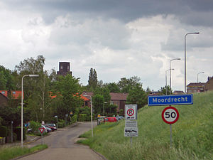
Moordrecht
Village in South Holland, Netherlands
Distance: Approx. 748 meters
Latitude and longitude: 51.98611111,4.66805556
Moordrecht (Dutch: [ˈmoːrdrɛxt] ) is a village and a former municipality in the province of South Holland, the Netherlands, situated along the river Hollandse IJssel. In September 2006, 93% of the population of Moordrecht chose by referendum to pursue a merger with the neighboring municipalities Nieuwerkerk aan den IJssel and Zevenhuizen-Moerkapelle. Only 7% chose to merge with Gouda.

Het Beijersche
Town in South Holland, Netherlands
Distance: Approx. 3852 meters
Latitude and longitude: 51.98333333,4.73333333
Het Beijersche is a town in the Dutch province of South Holland. It is a part of the municipality of Krimpenerwaard, and lies about 4 km south of Gouda. The statistical area "Het Beijersche", which also can include the surrounding countryside, has a population of around 350.

Gouwe (river)
River in South Holland, The Netherlands
Distance: Approx. 1288 meters
Latitude and longitude: 51.99722222,4.69111111
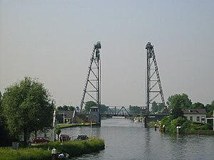
The Gouwe is a channelized river in South Holland, the Netherlands. It runs from north to south - from the Oude Rijn to the Hollandse IJssel.
Broek, Gouda
Distance: Approx. 3029 meters
Latitude and longitude: 52.01611111,4.67416667
Broek was a municipality in the Dutch province of South Holland, located west and north of Gouda. A longer name of the municipality, Broek, Bloemendaal, Broekhuizen, Thuil en het Weegje names the polders that are part of the municipality. Broek was a separate municipality between 1817 and 1870, when it became part of Waddinxveen.

Gouderak
Place in South Holland, Netherlands
Distance: Approx. 733 meters
Latitude and longitude: 51.98333333,4.68333333
Gouderak is a village in the Dutch province of South Holland. It is located 4 km southwest of Gouda on the river Hollandsche IJssel, in the municipality of Krimpenerwaard. Gouderak was a separate municipality until 1985, when it merged with Lageweg (Ouderkerk) and Ouderkerk aan den IJssel to become part of Ouderkerk.

Gouda railway station
Railway station in Gouda, Netherlands
Distance: Approx. 3696 meters
Latitude and longitude: 52.0175,4.70555556
Gouda is a railway station in Gouda, Netherlands. The station opened on 21 May 1855 when the Nederlandsche Rhijnspoorweg-Maatschappij (Dutch Rijn Railway Company) opened the Utrecht–Rotterdam railway. The Gouda–Den Haag railway to The Hague was opened in 1870, and the connection to Alphen a/d Rijn in 1934.

Sint Janskerk
Large Gothic church in Gouda, Netherlands
Distance: Approx. 3343 meters
Latitude and longitude: 52.01083333,4.71138889
The Sint Janskerk in Gouda, the Netherlands, is a large Gothic church, known especially for its stained glass windows, for which it has been placed on the list of the top 100 Dutch monuments.

Groenhovenbad
Distance: Approx. 3978 meters
Latitude and longitude: 52.024,4.6896
Groenhovenbad is an aquatic centre in Gouda, the Netherlands. It hosted from 21-28 March the 2016 Women's Water Polo Olympic Games Qualification Tournament.
Schielands Hoge Zeedijk
Distance: Approx. 3493 meters
Latitude and longitude: 52.02,4.67
Schielands Hoge Zeedijk, formerly called Hoogendijk ("high dike") is a Dutch dike in the province of South Holland that stretches from the Schie at Schiedam to the Gouwe near Gouda. Constructed in the 13th century, the dike continues to protect an area inhabited by 3 million people from flooding by the North Sea.

Waddinxveen Triangel railway station
Railway station in the Netherlands
Distance: Approx. 4678 meters
Latitude and longitude: 52.027061,4.648975
Waddinxveen Triangel railway station is a railway station in Waddinxveen, South Holland, Netherlands that opened on 12 February 2018. It is situated on the Gouda–Alphen aan den Rijn railway, which connects Gouda and Alphen aan den Rijn, 1,5 kilometre south of Waddinxveen railway station. Trains running on the line are R-net Stadler FLIRTs.
Weather in this IP's area
overcast clouds
6 Celsius
3 Celsius
5 Celsius
7 Celsius
1026 hPa
89 %
1026 hPa
1026 hPa
6000 meters
3.6 m/s
90 degree
100 %
07:49:15
17:00:56