Country:
Region:
City:
Latitude and Longitude:
Time Zone:
Postal Code:
IP information under different IP Channel
ip-api
Country
Region
City
ASN
Time Zone
ISP
Blacklist
Proxy
Latitude
Longitude
Postal
Route
Luminati
Country
Region
8
City
wolfurt
ASN
Time Zone
Europe/Vienna
ISP
Vorarlberger Informatik- und Telekommunikationsdienstleistungsgesellschaft mbH
Latitude
Longitude
Postal
IPinfo
Country
Region
City
ASN
Time Zone
ISP
Blacklist
Proxy
Latitude
Longitude
Postal
Route
db-ip
Country
Region
City
ASN
Time Zone
ISP
Blacklist
Proxy
Latitude
Longitude
Postal
Route
ipdata
Country
Region
City
ASN
Time Zone
ISP
Blacklist
Proxy
Latitude
Longitude
Postal
Route
Popular places and events near this IP address
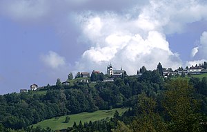
Wolfurt
Place in Vorarlberg, Austria
Distance: Approx. 822 meters
Latitude and longitude: 47.47307778,9.75391944
Wolfurt is a municipality in the western Austrian state of Vorarlberg.
Lauterach
Place in Vorarlberg, Austria
Distance: Approx. 2234 meters
Latitude and longitude: 47.47722222,9.73138889
Lauterach is a town in the district of Bregenz in the Austrian state of Vorarlberg. Honorary consulates of Finland, and the United Kingdom are located in Lauterach. The Lauterach Transmitter is a 116 m tall broadcasting facility.
Bildstein
Place in Vorarlberg, Austria
Distance: Approx. 1940 meters
Latitude and longitude: 47.45,9.76666667
Bildstein is a municipality in the district of Bregenz in the Austrian state of Vorarlberg.

Kennelbach
Place in Vorarlberg, Austria
Distance: Approx. 2088 meters
Latitude and longitude: 47.48305556,9.76666667
Kennelbach is a community in the district of Bregenz in the westernmost Austrian state of Vorarlberg. As of 2016, it is the home of the operational headquarters of the sporting goods manufacturer Head, along with Amsterdam, the corporate headquarters.

Parish church of St. Gallus, Bregenz
Roman Catholic church in the city of Bregenz in Vorarlberg, Austria
Distance: Approx. 3679 meters
Latitude and longitude: 47.49843,9.74804
The parish church of St. Gallus is a Roman Catholic church in the city of Bregenz in Vorarlberg, Austria. The church is situated in the southeast of the city center in the district of Bregens village on a terrace, which slopes down to the creek valley.

Kreuzkirche am Ölrain
German church
Distance: Approx. 3792 meters
Latitude and longitude: 47.49743,9.7371
The Kreuzkirche am Ölrain is a German Reformed Church of the town Bregenz and is located on the site of a former Roman settlement. The church building was constructed from 1862 to 1864 according to the plans of the architect Christian Friedrich von Leins from Stuttgart in Gothic Revival architecture style. In 1904, the church was also the first electrically lit and heated church in the k.u.k.
Vorarlberg State Library
Austrian library
Distance: Approx. 3225 meters
Latitude and longitude: 47.49388889,9.74527778
The Vorarlberg State Library (Vorarlberger Landesbibliothek) is a regional academic library in Bregenz, Western Austria. It founded in 1904 as a branch of the Vorarlberg State Archives. Granted autonomous status in September 1977, the library became subordinate to the Vorarlberg State Government.
Lauterach railway station
Railway station in Vorarlberg, Austria
Distance: Approx. 2622 meters
Latitude and longitude: 47.47630556,9.72461111
Lauterach railway station (German: Bahnhof Lauterach) is a railway station in the town of Lauterach in the district of Bregenz in the Austrian state of Vorarlberg. It sits at the junction of the standard gauge Vorarlberg and St. Margrethen–Lauterach lines of Austrian Federal Railways (ÖBB).

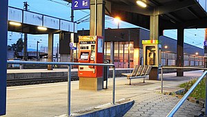
Wolfurt railway station
Railway station in Vorarlberg, Austria
Distance: Approx. 1481 meters
Latitude and longitude: 47.45703889,9.74098889
Wolfurt railway station (German: Bahnhof Wolfurt) is a railway station in the municipality of Wolfurt, in the district of Bregenz, in the Austrian state of Vorarlberg. It is located on the Vorarlberg line of Austrian Federal Railways (ÖBB). Adjacent to the station is the Wolfurt Freight Centre, also known as ÖBB Terminal Wolfurt, a major goods station.

Schwarzach in Vorarlberg railway station
Railway station in Vorarlberg, Austria
Distance: Approx. 2195 meters
Latitude and longitude: 47.44611111,9.75426111
Schwarzach in Vorarlberg railway station (German: Bahnhof Schwarzach in Vorarlberg) is a railway station in the municipality of Schwarzach, in the district of Bregenz, in the Austrian state of Vorarlberg. It is located on the Vorarlberg line of Austrian Federal Railways (ÖBB).
Haselstauden railway station
Railway station in Vorarlberg, Austria
Distance: Approx. 3743 meters
Latitude and longitude: 47.432463,9.74932
Haselstauden railway station (German: Bahnhof Haselstauden) is a railway station in the municipality of Haselstauden, in the district of Dornbirn, in the Austrian state of Vorarlberg. It is located on the Vorarlberg line. The station is owned and operated by Austrian Federal Railways (ÖBB).
Lauterach Unterfeld railway station
Railway station in Vorarlberg, Austria
Distance: Approx. 3463 meters
Latitude and longitude: 47.480954,9.715606
Lauterach Unterfeld railway station (German: Lauterach Unterfeld) is a railway station in the Unterfeld part of the town of Lauterach, located in the district of Bregenz in the Austrian state of Vorarlberg. It is located on the standard gauge St. Margrethen–Lauterach line of Austrian Federal Railways (ÖBB).
Weather in this IP's area
overcast clouds
7 Celsius
7 Celsius
5 Celsius
8 Celsius
1015 hPa
90 %
1015 hPa
960 hPa
10000 meters
1.03 m/s
100 %
07:30:36
16:42:07


