Country:
Region:
City:
Latitude and Longitude:
Time Zone:
Postal Code:
IP information under different IP Channel
ip-api
Country
Region
City
ASN
Time Zone
ISP
Blacklist
Proxy
Latitude
Longitude
Postal
Route
Luminati
Country
ASN
Time Zone
Europe/Zurich
ISP
VTX Services SA
Latitude
Longitude
Postal
IPinfo
Country
Region
City
ASN
Time Zone
ISP
Blacklist
Proxy
Latitude
Longitude
Postal
Route
db-ip
Country
Region
City
ASN
Time Zone
ISP
Blacklist
Proxy
Latitude
Longitude
Postal
Route
ipdata
Country
Region
City
ASN
Time Zone
ISP
Blacklist
Proxy
Latitude
Longitude
Postal
Route
Popular places and events near this IP address

Nydeggbrücke
Bridge in Bern, Switzerland which connects the old city to the new part
Distance: Approx. 67 meters
Latitude and longitude: 46.94833333,7.45888889
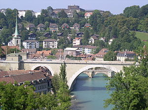
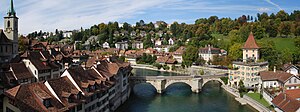
The Nydeggbrücke is a bridge in Bern, Switzerland which connects the eastern part of the old city to the new part. It crosses over the Aare and is located very close to the Bärengraben. It was built in parallel to the Untertorbrücke in 1840, which until then had been the only bridge crossing the Aare.

Bärengraben
Tourist attraction in the Swiss capital city of Bern
Distance: Approx. 2 meters
Latitude and longitude: 46.94801944,7.45962778
The Bärengraben, or Bear Pit, is a tourist attraction in the Swiss capital city of Bern. It is a bear pit, or enclosure housing bears, situated at the eastern edge of the old city of Bern, next to the Nydeggbrücke and the River Aar. Although still in use, the Bärengraben has been supplemented since 2009 by the adjacent BärenPark, a larger and more natural enclosure alongside the River Aar.

Untertorbrücke
Stone arch bridge that spans the Aare in the city of Bern
Distance: Approx. 182 meters
Latitude and longitude: 46.94943333,7.45846389
The Untertorbrücke (German: Lower Gate Bridge) is a stone arch bridge that spans the Aare at the easternmost point of the Enge peninsula in the city of Bern, Switzerland, connecting the Mattequartier in the Old City to the Schosshalde neighbourhood. Built in its current form in 1461–89, it is the oldest of Bern's Aare bridges, and was the city's only bridge up until the middle of the 19th century. It is a Swiss heritage site of national significance.
Gerechtigkeitsgasse
Distance: Approx. 389 meters
Latitude and longitude: 46.948377,7.454525
The Gerechtigkeitsgasse ("Justice Alley") is one of the principal streets in the Old City of Bern, the medieval city center of Bern, Switzerland. Together with its extension, the Kramgasse, it is the heart of the inner city. Hans Gieng's most famous fountain figure, the statue of Lady Justice on the Gerechtigkeitsbrunnen, commands the view of the street's gentle slopes and curves.
Junkerngasse
Distance: Approx. 404 meters
Latitude and longitude: 46.9479,7.4543
The Junkerngasse ("Nobility Lane") is a street in the Old City of Bern, the medieval city center of Bern, Switzerland. It connects the tip of the Aar peninsula (the Nydegg neighbourhood) to the Münster. The Junkerngasse is the Old City's best-preserved street.
Nydeggstalden
Distance: Approx. 212 meters
Latitude and longitude: 46.94933333,7.457625
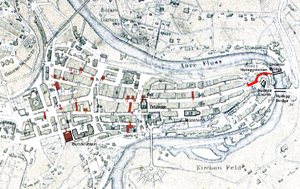
The Nydeggstalden is one of the streets in the Old City of Bern, the medieval city center of Bern, Switzerland. It is part of the Nydegg which was part of the medieval industrial section of Bern. It is a semi-circular road running from Gerechtigkeitsgasse toward the Aare river and the Untertorbrücke (German: Lower Gate bridge).
Postgasse
Street in Bern, Switzerland
Distance: Approx. 334 meters
Latitude and longitude: 46.94901667,7.45548889
The Postgasse is one of the streets in the Old City of Bern, the medieval city center of Bern, Switzerland. It is part of the Zähringerstadt which was built during the foundation of the city in 1191. It runs from Nydeggstalden near the Aare river in the east to the transverse Kreuzgasse, where the name changes to Rathausgasse.

Mattequartier
Distance: Approx. 274 meters
Latitude and longitude: 46.94716667,7.45622222
The Mattequartier is a historic section in the Old City of Bern in Bern, Switzerland. The first expansion of Bern occurred as the city was founded in 1191. The central and oldest neighbourhood was known as the Zähringerstadt (Zähringer town) after the founder, Duke Berthold V of Zähringen.

Nydegg
Distance: Approx. 177 meters
Latitude and longitude: 46.94886111,7.45766667
The Nydegg is a historic section in the Old City of Bern in Bern, Switzerland. The first expansion of Bern occurred as the city was founded in 1191. At the east end of the central and oldest neighbourhood, the Zähringerstadt (Zähringer town), was the Nydegg castle near the banks of the Aare river.

Nydeggkirche
Church in Bern, Switzerland
Distance: Approx. 194 meters
Latitude and longitude: 46.94880556,7.45736111
The Reformed Nydeggkirche (from the Bernese German expression for "Lower corner") is located on the eastern edge of the Old City of Bern, in the Nydegg section.

Läuferbrunnen
Distance: Approx. 237 meters
Latitude and longitude: 46.949722,7.457778
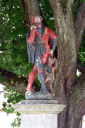
The Läuferbrunnen (Runner Fountain) is a fountain on Läuferplatz in the Old City of Bern, Switzerland. It is a Swiss Cultural Property of National Significance and is part of the UNESCO World Heritage Site of the Old City of Bern.

Felsenburg (Bern)
Historical Castle in Bern, Switzerland
Distance: Approx. 180 meters
Latitude and longitude: 46.94941389,7.45847222
The Felsenburg is a fortified castle and tower in the city of Bern, Switzerland.
Weather in this IP's area
overcast clouds
8 Celsius
7 Celsius
7 Celsius
9 Celsius
1029 hPa
90 %
1029 hPa
967 hPa
9000 meters
2.06 m/s
320 degree
100 %
07:14:31
17:12:50


