212.31.112.110 - IP Lookup: Free IP Address Lookup, Postal Code Lookup, IP Location Lookup, IP ASN, Public IP
Country:
Region:
City:
Location:
Time Zone:
Postal Code:
ISP:
ASN:
language:
User-Agent:
Proxy IP:
Blacklist:
IP information under different IP Channel
ip-api
Country
Region
City
ASN
Time Zone
ISP
Blacklist
Proxy
Latitude
Longitude
Postal
Route
db-ip
Country
Region
City
ASN
Time Zone
ISP
Blacklist
Proxy
Latitude
Longitude
Postal
Route
IPinfo
Country
Region
City
ASN
Time Zone
ISP
Blacklist
Proxy
Latitude
Longitude
Postal
Route
IP2Location
212.31.112.110Country
Region
larnaka
City
mazotos
Time Zone
Asia/Nicosia
ISP
Language
User-Agent
Latitude
Longitude
Postal
ipdata
Country
Region
City
ASN
Time Zone
ISP
Blacklist
Proxy
Latitude
Longitude
Postal
Route
Popular places and events near this IP address

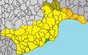
Mazotos
Place in Larnaca District, Cyprus
Distance: Approx. 160 meters
Latitude and longitude: 34.80222222,33.49
Mazotos (Greek: Μαζωτός, Italian: Mazotto) is a village 22 km away from Larnaca in Cyprus, close to the sea. The community today numbers about 1,200 predominantly Greek speaking Cypriots but with about 350 expatriates who are here on a permanent basis as retirees. In addition the village can accommodate a further 2,500 in 'holiday homes'.

Alaminos, Cyprus
Place in Larnaca District, Cyprus
Distance: Approx. 5198 meters
Latitude and longitude: 34.80694444,33.43277778
Alaminos (Greek: Αλαμινός, Turkish: Aleminyo) is a village in the Larnaca District of Cyprus, west of the city of Larnaca. In 1960, it had 564 inhabitants, with a roughly equal number of Greek and Turkish Cypriots. In 2011, its population was 345.
Anafotia
Village in Larnaca District, Cyprus
Distance: Approx. 3271 meters
Latitude and longitude: 34.82388889,33.46361111
Anafotia (Greek: Aναφωτιά or Αναφωτία; Turkish: Akkor) is a village located in the Larnaca District of Cyprus, west of Larnaca. In 1994, the official name of the village became Anafotida (Aναφωτίδα), following a decision by the then-government of Cyprus to make the names of villages on the island more Greek. However, locally the village is still referred to as Anafotia.

Pervolia
Village in Larnaca District, Cyprus
Distance: Approx. 8666 meters
Latitude and longitude: 34.83083333,33.57833333
Pervolia (Greek: Περβόλια; Turkish: Bahçalar), also spelled Perivolia (Greek: Περιβόλια), is a village located in the Larnaca District of Cyprus.

Tersefanou
Place in Larnaca District, Cyprus
Distance: Approx. 7691 meters
Latitude and longitude: 34.85472222,33.54611111
Tersefanou (Greek: Τερσεφάνου) is a village in the Larnaca District of Cyprus, located 2 northwest of Kiti.

Softades
Village in Larnaca District, Cyprus
Distance: Approx. 6689 meters
Latitude and longitude: 34.83638889,33.55083333
Softades (Greek: Σοφτάδες; Turkish: Softalar) is a village in the Larnaca District of Cyprus, located 3 km west of Kiti. Prior to 1964 the village was inhabited almost exclusively by Turkish Cypriots.

Alethriko
Village in Larnaca District, Cyprus
Distance: Approx. 6231 meters
Latitude and longitude: 34.85944444,33.49416667
Alethriko (Greek: Αλεθρικό; Turkish: Aletriko) is a village in the Larnaca District of Cyprus, west of Larnaca. The first known census was carried out under Ottoman Rule in 1831; it listed only males: there were 46 Greek Cypriots and 18 Turkish Cypriots. In the census of 1891 the population of Alethriko was recorded as 37 Turkish Cypriots and 233 Greek Cypriots of both sexes.

Kivisili
Place in Larnaca District, Cyprus
Distance: Approx. 4251 meters
Latitude and longitude: 34.83944444,33.50555556
Kivisili (Greek: Κιβισίλι; Turkish: Civisil or Cevizli) is a village in the Larnaca District of Cyprus, located 2 km (1.2 mi) south of Alethriko. Prior to 1974, it was inhabited solely by Turkish Cypriots. As of 2011, Kivisili had a population of 233.
Menogeia
Village in Larnaca District, Cyprus
Distance: Approx. 6229 meters
Latitude and longitude: 34.84277778,33.44083333
Menogeia (Greek: Μενόγεια; Turkish: Ötüken or Mennoya) is a village in the Larnaca District of Cyprus, located 2 km west of Anglisides. In 2011, it had a population of 50. Menogeia was a mixed Greek- and Turkish-Cypriot village until 1946.
Anglisides
Village in Larnaca District, Cyprus
Distance: Approx. 6267 meters
Latitude and longitude: 34.85277778,33.45611111
Anglisides (Greek: Αγγλισίδες) is a village in the Larnaca District of Cyprus, located 4 km north of Anafotida and 20 km southwest of Larnaca.
Aplanta
Village in Larnaca District, Cyprus
Distance: Approx. 3045 meters
Latitude and longitude: 34.82833333,33.47527778
Aplanta (Greek: Απλάντα; Turkish: Aplanda) is an abandoned village in the Larnaca District of Cyprus, located 4 km south of Anglisides. Aplanta was inhabited exclusively by Turkish Cypriots; in 1960, they numbered 55. Due to the Cyprus crisis of 1963–64 they fled to Kivisili in December 1963.

Panagia tis Angeloktistis
Distance: Approx. 8914 meters
Latitude and longitude: 34.8476,33.571
Panagia tis Angeloktistis (Greek: Παναγία της Αγγελόκτιστης) or Panagia Angeloktisti (Παναγία Αγγελόκτιστη, "Panagia Built by Angels") is a Byzantine church located in the village of Kiti, Cyprus, roughly 12 kilometers to the southwest of modern-day Larnaka and the ancient city Kition. The Church of Panagia Aggeloktisti was submitted as a possible UNESCO World Heritage Site in September 2015 and is currently listed on the list of Tentative UNESCO World Heritage Site.
Weather in this IP's area
scattered clouds
10 Celsius
7 Celsius
9 Celsius
10 Celsius
1021 hPa
44 %
1021 hPa
1012 hPa
10000 meters
6.69 m/s
350 degree
40 %