212.229.80.212 - IP Lookup: Free IP Address Lookup, Postal Code Lookup, IP Location Lookup, IP ASN, Public IP
Country:
Region:
City:
Location:
Time Zone:
Postal Code:
IP information under different IP Channel
ip-api
Country
Region
City
ASN
Time Zone
ISP
Blacklist
Proxy
Latitude
Longitude
Postal
Route
Luminati
Country
Region
eng
City
miltonkeynes
ASN
Time Zone
Europe/London
ISP
Vodafone Limited
Latitude
Longitude
Postal
IPinfo
Country
Region
City
ASN
Time Zone
ISP
Blacklist
Proxy
Latitude
Longitude
Postal
Route
IP2Location
212.229.80.212Country
Region
england
City
merston
Time Zone
Europe/London
ISP
Language
User-Agent
Latitude
Longitude
Postal
db-ip
Country
Region
City
ASN
Time Zone
ISP
Blacklist
Proxy
Latitude
Longitude
Postal
Route
ipdata
Country
Region
City
ASN
Time Zone
ISP
Blacklist
Proxy
Latitude
Longitude
Postal
Route
Popular places and events near this IP address
Greatest Hits Radio West Sussex
Radio station
Distance: Approx. 2057 meters
Latitude and longitude: 50.83196,-0.756844
Greatest Hits Radio West Sussex is an Independent Local Radio station owned and operated by Bauer as part of the Greatest Hits Radio Network. It broadcasts to West Sussex.
Oving, West Sussex
Village and parish in West Sussex, England
Distance: Approx. 1880 meters
Latitude and longitude: 50.83719,-0.72093
Oving is a small village, and civil and ecclesiastical parish in the Chichester District of West Sussex, England. The village lies about 2.5 miles (4.0 km) east of the city of Chichester. The civil parish includes the settlements of Colworth, Drayton, Merston, and Shopwhyke.

Westbourne House School
British independent school
Distance: Approx. 2275 meters
Latitude and longitude: 50.8417,-0.7403
Westbourne House School is an independent preparatory school 1½ miles east of Chichester, West Sussex, England. It is co-educational and serves around 450 boarding and day-school pupils from ages 2–13. The headmaster is Martin Barker.

North Mundham
Village and parish in West Sussex, England
Distance: Approx. 2060 meters
Latitude and longitude: 50.8139,-0.75871
North Mundham is a village, Anglican parish and civil parish in the Chichester district of West Sussex, England. It lies on the B2166 road two miles (3.2 km) southeast of Chichester. The parish includes the village of Runcton.

Colworth, West Sussex
Hamlet in West Sussex, England
Distance: Approx. 2025 meters
Latitude and longitude: 50.81771,-0.70428
Colworth is a hamlet in the Chichester district of West Sussex, England. It lies just off the A259 road 2.7 mile (4.4 km) north of Bognor Regis. At the 2011 census the population of the hamlet was included in the civil parish of Oving.

Merston
Village and parish in West Sussex, England
Distance: Approx. 447 meters
Latitude and longitude: 50.818,-0.7308
Merston is a small village, an Anglican parish and former civil parish, now in the civil parish of Oving, in the Chichester district of West Sussex, England. It lies just south of the A259 road 2.4 miles (3.9 km) southeast of Chichester.

Runcton
Village in West Sussex, England
Distance: Approx. 1545 meters
Latitude and longitude: 50.81505,-0.7514
Runcton is a village in the Chichester district of West Sussex, England. It lies on the B2166 road 1.9 miles (3.1 km) southeast of Chichester. In the 2011 census the population of the hamlet was included in the civil parish of North Mundham.

Chichester East (electoral division)
Distance: Approx. 157 meters
Latitude and longitude: 50.82329,-0.73196
Chichester East is an electoral division of West Sussex in the United Kingdom, and returns one member to sit on West Sussex County Council.
Chichester Free School
Free school in Chichester, West Sussex, England
Distance: Approx. 1321 meters
Latitude and longitude: 50.823,-0.751
Chichester Free School is a mixed-sex free school located in Chichester, West Sussex, England. It opened in 2013 and caters for students aged 4–16 years. The school is located on the newly re-developed Carmelite convent site, which was damaged in a fire in 2009.

RAF Merston
Former RAF station in West Sussex
Distance: Approx. 808 meters
Latitude and longitude: 50.8203,-0.7435
Royal Air Force Merston or more simply RAF Merston is a former Royal Air Force satellite station located in West Sussex, England.

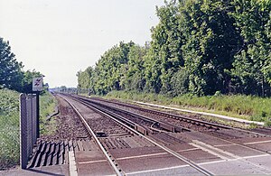
Drayton railway station (West Sussex)
Disused railway station in Chichester, West Sussex
Distance: Approx. 1216 meters
Latitude and longitude: 50.8323,-0.7376
Drayton railway station co-served the city of Chichester, West Sussex, England, from 1846 to 1963 on the Brighton and Chichester Railway.

V2 Radio
Commercial Radio Station in England.
Distance: Approx. 281 meters
Latitude and longitude: 50.82441667,-0.7325
V2 Radio is an Independent Local Radio station owned and operated by VeeToo Trade in the United Kingdom. It broadcasts to West Sussex and South Hampshire, England.
Weather in this IP's area
scattered clouds
7 Celsius
4 Celsius
6 Celsius
7 Celsius
1012 hPa
76 %
1012 hPa
1009 hPa
10000 meters
4.02 m/s
10.28 m/s
315 degree
34 %
